This one covers last weekend's ride North from Baltimore into Pennsylvania, in search of Gifford Pinchot State Park and a slew of little stream-side roads. Once more, I semi-randomly plotted out a course using MapSource, selecting any road or area that looked interesting. I haven't added them all up, but I would guess that the route encompassed at least 100 different roads, and never more than a few miles on any one of them. That's the trouble with a GPS: I never could have undertaken such a goofy route with just a set of written instructions.
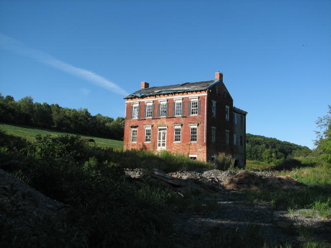
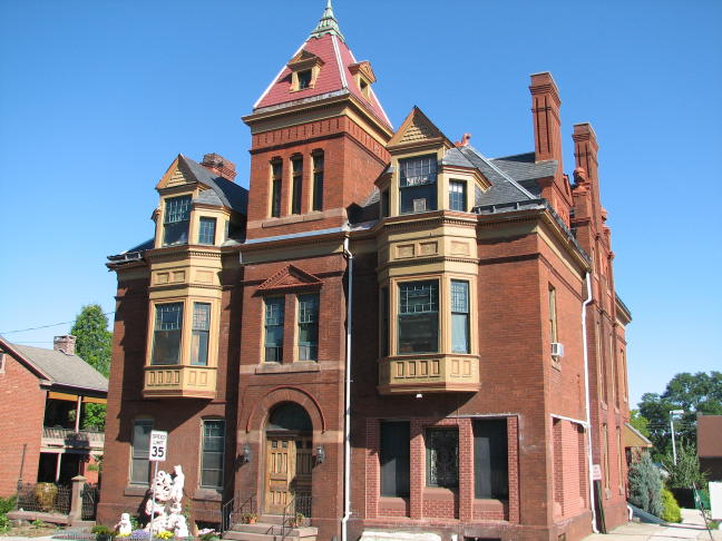
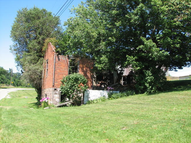
With an early start, I rode 97 North through Westminster and on into PA. My first major milestone was to visit the state park, but on the way I spotted an overgrown path leading off of 97, a couple of miles north of Union Mills. Curious as ever, I decided to follow it a ways...
It actually wasn't very long, and I found this at the end. The grand old place looked like it was undergoing a renovation. Definitely worth the side excursion, and it was really nice to see such a place being fixed up for once, rather than suffering a prolonged deterioration.
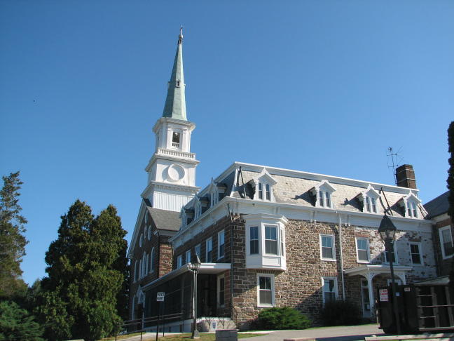
After crossing the Mason-Dixon Line into Pennsylvania, and traveling through Littlestown, I headed northeast toward the state park. Along the way I found this sizable church (the Basilica of the Sacred Heart of Jesus)...
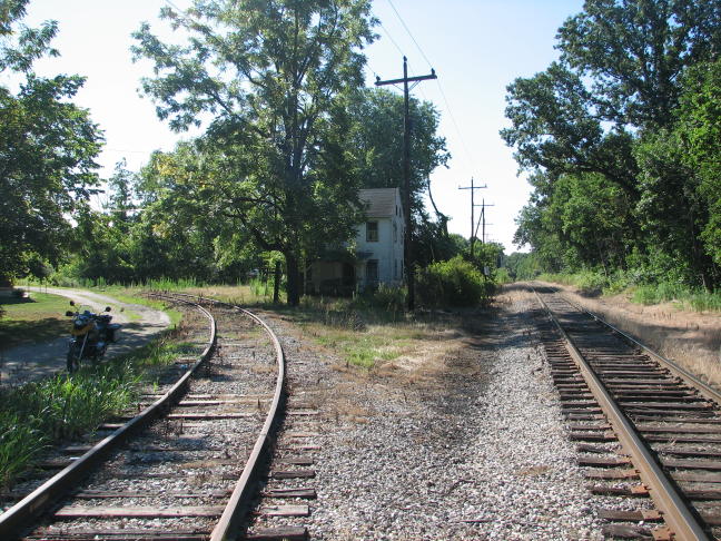
...and this not-so-sizable former whistlestop, which was a little ways east of New Oxford:
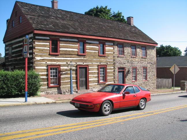
Abbottstown offered plenty of interesting old buildings, and the occasional old sports car (if a 1987 Porsche 924 can be thought of as old).
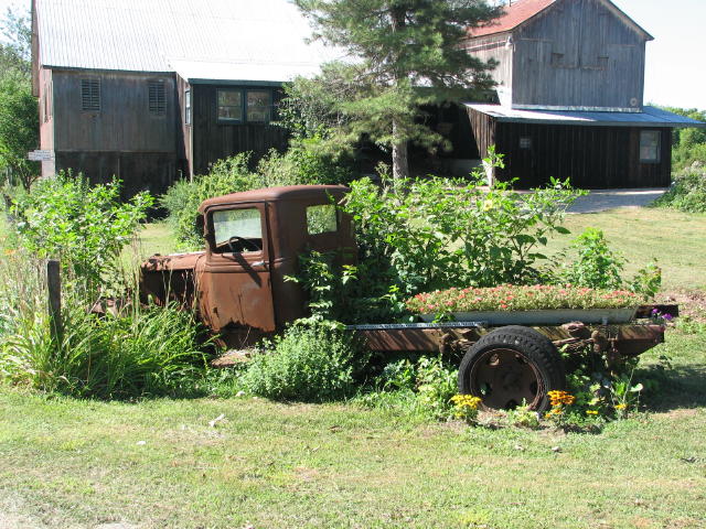
Why is it that I keep finding ancient flatbed pickup trucks?? This one, however, hadn't been abandoned like the others; it had been converted into an elaborate planter.
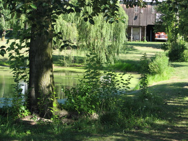
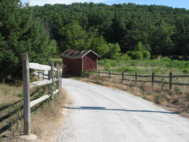
Nearby there was a pretty farm pond, complete with a rustic barn in the background and (of course) yet another aging truck.
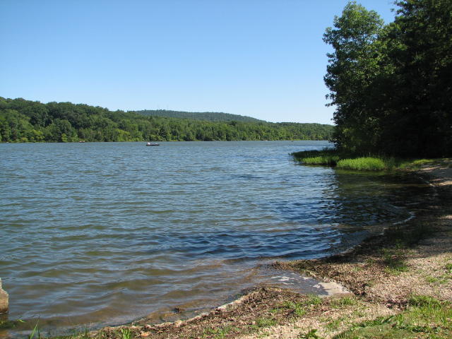
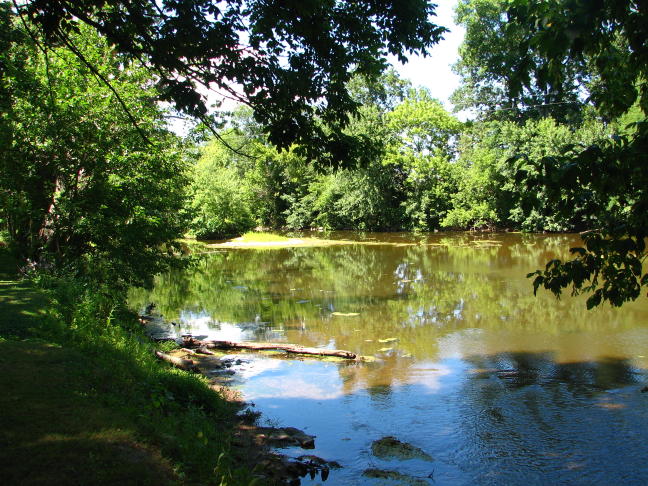
Despite all the turns, picture stops, etc., I managed to finally arrive at Gifford Pinchot State Park a mere 3 hours after leaving Catonsville. It had an appealing lake and nice facilities:
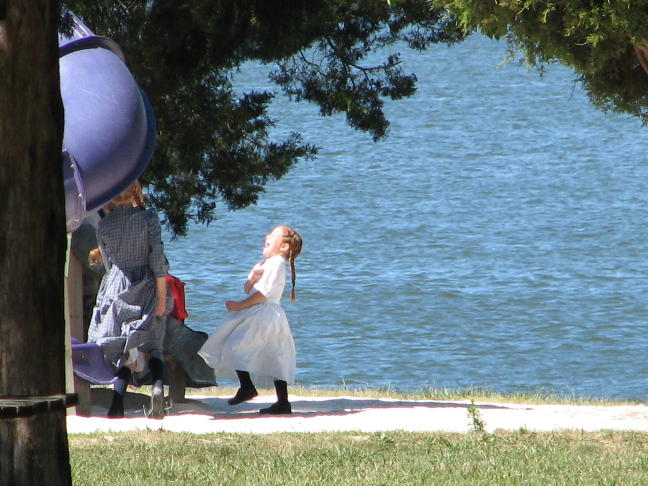
It also had lots of playground equipment, which, in this case, was being enjoyed by a number of young Mennonite children.
Who was Gifford Pinchot, by the way? Turns out he was quite a character, serving as the country's Chief Forester under his friend President Teddy Roosevelt in the late 1800's. He was later elected governor of Pennsylvania. He was one of the first, and among the best-known, proponents of conservation. More information on this intriguing fellow is available at http://www.fs.fed.us/gt/local-links/historical-info/gifford/gifford.shtml.
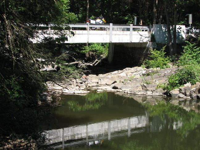
After eating a gigantic brownie and drinking half a bottle of pop, it was time to dive--yet again--into virtually uncharted roads. In fairness, the Middle o' Nowhere in Pennsylvania is still a lot more civilized than in West Virginia! But even so, there was more than enough time to take pictures without creating a traffic jam, such as this one on a bridge over Beaver Creek.
Something bad seems to have happened here, possibly involving a little pig and a bigger, badder wolf. Before I could inquire further, I was chased away by a scowling granny, apparently from a different bedtime story...
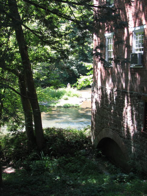
Continuing off the beaten path, I found a massive old mill beside Yellow Breeches Creek, complete with an artist painting the scene. D'you suppose he hasn't heard of digital cameras? Also, where do some of these creek names come from??
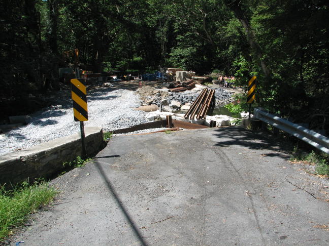
Continuing along my planned route, I encountered the first of the Missing Bridges. This one should have spanned Yellow Breeches Creek where it met Stony Run--but it didn't. I checked for possible fording opportunities--but it was a good 20' drop down to the water. (Where's The Dude or Mr. Enloe when you need them??)
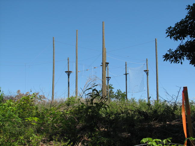
Near the creek, incidentally, was the following contraption. As best I could tell, it was a small Quidditch field--but perhaps one of you would know what it really is?
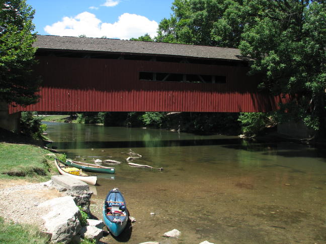
After consulting the Zumo, I retraced part of my route and then rode around to the other side of the missing bridge. Or, at least, I would have, except for another missing bridge (!) this time on Mill Street near Messiah College in Grantham. Looking downstream a ways, however, I saw a great old covered bridge across the creek.
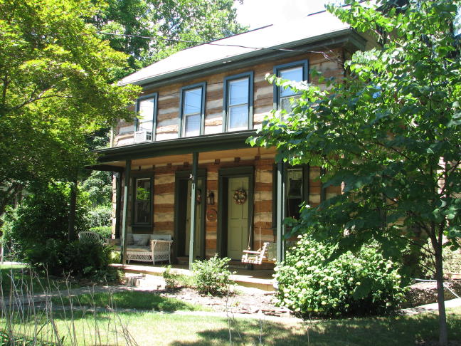
This bridge, however, only led into a parking lot for the college's athletic facilities. There wasn't any way to continue on, so I did some further Zumo consulting. In the process of flailing around, looking for detours that didn't dead-end at Route 15, I went by this log home for the fourth time (really!) and decided that the circumstances called for a picture:
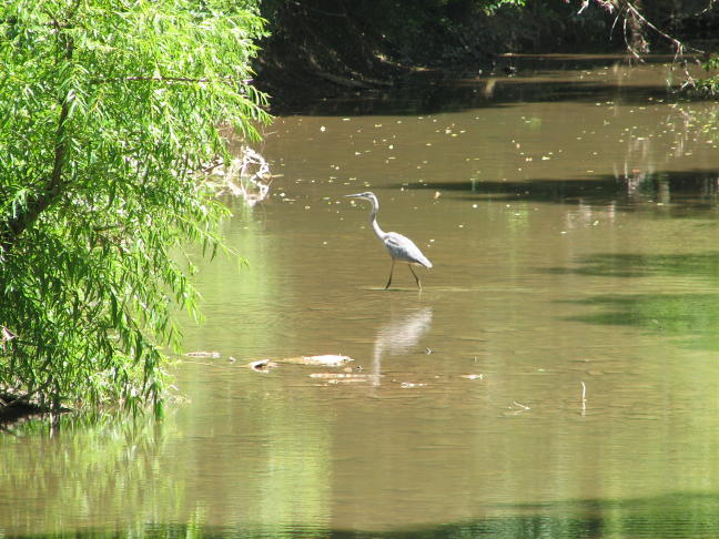
After a longish detour, I managed to return to my regularly scheduled route. Safely back on teeny roads in the middle of nowhere, I relaxed and went back to photographing everything in sight--for instance, this great blue heron, which had no trouble fording the North Branch of Bermudian Creek:
Moments later, needless to say, I encountered yet another missing bridge, this time approaching the Kralltown Road bridge over Bermudian Creek. Having learned the hard way that there wouldn't be any way across the stream, I dutifully followed the detour signs and then backtracked to the stream. Whereupon I found that the bridge was finished and, although blocked off to traffic, it would have been quite easy to get around the barriers on a bike! Ah well...
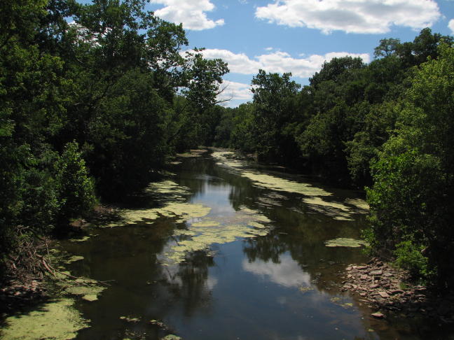
Later on, I ran across this dramatic view where Peepytown Road crosses Conewago Creek. (I'm not making up these road names, honest!) If you look carefully, you can see the remains of a bridge abutment in the lower-right corner of the picture. I would be within my rights to count that as another missing bridge ... but I won't.
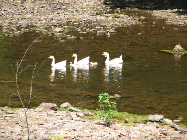
Aw, ain't they cute?
Next up was a search for Kuhn's Fording across Conewago Creek. I was pretty sure there wasn't a bridge, but MapSource showed a perfectly good road leading up to each side of the creek, and I figured there might be an opportunity to ride across the stream. Wrong again! There was apparently a working ford here many, many years ago, but it was replaced in the late 1800's by a covered bridge, which was then demolished in 1982. At present, the approach to the creek has been carefully blocked off.
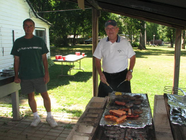
This time I'd preplanned a detour, on the hypothesis that there might not actually be a ford. I quickly found my way to the other side of the stream and discovered a small community park that just happened to have a picnic going. Although it was a private group, they quickly took pity on a lonely, starving, weird, picture-takin' motorcyclist--and plied me with free hot dogs, hamburgers, salads, desserts, etc! The kindly host (on the left) puts on an annual picnic for all his family and friends, and I really appreciated his hospitality on my behalf.
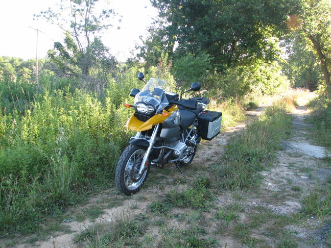
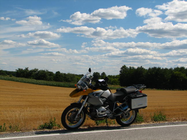
Meanwhile, the thought occurred to me that our very own BMRGirl Tina might be having another calendar contest this year. Taking advantage of the gorgeous day, I started working on an entry:
There were many other beautiful spots on this trip, including Group Mill Road along Conewago Creek and the miniscule Irishtown. But the day was drawing on, and I still had dozens of little roads to go, so I pressed on.
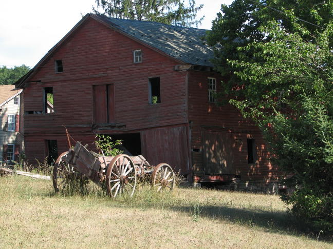
Back in Maryland, Babylon Road proved to be a narrow but enjoyable dirt lane with no shortage of pleasing views. So, will the barn or the wagon collapse first?
This final shot sums up what most of the trip was like: Perfect!
By the time I got home, I'd been on the road for over 10 1/2 hours and had managed to cover all of 245 miles in that time. (And all on one tank of gas, I might add, which is good for an R1200GS. It apparently helps to go very slowly.) It was a great time despite all the detours. However, it's a bit daunting to realize that the 100+ little roads I was on represent probably no more than 0.1% of all such roads in Pennsylvania. How will I ever see all the rest of them before I'm 90??
Rick F.
PS--No one in their right mind would follow such a convoluted route, but if you're interested, just let me know!