The idea for this road trip began a couple of years ago when Buzz and I read The Frontiersmen by Allan W. Eckert. We were entranced by the author’s dramatic stories, and we vowed to find the places where these events had taken place.
Getting there is half the fun
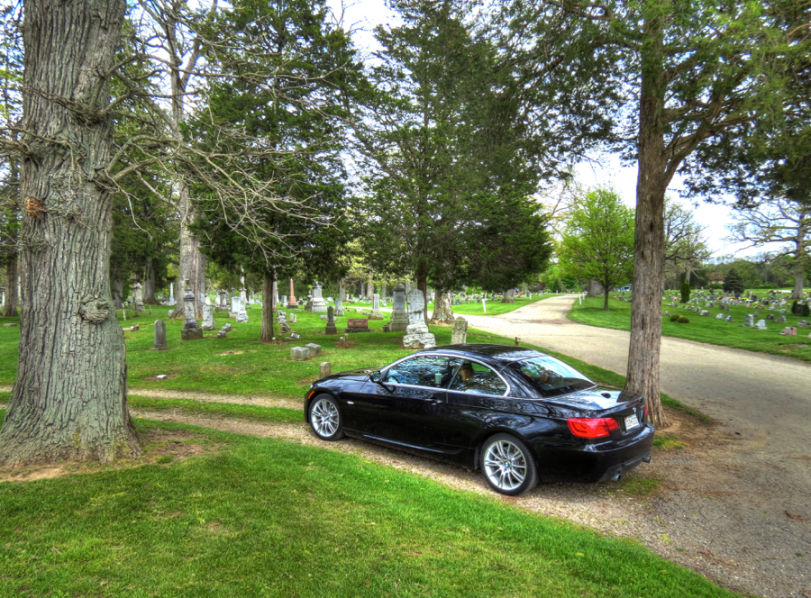
Accordingly, back in early May, I checked over the faithful 2013 BMW 335i cabriolet and launched it in the direction of the Ohio River. Driving this incredible car is an exercise in hanging on and watching the scenery pass by at an astonishing rate. I would meet up with Buzz the following day, whereupon the real adventures would begin. You do remember Buzz, right? My roommate at the College of Wooster in Ohio and best friend ever since? Not to mention the hero of “A Nice Morning Drive,” which prompted Rush drummer Neil Peart to write “Red Barchetta”? Yep, it’s all true.
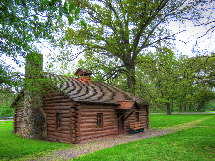
Along the way, I reacquainted myself with the Pennsylvania Turnpike for as long as I could stand and then turned off to find Old Economy Village, on the eastern shore of the Ohio River in western Pennsylvania. Despite some rain en route, the Bimmer still looked pretty clean.

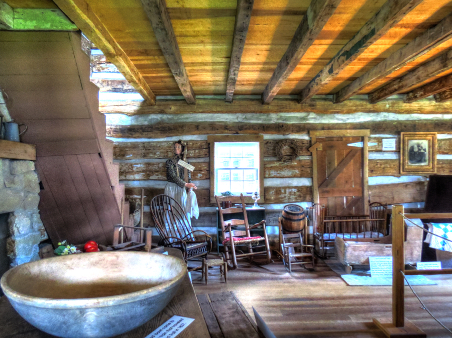
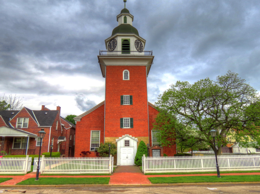
Old Economy Village was a prosperous town formed by the Harmony Society in the early 1800s. The sect was founded by Johann Georg Rapp in Germany in 1785, but religious persecution forced them to the U.S. They were an industrious lot, and their clothing factories, brick works, silk mills, oil wells, and other businesses thrived. This was their church in Old Economy, designed by Georg’s adopted son Frederick and built in 1828.
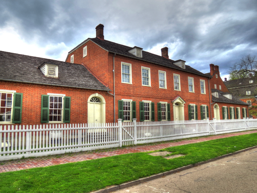
On the other side of Church Street was the Rapp’s home. Like almost all the other buildings here, it was made from bricks produced by the town’s own industry.
Georg passed away at age 89 in 1847, but the Harmonites continued here for another 60 years. With all of the group’s success, why did it die out in the early 1900s? Well, one of their religious principles was celibacy… As the years went by, many of the younger members found this requirement too burdensome and left. The remaining members just got older and fewer. Here is a photo of one of the couples living at Old Economy Village (courtesy of the Pennsylvania State Archives).

A little further north, I found the site of Logstown—one of the largest Shawnee settlements in the area. By the late 1740s, the French were trying to claim the Ohio River valley, and Logstown became an active trading village for Native Americans, the French, and also the British. Eventually, both the British and Indians became irritated with the French. A small British force under the command of a young George Washington, together with Iroquois allies, routed a portion of the French forces from Fort Duquesne (now Pittsburgh). According to some accounts, the Iroquois “Half King” Tanacharison subsequently killed the French commander, Joseph de Jumonville, while he was a prisoner of war. (The Half King might have had a grudge: he had been taken by the French as a child and sold into slavery.)

Washington’s victory was short-lived. A much larger French force, led by de Jumonville’s brother, pursued Washington and his troops to Fort Necessity and forced their surrender. The Battle of Jumonville Glen, and de Jumonville’s death, helped precipitate the French and Indian War in North America—and, for good measure, the world-wide Seven Years’ War between the French and British.
As for Logstown, by 1760 it had been abandoned by Indians and settlers alike. In 1792, General “Mad Anthony” Wayne built the first official basic training facility for the U.S. military here, naming it Legionville. Today, all that remains of Logstown / Legionville is an empty stretch of unsightly land on the banks of the Ohio. These weeds were the only scenic aspect of the place.

I continued to meander along the river until I came to Beaver, PA, where I tracked down the foundations of Fort McIntosh—the Continental Army’s primary fortress in the west during the American Revolution. It was named for its commanding officer, General Lachlan McIntosh. As shown in the drawing (courtesy of Beaver, PA), it was a large structure, with 15-foot-wide ditches protecting three sides. The fourth side sat 130 feet above the Ohio River. Today, Fort McIntosh is a public park, displaying the original stone footers for the log walls and fireplaces.


Gangsters and ghosts
An hour later, I’d finally crossed into Ohio and ventured northward to Beaver Creek State Park to search for gangsters and ghosts. First, there was Esther Hale: On August 12, 1838, she was wearing her wedding dress and waiting for her fiancé to arrive in Sprucevale for their wedding. He never showed up, and at midnight poor Esther retired to her cabin—and never left. Her friends tried to console the heartbroken young woman, but to no avail. That winter, she was found dead in her room, still wearing her wedding dress. Every year since, a woman in a white wedding gown is seen on the night of August 12th, still waiting by the bridge over Little Beaver Creek for her intended.
As it happens, the state park is full of ghosts. Fortunately, my 335i is not afraid of such manifestations, so it did not mind being parked next to this old stone mill—which, of course, is said to be haunted by either Esther Hale or the ghost of a Quaker minister. It was built by the Hambleton Brothers in 1837, and it’s almost all that is left of the canal town of Sprucevale.

I learned these facts from three ex-Army buddies who had been hiking through the park together. The oldest of the three told me that people often heard unexplained moaning inside the mill and occasionally saw dazzling lights during the night. I threw my lot in with them, and we proceeded to have a great time checking out the mill. Its lower entrances and windows are all blocked by steel bars, and all the flooring on the upper stories has been removed. Still, it was quite a sight. The millrace originally ran through the lower part of the building, so it was not too surprising that this area was now flooded.

Around back, we discovered that the bars blocking the millrace entrance had been forced slightly apart—by whom or what we had no idea. Here I am, possibly on the lawful side of the bars.
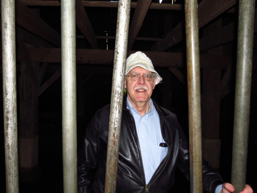
Cramer, one of the younger two, decided he could get into the unflooded part of the mill by squeezing past the large stone blocking a window and dropping down to the floor. We had our doubts about this possibility, but before we knew it, there he was. After several minutes, while the rest of us were chatting outside, Cramer suddenly appeared at the window and asked (and I’m not making this up), “Did you all hear a moaning sound just now??” He looked seriously worried—and exited the basement even faster than he entered!

This photo of the mill, courtesy of Something Is Out There, definitely lends credence to his concerns!

Before we went our separate ways, the guys told me about Gretchen, the youngest and best-known ghost in the park. When the Sandy and Beaver Canal was being built, the lead engineer was a Dutchman named Hans Gil. Shortly before he and his family were to set sail for America, tragedy struck when his wife died. Grief-stricken, Hans and his little daughter Gretchen came to Ohio, where tragedy struck again when Gretchen contracted malaria. Her dying wish was to be buried with her mother in Holland.
While construction of the canal continued, Hans placed Gretchen’s casket within the stone walls of one of the locks. Later, he retrieved poor Gretchen and sailed for home. As fate would have it, the ship and all its passengers were lost at sea—but Gretchen is often seen in the vicinity of the old lock ruins and can be heard saying, “Please bury me with my mother.”
As if all that were not enough, did I mention Pretty Boy Floyd? On July 23, 1934, J. Edgar Hoover named Charles Arthur Floyd “Public Enemy Number 1” as a result of his string of bank robberies, murders, jail escapes, and other mayhem. Three months later, FBI agents spotted Floyd at a farm, just off of Sprucevale Road in what is now Beaver Creek State Park. A shootout ensued, during which Floyd was shot and killed. Despite his life of crime, Pretty Boy Floyd was a popular figure, partly because banks were not viewed kindly during the Great Depression, and partly because he was said to have distributed much of his ill-gotten gains to poor farmers in Oklahoma. Over 50,000 people attended Floyd’s funeral, and Woody Guthrie wrote a popular folk song about him. The otherwise-nondescript field where Floyd died is now used by an R/C model airplane club.

Not far away, I stopped to enjoy the very-descript view of Little Beaver Creek from the western foothills of the Appalachian Mountains. From there, it was a short jaunt over to East Liverpool, OH and a welcoming Holiday Inn Express.

The Yellow Creek Massacre
The next morning I was up early to get a photo of the World’s Largest Teapot in Chester, WV for Buzz’s wife, Linda, who is something of a tea connoisseur. It started life as a giant Hires Root Beer advertising barrel before being converted to a teapot in 1938, when it served as a concession and souvenir stand for a local pottery factory.

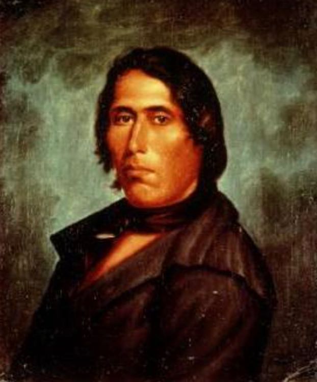
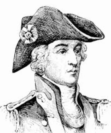
By now, you’re no doubt wondering how “vengeance” ever fits into this road trip. Well, read on. When we last met the Seneca Chief Logan (Talgayeeta), we were at the site of his cabin outside of Lewisburg, PA. (See Central Pennsylvania: Crossing Mountains, Covered Bridges, and Cornfields by BMW.) Logan was a friend to all the other Indian nations and the white man alike, and he served as an important go-between in an effort to preserve peace in the rapidly changing frontier areas. In 1770, following years of European settlement in Pennsylvania, Logan and his family moved to the Ohio Territory. They, along with many other migrating Senecas, Shawnees, and Delawares became known as Mingoes. (Painting courtesy of ExplorePennsylvania.com and Robert Griffing.)

Logan’s village was on the banks of Yellow Creek, a short distance upstream from where the creek empties into the Ohio River. They lived here peacefully, and Logan always counseled against violence. As Alan Eckert wrote, “No other Indian on the frontier was as widely respected by both whites and Indians as [Logan]. Time and again his wisdom and persuasiveness had prevailed to smooth strained relationships between the two races and his word carried great weight.”
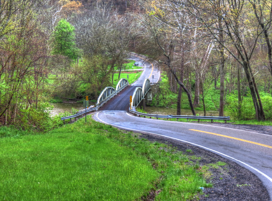
To reach the site of Logan’s village, I had to drive quite a distance on the aptly named River Road—since the road contained much of the adjacent Ohio River after recent flooding. The mud and potholes were epic, but the BMW was game as always and slithered through in fine fashion.

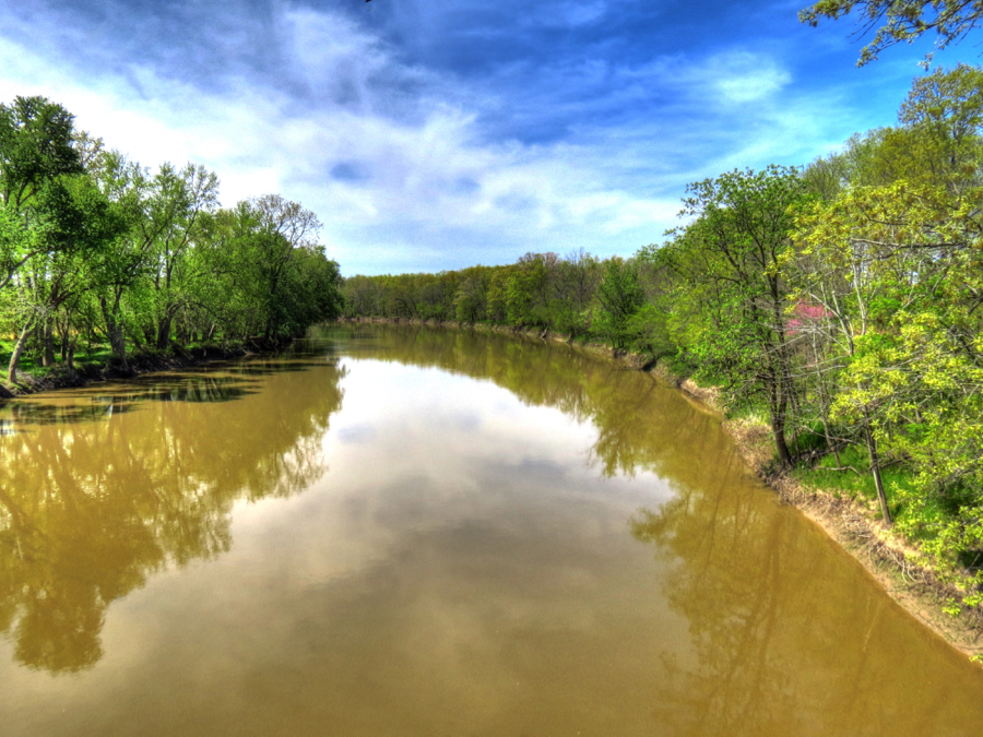
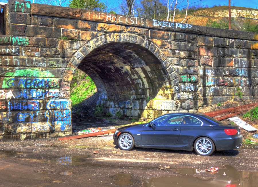
I eventually reached this colorful railroad viaduct and parked on the driest land I could find. The viaduct continues across the mouth of Yellow Creek. Logan’s village was about a quarter mile upstream, but a number of the Mingo braves would camp at the mouth to keep an eye on what was happening on the Ohio.

In 1774, tensions were building between the hundreds of white settlers traveling down the Ohio River to claim territory in Virginia (now West Virginia) on the southern side of the river. Under the 1768 Treaty of Fort Stanwix, the Ohio Territory, to the north, belonged to the Native Americans and was off limits to any whites. But based on past encroachments, the Indians were worried that the settlers would soon be hunting and claiming land in their territory. They weren’t wrong.
Meanwhile, Colonel Michael Cresap led a sizable group of would-be settlers to Fort Henry at Wheeling, attacking every small group of Indians they encountered along the way. At Wheeling, they boasted of their success and flaunted the Shawnee scalps they had taken. But one young warrior named Blue Jacket had escaped and rushed the news of these unprovoked attacks to his adoptive father, war chief Pucksinwah.
Cresap vowed to destroy Logan’s village at Yellow Creek—but en route, he thought better of it and called off the attack. One faction of his men, however, led by the notorious troublemakers Jacob and Daniel Greathouse, continued on. The Greathouses knew that Logan’s village was too large for them to attack. Instead, while their gang hid themselves in the forest on the opposite side of the Ohio, the brothers canoed across to Yellow Creek and cheerily greeted the Mingoes camped there. They offered an invitation to Chief Logan and his comrades to cross over and enjoy some rum, as well as a sporting contest to see whether the Indians or frontiersmen were better rifle shots.
Logan was away on a hunting trip, but in the early evening of April 30, 1774, a Mingo party came over in two canoes. They landed at a place known as Baker’s Bottom, approximately where this old apple storage warehouse now rests. The Mingo party consisted of seven warriors and two women. The men included Logan’s brother Taylaynee and nephew Molnah. The women were Logan’s wife Mellana and his pregnant sister, Koonay, who was also holding her 2-year-old daughter. (Koonay’s husband, white trader John Gibson, was away.)

On reaching the shore, the Indians received an effusive welcome by the Greathouse brothers and were led inland to a campfire, where a few of the gang members sat with their rifles casually laid out of reach. The braves were offered rum, which they quickly accepted. The Mingoes were used to friendly encounters with white men; any suspicions they harbored were put to rest—and the Greathouse trap was set.
For the shooting contest, the frontiersmen volunteered to fire at the target first. Feeling even safer now that the white men’s guns were empty, the warriors took their turn. Moments later, the settlers had backed away and another, much larger group had suddenly emerged from hiding and fired their guns, killing all of the warriors instantly. Mellana was shot next, and Koonay was wounded in the back as she was running for the shore.
Hearing the gunfire and screams, more than a dozen Mingo braves jumped into their canoes and paddled furiously across the river toward Baker’s Bottom. The Greathouse gang was waiting for them on the shore, hidden behind bushes. Their volley of rifle fire killed virtually all of the Indians, and the gang left, taking Koonay’s little daughter with them. (She was eventually returned to the care of her father, John Gibson.)
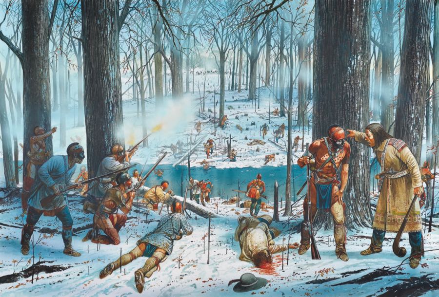
Those of delicate sensibilities may wish to skip over this paragraph. When Chief Logan returned from his hunting trip and learned of the massacre, he immediately crossed over to Baker’s Bottom. He found his wife, brother, and nephew all shot and scalped, along with the other five village braves. His pregnant sister Koonay’s wrists had been tied to a pair of saplings while she still alive and her abdomen sliced open. Logan found her still hanging there, scalped, and his unborn nephew lying on the ground below, also scalped.
The peaceful Logan, friend to all and counselor of harmony among the races, vowed to take 10 white lives for each of his tribe’s dead, and to take 20 more in vengeance for what had been done to his unborn nephew. It was the start of what became known as Dunmore’s War, and before its end Logan had indeed wreaked his revenge. (Painting courtesy of the Kentucky National Guard and Lord Dunmore’s War.)

Ghost towns, seen and unseen
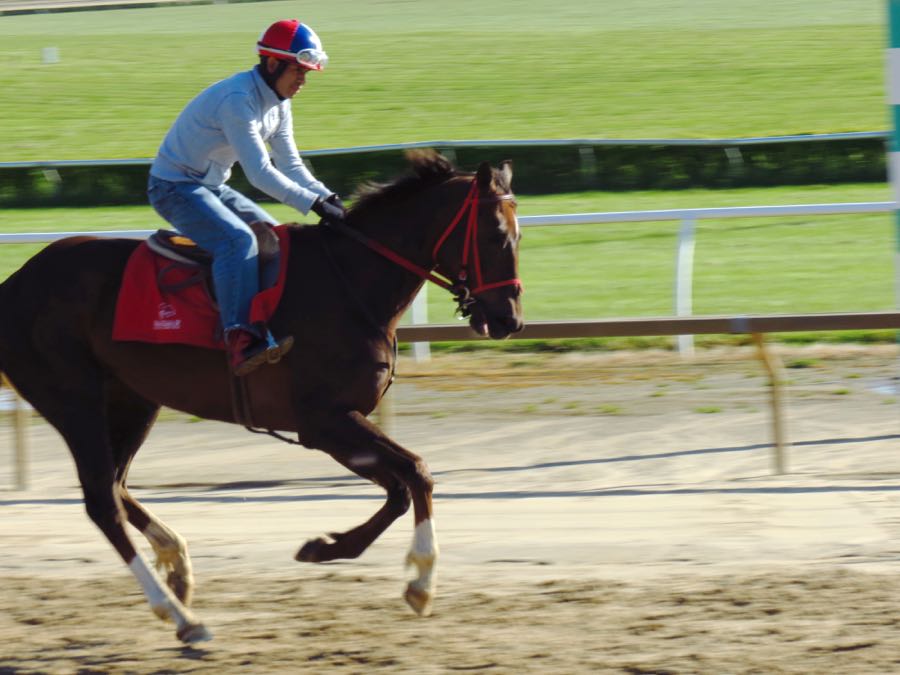
We have not heard the last of Logan, but for now it was time to continue on my way. As I left the Ohio River bank, I heard the thundering sound of hooves rapidly approaching. As yet another sign of Progress writ large, this historic site is now home to West Virginia’s Mountaineer Casino and Racetrack, and the thoroughbreds were out for their morning warm ups.

In Wellsville, OH, I stopped to admire this unusual “bottle kiln,” which was part of the Acme Craft Pottery. Between about 1840 and 1940, there were hundreds of potteries and brickworks on both sides of the Ohio River. The clay banks of the river were the perfect raw material.

Wellsville also offered some beautiful views of the Ohio, without the typical sprawling (and ugly) industrial plants.

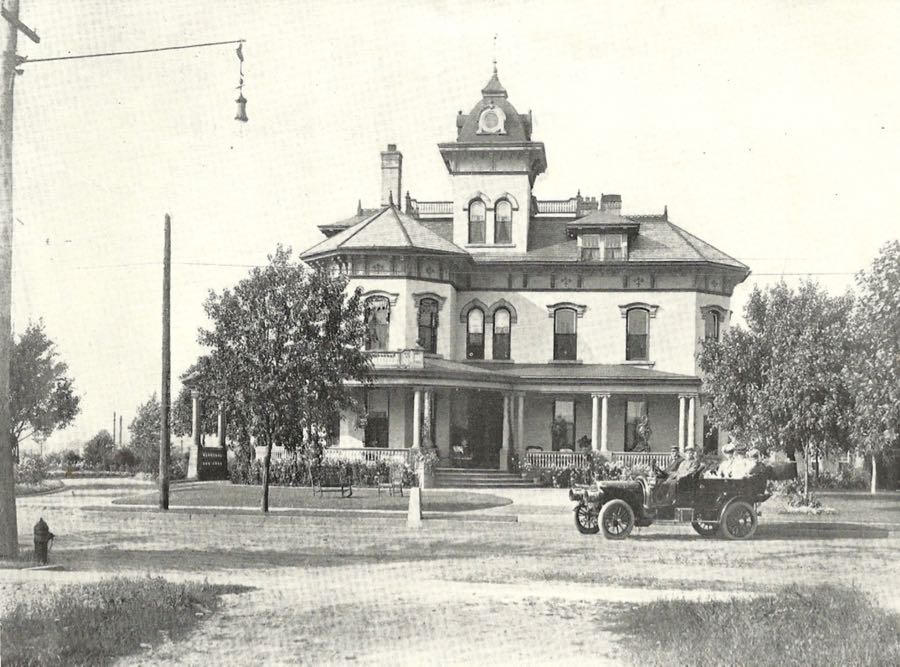
There were many stately homes along Riverside Avenue, including this one that now houses the Wellsville Historical Society.

The towering Riverside Church is also here, although it is perhaps not quite as well known as its namesake in New York City.

I continued to visit additional sites along the way, which will show up in due (historically chronological) course, but the day was drawing on, and I was scheduled to have dinner with Buzz and Linda that evening in Wooster. Accordingly, I tried not to get too carried away with sightseeing—but I did make a side trip to Deersville, which seems well on its way to becoming a ghost town.

I especially liked this old abandoned church. It clearly hasn’t been used for a long time, and I had no luck learning what denomination it was, when it was built, or any other basic information.

Wandering around back, I discovered that some enterprising person had built a garage-like extension and used it to work on Ford Mustangs. Based on their registration stickers, these cars haven’t been on the road since 2008.

Almost as oddly, there were several very large piles of books on the floor inside the main part of the church. Had the church served as the town library for a while? Regardless, it was a sad old place.

Of course, things could always be worse: Tappan was a thriving village soon after its founding in 1837, and it continued to do just fine until someone dammed Little Stillwater Creek. By 1938, the entire town was underwater. It’s said to be one of the most intact ghost towns in Ohio—although only accessible by (illegal) scuba diving.

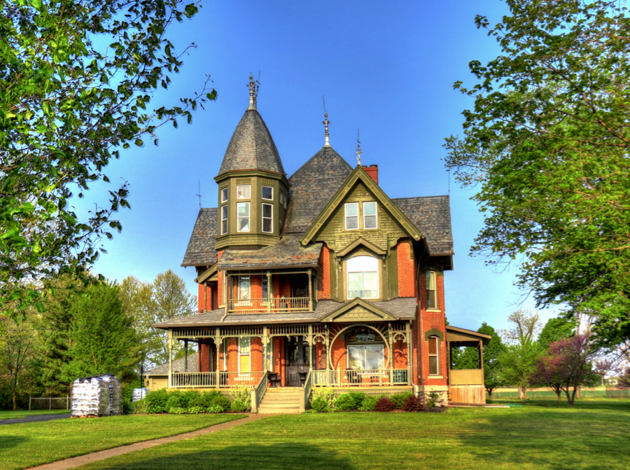
By now I was back on familiar roads, having driven to and from Wooster, OH on numerous occasions. I went through Cadiz (birthplace of Clark Gable), Uhrichsville (the “Clay Center of the World”), and stopped in Dover, OH to find the Jeremiah Reeves House. At first, I thought this building was the mansion—but it turned out to be “only” the carriage house.

The house itself was originally a farmer’s dwelling in 1870. Mr. Reeves purchased it in 1898 and had it extensively enlarged and remodeled, including the addition of a third story for a ballroom. The Dover Historical Society now operates a museum here.

They don’t make ’em like they used to…

I had just enough time for a car wash in New Philadelphia (site of Schoenbrunn, the 1772 Moravian mission for Delaware Indians) before driving the last 40 miles to Wooster. Buzz, Linda, and I had an excellent dinner at the City Square Steak House, talked far into the night, and finalized our plans for the next two days of touring.

Who is there to mourn for Logan?
After an outstanding breakfast courtesy of gourmet chef Linda, Buzz and I were on our way. Our first stop was to find the Kister Grist and Saw Mill, which dates from 1816. Unlike many others from the era, the Kister Mill remains in good working order. Here, Buzz is telling me that there is a hydraulic cider press just inside this front wing. (Interior photo courtesy of owners Richard and Cindy Boyer and MillPictures.com.)
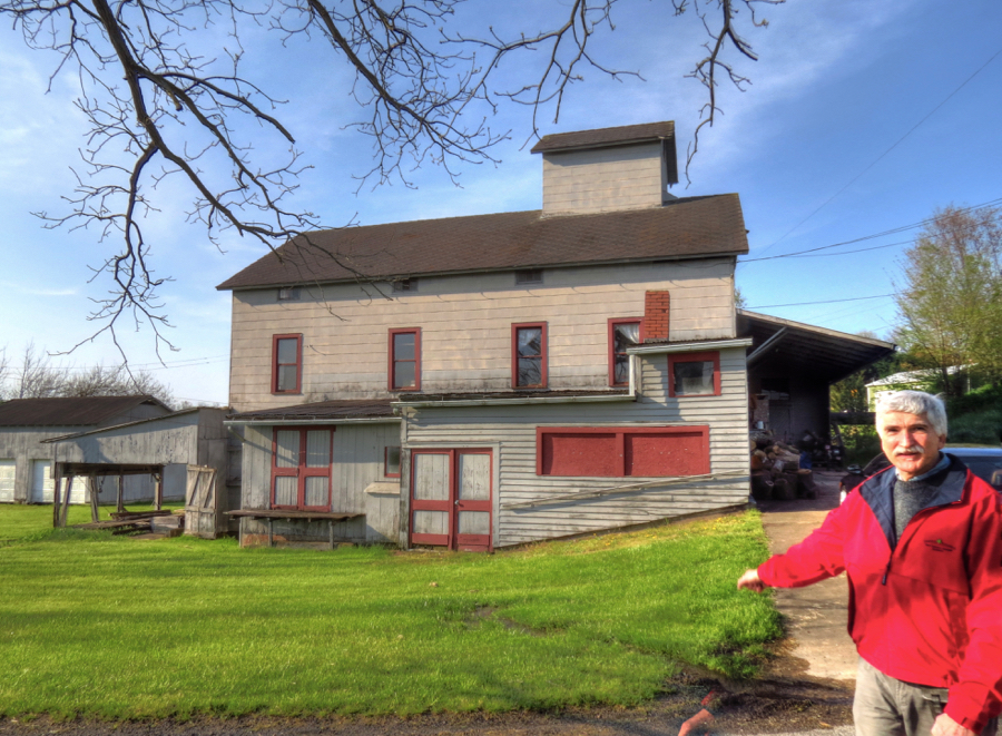

The mill was enlarged over the years to accommodate the sawmill, cider press, and other functions. As a result, it rambles all over the property. Following a hard winter, the overshot water wheel is in need of repair, but Richard will have that fixed in no time, I suspect.

Next up was Mohican State Park, where my wife Nancy and I had honeymooned for two days almost 45 years ago. (It was all we could afford at the time!) A Delaware Indian village was situated high on top of the hill beyond this footbridge over Clear Creek. It was called “Hell Town,” not because of any demons, high temperatures, or other unworldly features, but because of German settlers, whose word for “clear” was “hell.” As we navigated to this site, incidentally, the ever-helpful Garmin Montana GPS directed us to turn left and drive across the bridge—demonstrating yet again that the road to Hell is paved with good intentions.

Native Americans had lived at this site for untold centuries, and the Delaware settled here in 1770 after having been driven out of Delaware, New Jersey, and Pennsylvania. They left Hell Town in 1782, following the massacre of many of their relatives at Gnadenhütten—another topic of vengeance, to which we shall return.
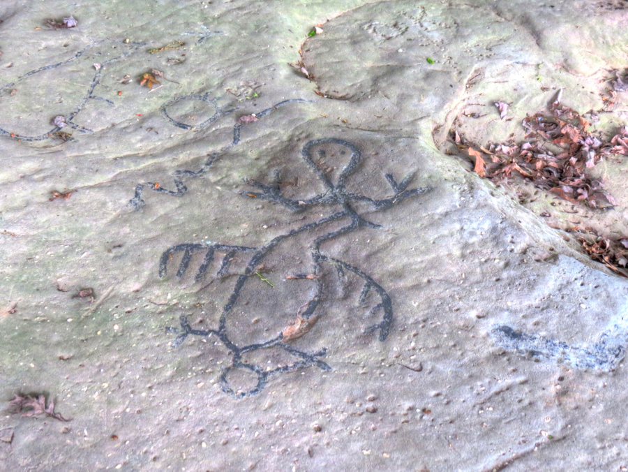
From Hell Town, we drove through Columbus, Circleville, and Chillicothe before finally arriving at the Leo Petroglyphs in southern Ohio. Archaeologists believe these fanciful rock carvings were created by the Fort Ancient Indian Culture, sometime between 1000 and 1650 AD. Out of the 37 images, these were my favorites:

Dunmore’s War was precipitated not only by Chief Logan’s quest for vengeance. Lord Dunmore, the British Governor of Virginia, was anxious to expand his colony’s territory. He also wanted to divert attention from the nascent rebellion that was developing against British authority. Dunmore had sent out surveying parties into areas of (now) West Virginia, Kentucky, and even Ohio—all places that had been reserved for the Indian Nations by the Treaty of Fort Stanwix. Hostilities broke out between the surveyors and the Shawnee and other Native American tribes.
The war consisted of these various skirmishes, Logan’s raids, and the major Battle of Point Pleasant, where the Kanawha River joins the Ohio. There, on October 10, 1774, Dunmore’s forces fought with the Shawnees and their allies under command of Chief Cornstalk. Although the colonial forces experienced five times as many casualties as the Indians, Cornstalk and his warriors withdrew at the end of the day. Dunmore called for a peace negotiation, asking that leaders of all the Indian war parties attend.
Chief Logan agreed to the peace, but he refused to attend the negotiations. Instead, under a majestic elm tree near the confluence of Scippo and Congo Creeks, he met with three white men: Simon Kenton, Simon Girty, and his own brother-in-law John Gibson. Logan dictated a message to Lord Dunmore, which was recorded by Gibson and carried to the peace conference. It read as follows:
- I appeal to any white man to say, if ever he entered Logan's cabin hungry, and he gave him not meat; if ever he came cold and naked, and he clothed him not. During the course of the last long and bloody war, Logan remained idle in his cabin, an advocate for peace. Such was my love for the whites, that my countrymen pointed as they passed, and said, Logan is the friend of the white men. I have even thought to live with you but for the injuries of one man. Col. Cresap, the last spring, in cold blood, and unprovoked, murdered all the relations of Logan, not sparing even my women and children. There runs not a drop of my blood in the veins of any living creature. This has called on me for revenge. I have sought it; I have killed many; I have fully glutted my vengeance. For my country, I rejoice at the beams of peace. But do not harbor a thought that mine is the joy of fear. Logan never felt fear. He will not turn on his heel to save his life. Who is there to mourn for Logan? Not one.
This message became known as “Logan’s Lament.” President Thomas Jefferson included it verbatim in his Notes on the State of Virginia, and for 100 years youngsters would memorize it from their McGuffey Readers. Scholars consider it one of the finest known examples of Native American oratory.
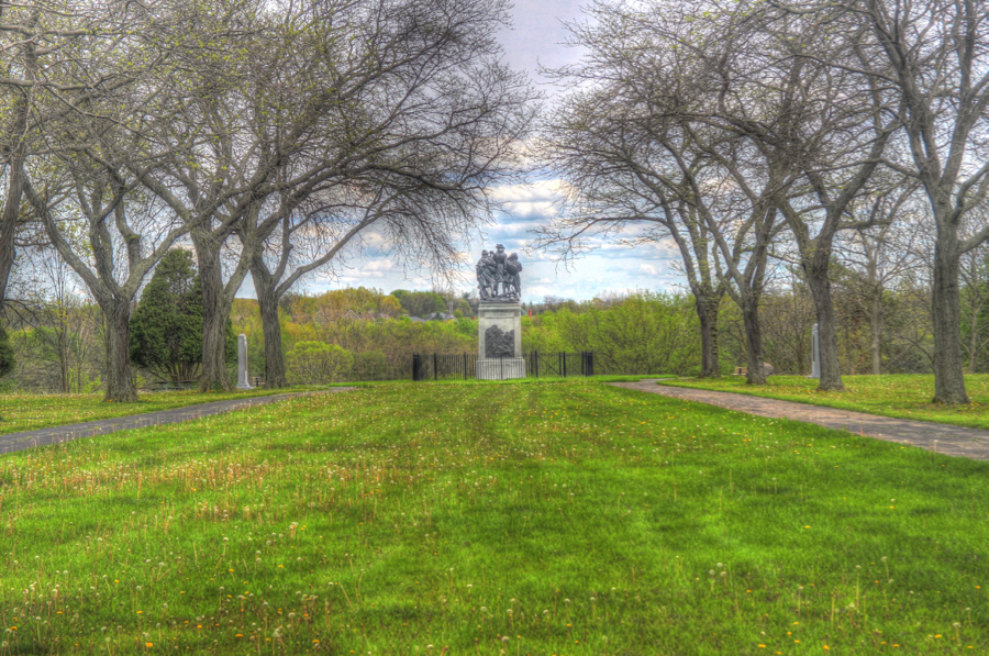
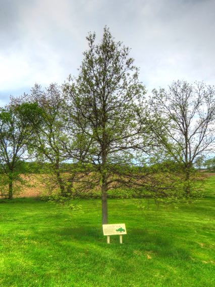
The elm tree where Logan delivered his message stood 104 feet tall and spread across 154 feet; it became known as the “Logan Elm.” The tree survived for another 190 years until succumbing to disease and storm damage in 1964. Today there is a small park at its location, memorializing Logan, Chief Cornstalk, and other Indian leaders. Here, Buzz is reading Logan’s Lament, which is engraved on the granite monument.

Although the Logan Elm is gone, a new one is growing in the same spot. In another 100 years, it, too, may stand as majestically as the original.

Among the other monuments in the park is this one, honoring Nonhelema, known to white settlers as “The Grenadier Squaw” because of her great height—said to be 6 feet, 6 inches. She was the sister of Chief Cornstalk, and they each founded large Shawnee villages on opposite sides of Scippo Creek, just north of the Logan Elm. We stopped for a photo of Scippo Creek, showing where the villages had been, but I inadvertently got Congo Creek. Here’s a Bing Maps view instead. Now, as then, the creek is bordered on both sides by farms.


The Treaty of Camp Charlotte was signed 3 miles east of the park by the Shawnee and Delaware Indians, giving up their hunting rights in Virginia and promising safe passage for settlers on the Ohio River. In exchange, the treaty reinforced that the Ohio Territory was reserved for the Indians only. Peace did not last long, however. When the American Revolution began the following year, Britain immediately enlisted all the Indian Nations they could to fight against the colonies, evening offering payment for every scalp delivered. The Indian wars resumed on America’s western frontier.
Simon Kenton, gauntlets, and the birth of a legend
As we left the site of Cornstalk and Nonhelema’s villages, Buzz discovered two important aspects of driving the 335i: First, that you can make really good time by using the acceleration available from 300 turbocharged horsepower, and second, that doing so is really fun! In no time, we were approaching Xenia, OH. Some of you may remember the horrendous tornado that destroyed much of this city in 1974. It was apparently not an isolated incident, as the Indian name for the area meant “place of the devil wind.”
Simon Kenton was a young man of 19 when he witnessed Chief Logan’s speech under the elm tree. He was already famous, however, as a result of his extraordinary skills as a frontiersman. Tall, strong, fast, smart, and an expert marksman, he had accomplished scouting missions that no one else could have, and he had survived a number of unfriendly encounters with Native Americans—while also forming many close friendships with notable warriors and their families. Among other singular attributes, he had learned to reload his flintlock rifle while running, and the Indians called him “the man whose rifle is never empty.” In 1777, he saved the life of his good friend Daniel Boone. (Kenton images courtesy of Steve White and Conquering the Wilderness, respectively.)


In 1778, Simon Kenton’s luck ran out. He was captured by an Indian war party near the massive Shawnee village of Chillicothe (now “Old Town” or “Old Chillicothe,” outside of Xenia). Once he was recognized as the famous frontiersman, his captors paraded him through a series of Indian villages on the way to Detroit, where the British had their western headquarters.
In Old Chillicothe, Kenton was forced to “run the gauntlet.” A distance of one-quarter mile was lined on both sides by Shawnee men, women, and children—roughly 400 in number, and all of them holding switches or clubs. If he could reach the Indian council house at the end, he would be allowed to live for now. Otherwise, he would be beaten to death. Toward the end of his first attempt, he was knocked down and had to start over from the beginning. Despite severe injuries, he made it. The council house was approximately where this barn is now located, with the gauntlet line running from left to right.

A stone marker commemorates Simon Kenton’s run through the gauntlet at Old Chillicothe. It also notes that one of the greatest Indian leaders in America’s history was born near here in 1768. On the night of his birth, a fiercely burning comet was seen in the sky, and the Shawnee considered it a favorable omen for the infant. His father, Pucksinwah, named his new son Tecumseh—meaning “shooting star” in the Shawnee language.

As Simon Kenton was marched from village to village, he had to run the gauntlet at each one. Few people ever survived even one such run; over a period of 3½ months, Kenton survived nine gauntlets—the final one run with a broken left arm and right collarbone. During his sixth gauntlet, Kenton leapt overtop of an Indian woman and ran for his life. His escape was brief; he ran headlong into Blue Jacket and his warriors, who were coming to see the famous captive, and was struck on the head by a tomahawk. He lived, barely, and was nursed back to health by Nonhelema herself.
Although Kenton’s execution was scheduled on three occasions, each time he was granted a temporary reprieve—twice as a result of interventions by his boyhood friend, Simon Girty, and once by his honorable adversary and friend, Chief Logan. Eventually, he was delivered to the British Governor of Detroit, General Henry Hamilton, and made a prisoner of war. He waited through the winter to recuperate (and spy on the British forces), then escaped and made his way to safety through British forces and Indian war parties across roughly 400 miles of unfamiliar, hostile territory. (Drawing of Kenton and Logan courtesy of Conquering The Wilderness.)

Ironically, while he was being marched from village to village during his ordeal, he couldn’t help noticing the clear waters, fertile grounds, and fresh breezes of the land. He promised himself that, if he survived, someday he would return and live here. In 1799, at the age of 44, he fulfilled this vow. He lived in and around present-day Urbana, OH for another 39 years, dying peacefully at his cabin, with his wife Elizabeth at his side. His grave is marked by this striking monument. As Alan Eckert wrote, “Few lives had ever been as eventful, few men as important to an era.”


In search of castles
After admiring Simon Kenton’s memorial and reflecting on his accomplishments, we walked back to the waiting 335i, which was impatient for more adventures.
Zooming along the roads toward the old Indian village of Mackachack, it was hard to remember that the 10-mile distance would have taken a day or more to travel on foot. Upon our arrival, we marveled at the beautiful Mac-O-Chee Castle, home of Donn Piatt and his descendants from 1879-1985.
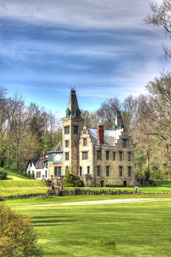
Photograph by Buzz
Nearby, Donn’s brother Abram completed his own Mac-O-Cheek Castle in 1871. His son William opened Mac-O-Cheek and its extensive collection of artifacts to the public in 1912, and both houses have been museums ever since. (Interior photos courtesy of The Piatt Castles.)


Did I mention that we arrived a little too late to take the tours? Mac-O-Chee sits prominently right by the road, so it was easy to photograph. However, Mac-O-Cheek is barely visible at the top of a hill. It’s possible that I walked through the woods a quarter mile to get a photo… Meanwhile, Buzz grabbed his telephoto lens and got a distant photo of me lurking about!

Photograph by Buzz
This cornfield is where the Indian Mackachack Village once stood. And yes, this was one of the towns where Simon Kenton had to run the gauntlet.

We were spending Saturday night in Blue Jacket’s Village, although most people now call it Bellefontaine. And it’s only fair to mention, I suppose, that we would be ensconced in a very nice Comfort Inn rather than a basic Shawnee wegiwa. Along the way, we stopped at Wapatomica, which had been the largest village and the geographical center of the Shawnee Nation—and the home of Simon Kenton at the time of his death in 1838. Now it is the small town of Zanesfield (not Zanesville), named after founder Isaac Zane. As a 9-year-old boy, he had been captured and adopted by the Wyandot Indians; he became a trader after his release and married Myeerah, daughter of Chief Tarhé. (Painting of Isaac and Myeerah courtesy of the Logan County Historical Society Museum.) Today, Zanesfield is a prosperous town of about 250 people, with little indication of its place in frontier history.


Not far from our motel in Bellefontaine, we managed to locate the highest point in all of Ohio: Campbell Hill, with an elevation of 1,550 feet. (Okay, we admit that’s not very impressive.) There was an Air Force “early warning” station here during the Cold War, which has since been converted to the Ohio Hi-Point Career Center.

We had an excellent dinner of catfish and ribs at 2 G’s Barbecue, after which we visited the first concrete-paved street in the country, built in 1891 immediately next to the Logan County Courthouse. (Remarkably, it’s never been repaved.)

The next day promised to be another exciting one, with much exploration yet to come.
Rick F.