If At First You Don’t Succeed…
My first attempt at this trip ended in frustration last December, with my summer performance Bridgestones scrabbling uselessly in the snow as I tried to negotiate a steep climb via switchback corners. There hadn’t been any snow predicted near my hometown or at my furthest destination—but I’d forgotten to check for the mountains in between.
By the time I reached Grantsville, Maryland, back in December, it was snowing heavily off and on, and all the back roads were covered by 1 to 3 inches of the stuff. I made it to the Fuller-Baker House without difficulty and with a fairly clean car (although not for long). General Edward Braddock and his ill-fated army camped here in 1755, on their way to a massive defeat against the French and their Indian allies near what is now Pittsburgh, PA. (General Braddock did not make it back; a young Colonel George Washington did.) In 1791, Thomas Johnson bought this property. (As we recently saw in Mansions in the Snow, and the Darker Side of History, Johnson later became the first elected Governor of Maryland.) The log building wasn’t constructed until 1815, and it apparently served as a tavern on the new National Road before becoming a family dwelling. (Unless noted otherwise, historical photos and other images are courtesy of the Library of Congress, National Register of Historic Places, or Wikipedia.)

The Casselman Inn also catered to travelers on the National Road, starting in 1842. As many as 14 stagecoaches a day would stop here. On my December visit, it was snowing so hard that my camera had difficulty focusing.

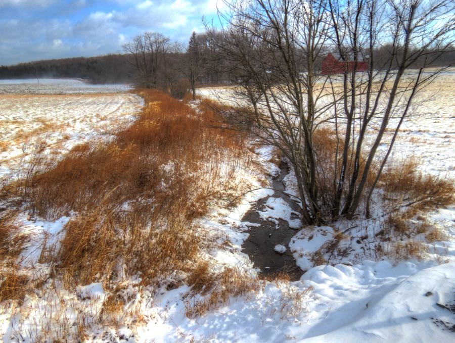
I continued on my snowy adventure, even as the roads got worse and the wind blew harder. From time to time, the skies would clear temporarily, such as in this photo of the headwaters of the Casselman River. From here, it runs northward for 56 miles before emptying into the mighty Youghiogheny at Confluence, PA. The wind in this open area was so strong that it nearly blew me into the fledgling river!
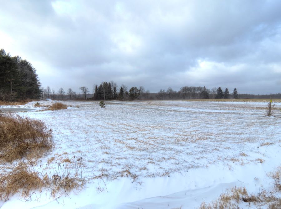
The area wasn’t so flat and open just by coincidence. This is “Buckel’s Bog”: the site of the only known natural lake in all of Maryland. During the late Pleistocene Era (about 14,000 to 19,000 years ago), there was a shallow, 160-acre lake here. It’s long gone, obviously, and every current lake or reservoir in Maryland is man-made.
Continuing to fight the snow, I willed the 335i on through a long series of descents and climbs, passing by Fort Henry, the Wisp ski resort, and a number of small towns. I doubted the wisdom of this adventure more and more as the BMW slid frequently and unexpectedly, even at slow speeds. Approaching a steep uphill section near Swallow Falls State Park, I realized that I was facing a dilemma: If I got a running start sufficient to make the climb, I’d never be able to negotiate the upcoming hairpin turn. And if I slowed enough for the curve, I wouldn’t be able to climb the grade. I chose the latter option, with predictable results. I threw in the towel, backed down the mountain, turned around, and (with considerable difficulty) retraced my steps back to civilization—in the form of plowed roads!
…Try, Try Again
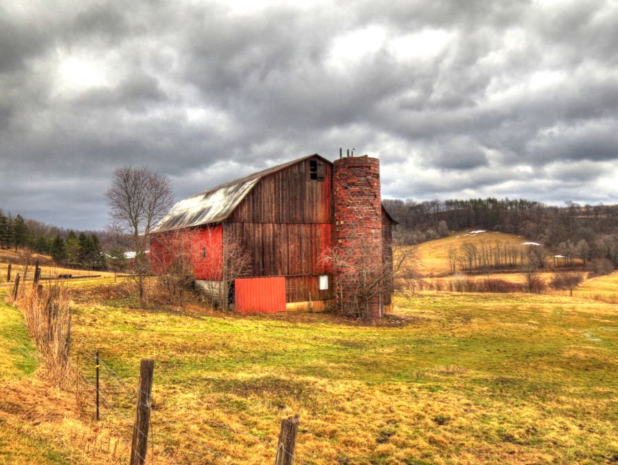
Having been defeated in December, on the last day of February I returned to finished the remaining seven-eighths of my planned trip. This time the weather cooperated, although the skies rained on my just-washed 335i for roughly 100 miles. But it was worth it, since sights such as this one were everywhere.
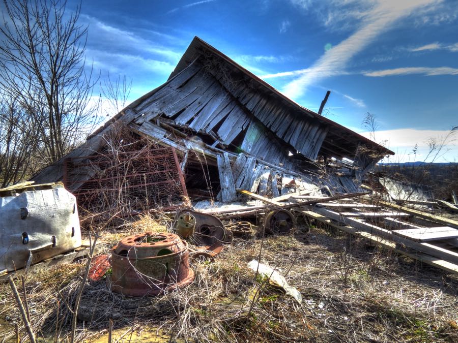
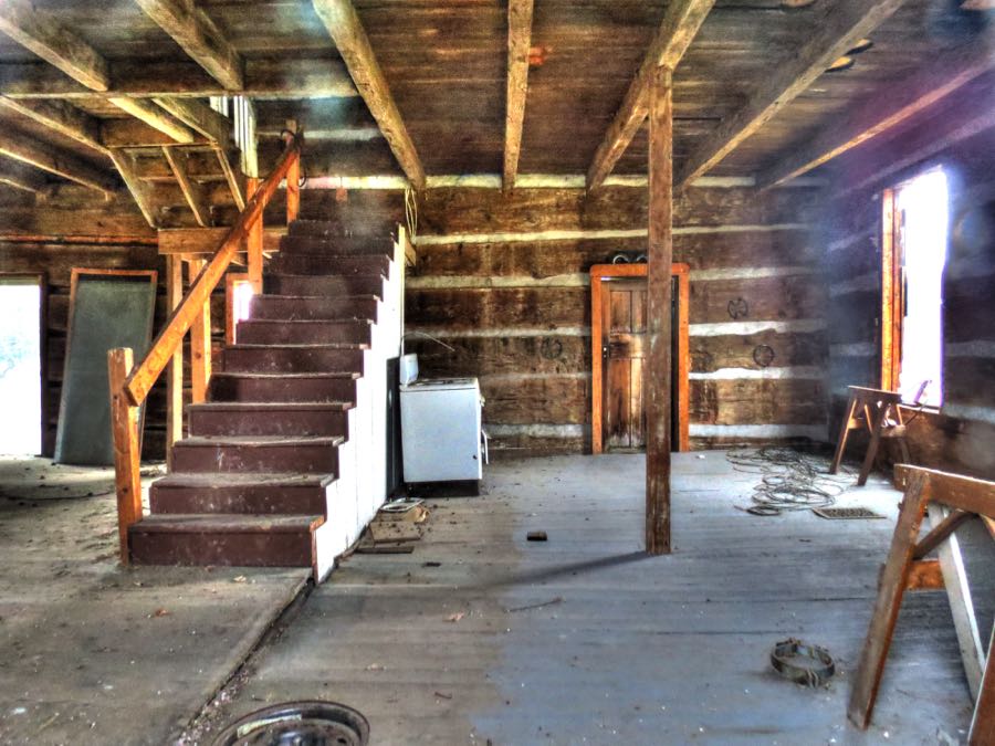
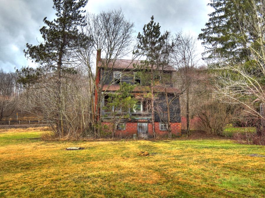
There were so many abandoned houses along the rural roads that I eventually stopped photographing them. A 32 GB memory card only goes so far…
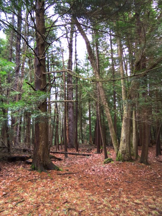
With my Blizzak snow tires safely in place, I was confident that I could tackle any snow along the way. Naturally I didn’t find any (but the tires still helped on several muddy sections). This time I easily zoomed up the mountain and around the switchbacks, arriving at a deserted Swallow Falls State Park by 10:45 AM. The virgin Hemlock and White Pine grove at the park is the last such stand in Maryland. Some of the trees are over 300 years old. I realized that I could be witnessing the same trees that Daniel Boone, Simon Kenton, and other frontiersman saw when they passed through this area on their way west.
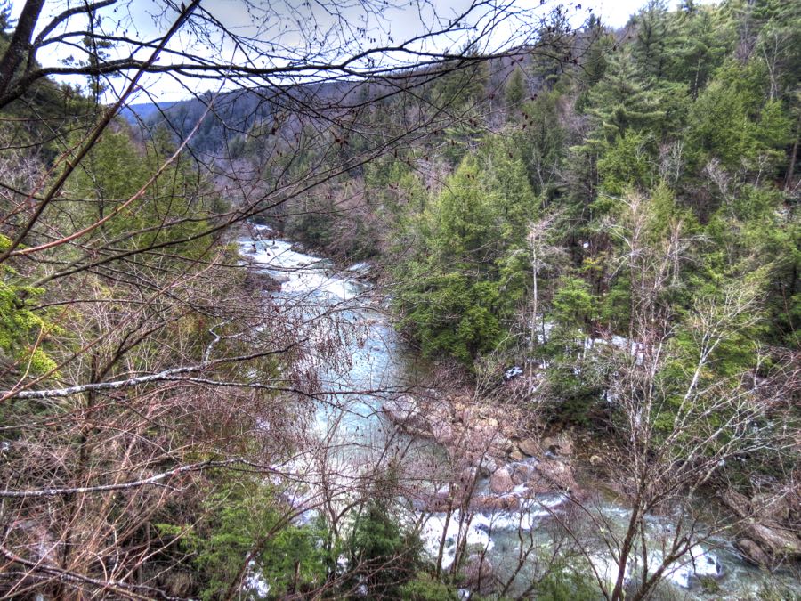
Hiking into the woods, I soon located the Youghiogheny River. Kayakers and exceptionally brave canoeists regard the Yough the same way that BMW drivers and riders view the Tail of the Dragon and the Nürburgring. And, as with these automobile venues, not everyone survives a trip down the Yough.
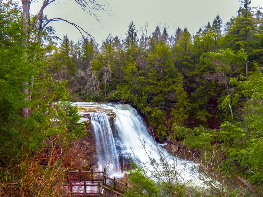
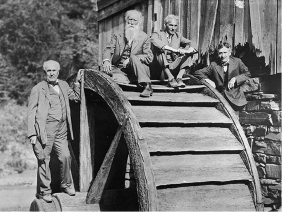
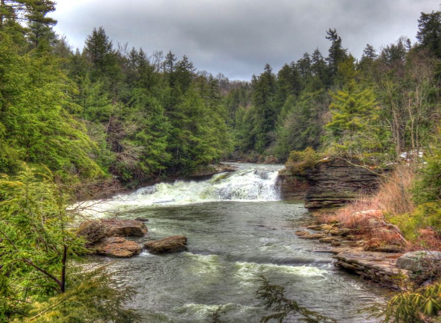
With heavy rain the night before, Muddy Creek Falls was predictably spectacular. In 1918 and again in 1921, a group of friends calling themselves “The Vagabonds” chose to camp at this site. The group comprised Henry Ford, Thomas Edison, Harvey Firestone, and naturalist John Burroughs. We can only hope that they invoked all the relevant antitrust warnings and rules before launching into their campfire songs. (The historical photo shows Edison, Burroughs, Ford, and Firestone from left to right, courtesy of the Panama-Pacific International Exposition.)
Another short hike brought me to this view of upper Swallow Falls, on the Youghiogheny.
And if there’s an upper falls, there’s bound to be a lower set as well, right?

Trains & Tunnels
Between the rain, damp roads, and leftover road salt and cinders, my poor car was a mess. Fortunately, I later found a U-spray car wash in nearby Oakland, MD, and I was able to clear off the worst of the grime.
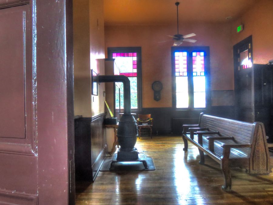
I also found the wonderfully scenic 1884 Oakland B&O Railroad station, residing under glowering skies and wondering why the passenger trains no longer stop here. (Regular passenger service ended in 1965, although it was briefly restored by Amtrak during 1976-1981.) There is scant evidence that anyone is haunting the station, although, during a 2013 paranormal investigation, a recording picked up a faint voice saying in a confused tone, “Is this Hell?”

I left Oakland and headed (finally) for West Virginia. Just before crossing the state line, however, this weathered space rocket appeared out of the shadows.
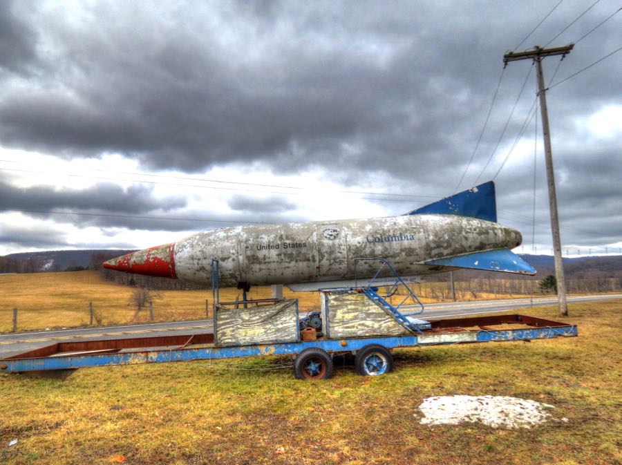
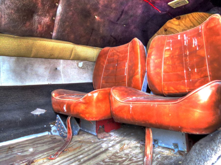
Investigating further, I was able to open its hatch and peer inside. I marveled at NASA’s clever use of plywood as a structural element of the craft, but eventually I realized that this odd rocket was just an old amusement park ride. It looked like it would have been fun, even though there was no way to see out.
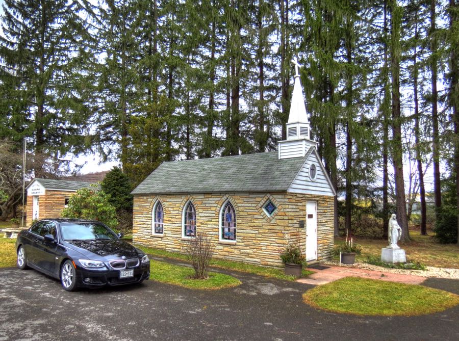
Just across the West Virginia line, I went looking for what is claimed to be the smallest church in the continental U.S. I suspected that it might be hard to find… Our Lady of the Pines Catholic Church in Silver Lake, WV measures just 12 feet by 24 feet and was built in 1958 as a family memorial. Behind the church is (possibly) the country’s smallest post office. It handles outgoing mail every day, but counter service is available only on Fridays the Thirteenth. There was no question but that I was now in West Virginia!
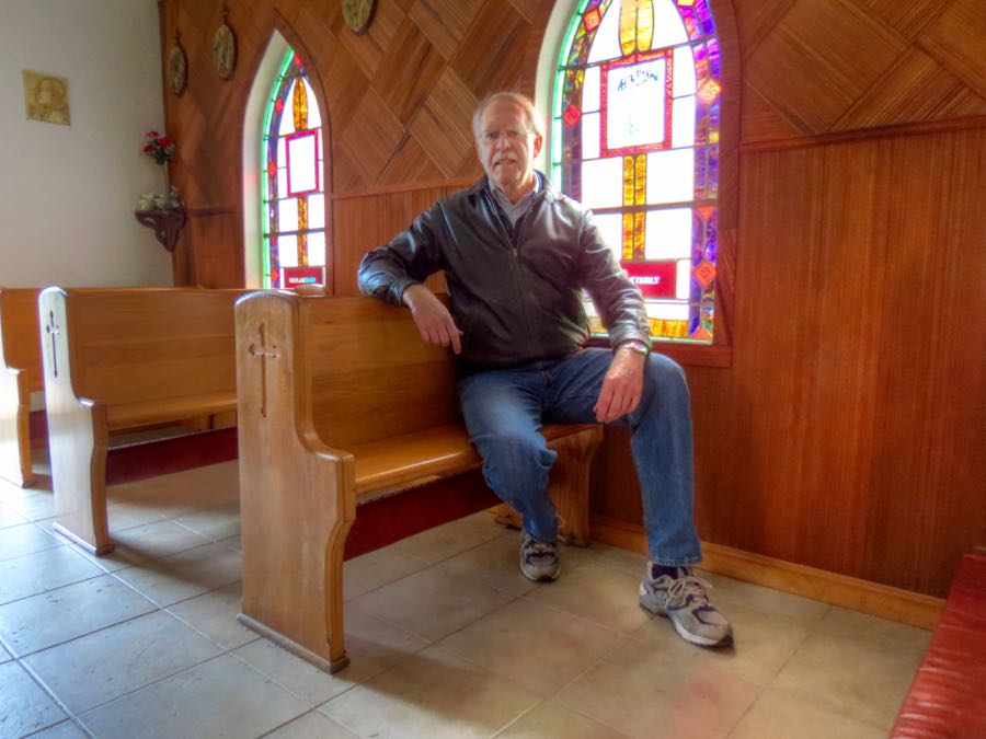
As luck would have it, the little church was open. Inside was a nice-looking altar, plus six two-person pews. In other words, just enough room for a minister and 12 disciples.
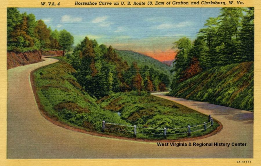
The 335i was already beginning to pick up more spray from the road, and I contemplated washing it for the third time in less than 24 hours. However, I decided in favor of using it as The Ultimate Driving Machine, rather than The Ultimate Washing Machine, and pressed on toward Tunnelton. I hadn’t been on this section of Route 50 for a long time (see West Virginia (GPS, Gravel, and All)), and I thoroughly enjoyed pushing The Ultimate through the continuous series of bends, rises, and declines.

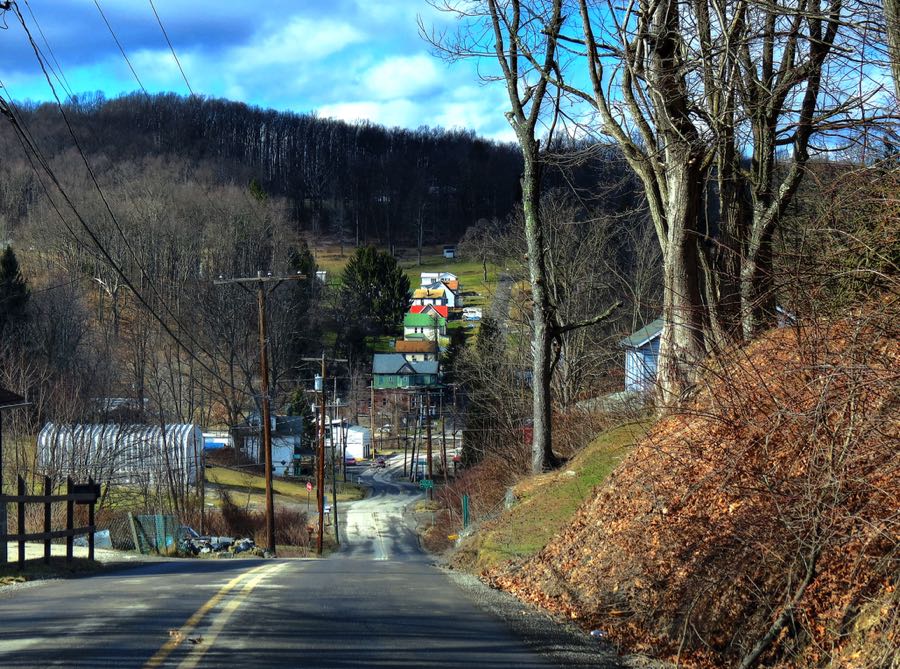
In planning my trip, I figured that a town named Tunnelton probably had a tunnel. Approaching the village, I marveled again at how vertical West Virginia is.
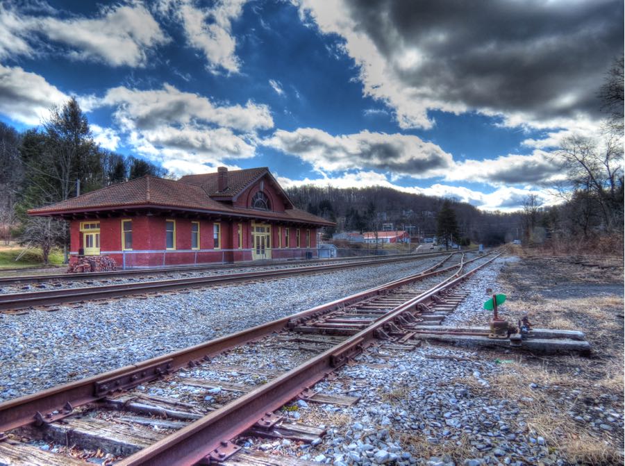
The Baltimore & Ohio Railroad used to run right through Tunnelton, and its modern-day successors still do. This was the old freight station, which was built in the early 1900s and continued in use through about 1980.

The Tunnelton passenger station opened in 1913 and closed its doors in 1968, leading to a long period of deterioration. Thankfully, the local historical society came to its rescue, and the station has been renovated and is being converted to a museum.

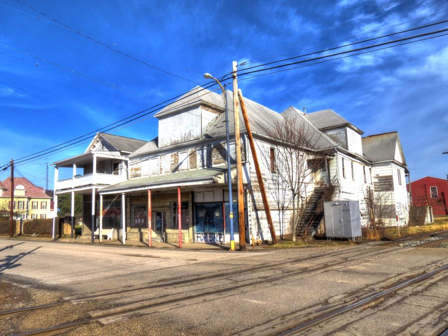
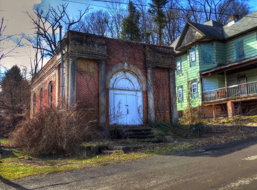
These days, Tunnelton’s population totals less than 300. The town thrived during the railroad and coal mining years, but, like the railroad station, it has deteriorated substantially. Its troubles began when the Bank of Tunnelton failed in 1928, shortly before the onset of the Great Depression. (Tunnelton continued its economic decline as the railroad and coal mining industries died out, and it has never recovered.) It appears that the bank was later used as a residence, but it was pretty hard to tell, owing to its trashed interior. I interviewed a 1% sample of the population—three teenagers sitting on a nearby porch—but they knew little about the bank’s history.
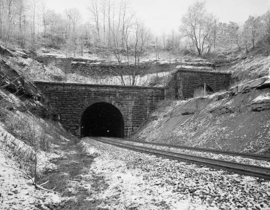
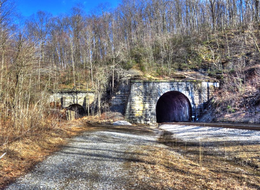
The boys did tell me that on numerous occasions they had walked through the railroad tunnel for which the town is named. They proudly stated that they did so without a flashlight. At the time, I assumed they were referring to the original, abandoned, 1850s tunnel, but in retrospect it’s clear that they were talking about the 1912, double-track tunnel, which is still active. (It’s a wonder that anyone ever survives to adulthood.) Here is an old photo of both entrances:
My plan was to walk along the abandoned right of way for the old tracks, which I figured would parallel the active tracks all the way to the tunnel entrances. Moreover, it looked like an easy, safe hike of just a quarter mile or so.
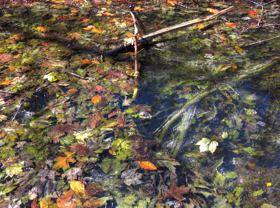
Before long, a couple of things became apparent: First, there were quite a number of fallen trees across the right of way. I’m reasonably agile for an old far … uh, I mean an old guy, and I managed to clamber over and under the trees as necessary. But second, all that rain from the prior day and night had run down the embankment and pooled in the right of way. My hike soon became an exercise in hopping from one little island of bamboo and underbrush to another, with the ratio of land to bog going down at an alarming rate. Oh, did I mention the hundreds of thorn bushes?
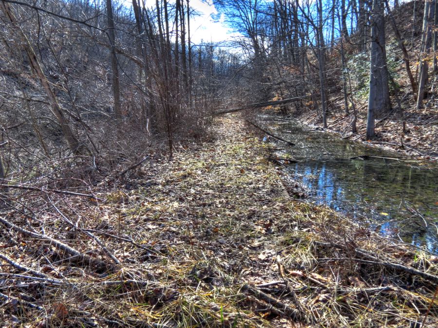
At least sections of the trail were pretty—in kind of a dead and sodden way.
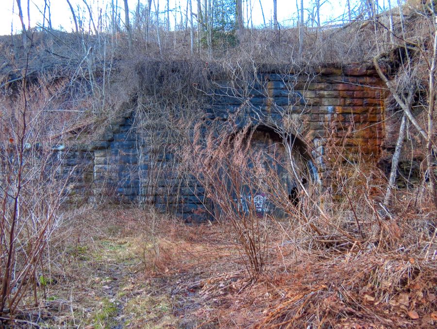
My GPS data indicated that I started off at a brisk 3.5-mph pace, which soon slowed to about 2 mph, then down to 0.2 mph while clambering and scouting. Still, I apparently reached the tunnel entrance after only about 15 minutes. I swear, it seemed like an hour or more! But there it was, the old Kingwood Tunnel, built by the B&O as part of its massive effort to connect Baltimore with the Ohio River. At the time of its completion in 1852, it was the longest tunnel in the U.S. Two sets of tracks originally ran through here, but in 1865 the line was reduced to a single track to accommodate larger trains. The tunnel continued in use until the 1950s.
A very interesting account of the engineering required to build the tunnel is available at ”Baltimore and Ohio Railroad: Kingwood Tunnel.” Cave-ins were common during construction, and as many as 30 workers were killed and another 300 injured. The B&O’s chief engineer was Benjamin H. Latrobe, II, whose father had helped design and build the U.S. Capitol. When Labrobe realized that the Kingwood tunnel could not be completed in time for the line to be opened to the Ohio River, he designed a temporary series of switchback tracks. Trains would climb a grade that was nearly 5 times steeper than the industry standard of 116 feet per mile, then reverse onto the next section of track, climb that section, and pull forward again onto the next section. Labrobe wasn’t even sure that it would work, but it did. Early passengers were so terrified by this process that many of them preferred to disembark and walk over the mountain. The Kingwood tunnel and a portion of the temporary switchback system are shown in this early engraving.

I wasn’t surprised to see that the abandoned tunnel entrance was closed off with large stone blocks, but I wasn’t expecting to see a person-sized hole knocked through the barrier. (With my usual macabre curiosity, I wondered whether the opening had been created by people outside, seeking to get into the blocked-off tunnel, or by someone or something inside, wishing to escape…) I really wanted to get a look inside, but every approach lay under a foot or more of water. My shoes and socks were already soaked and muddy, but my pants legs were still dry, so I didn’t just hop in.
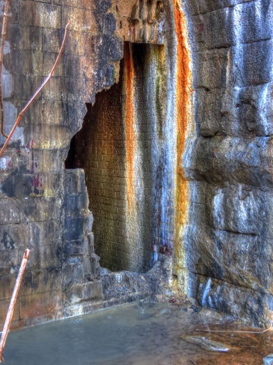
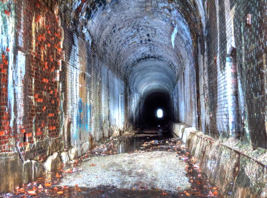
If I had waded in, then the resulting picture would have looked much like this one. In fact, this is my own photo of the inside of the 1852 Kingwood Tunnel. The old bricks lining the tunnel were holding up pretty well, but the entire 4,137-foot length appeared to be well under water.
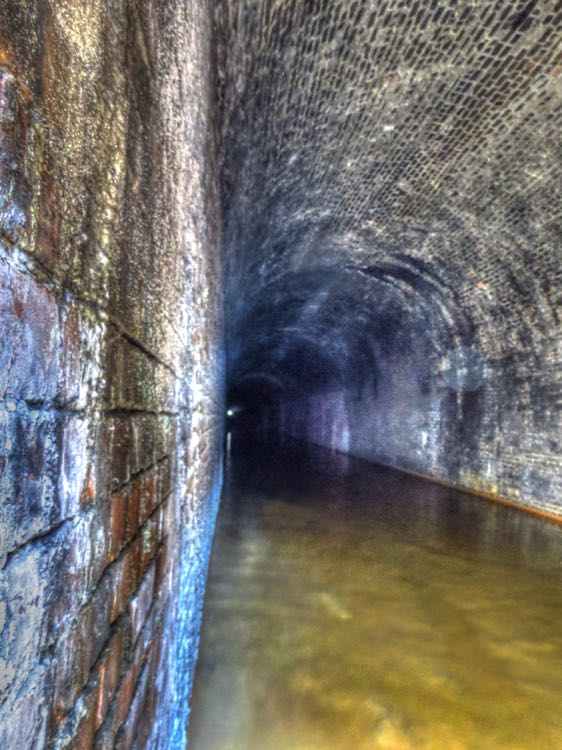
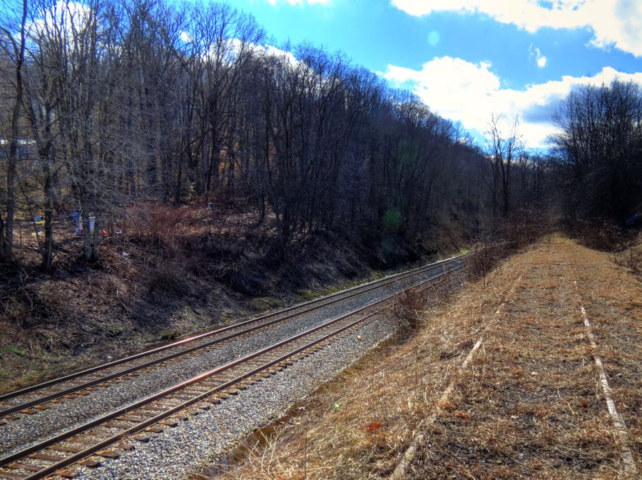
I got the above photo by powers of deduction, i.e., if a tunnel has an entrance, then it probably also has an exit. I merely hiked the quarter-mile swamp back to Tunnelton and then drove around to the west entrance, parked, and hiked the (surprisingly dry) four-tenths of a mile to that entrance. CSX had helpfully bulldozed a huge mound of dirt, rocks, and tree limbs into a pile blocking off the final approach to the old west entrance, but there was no stopping me now. As I climbed over the debris, I saw that there was also a hole knocked through the stone wall blocking this entrance, with a little 6-inch-wide outcropping available to balance on while holding the camera one-handed through the opening.
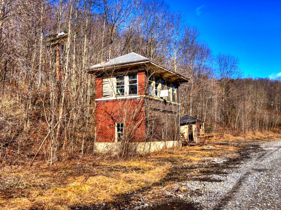
Anyway, if you’re going to visit the Kingwood Tunnel, definitely go for the west entrance. There’s even an abandoned B&O control tower along the way. You almost never see these anymore.
The Origin of Mother’s Day
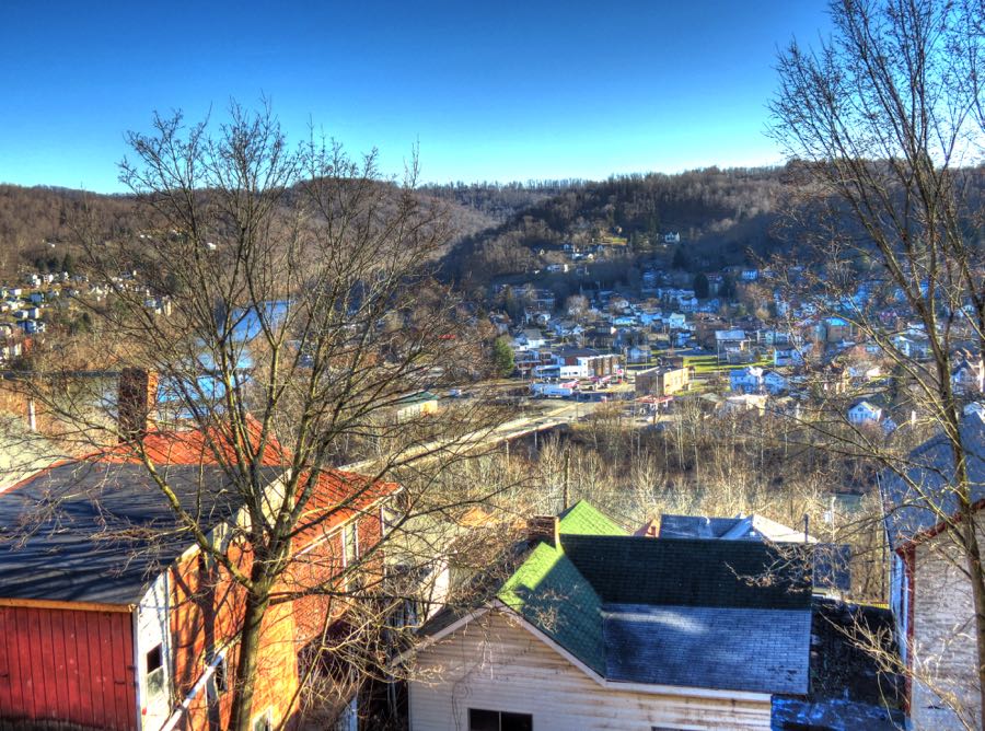
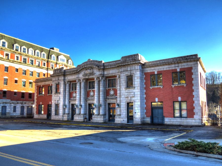
After all this hiking around, I was—as usual—well behind schedule. Once I was back on Highway 50, I enjoyed making back some of that time on its unending corners. The city of Grafton is like many others in West Virginia, in that it’s nestled up and down along the steep hills that were carved out of the mountains by a river; the Tygart Valley River in this instance. (Unbeknownst to me when I took this photo, a fellow named Foreman had the same idea in 1890.)

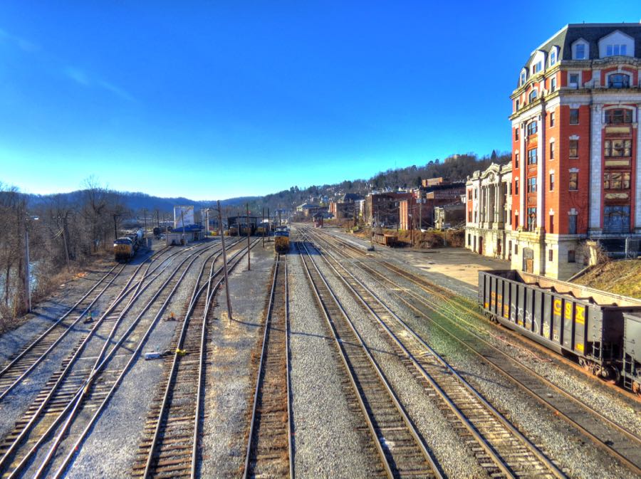
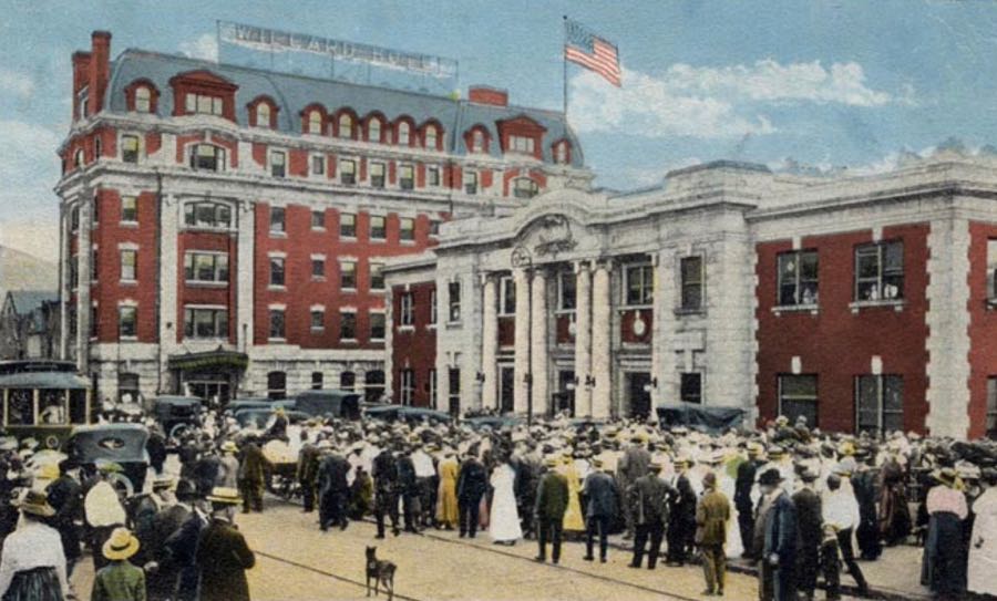
Grafton was, and still is, a major railroading town. The second building from the right is the former B&O passenger station, with the 6½-story Willard Hotel next to it. Both were built in 1911 and have been vacant for many years, although the station has benefited from some renovations. (Postcard of opening day courtesy of A History of Grafton.
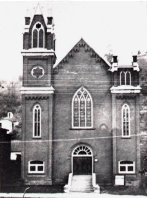
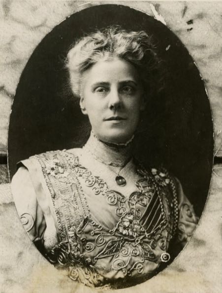
Anna Jarvis (1864-1948) was born in nearby Webster, WV (one of thirteen children) and moved to Grafton as a child. She went to college in Staunton, VA, and later moved to Philadelphia, PA, where she became the first high-level female employee at the Fidelity Mutual Life Insurance Company. Following her mother’s death, Anna held a memorial ceremony at Grafton’s Andrews Methodist Episcopal Church on the second Sunday in May, 1908. The service was in honor of her mother and all mothers, and it was the first formal observance of Mother’s Day. She worked tirelessly thereafter, promoting Mother’s Day across the U.S. and in other countries, and President Woodrow Wilson officially proclaimed the national holiday in 1914. In 1962, the Andrews Church became the International Mother’s Day Shrine. (Photo of Anna Jarvis courtesy of the Historical Society of Pennsylvania.)

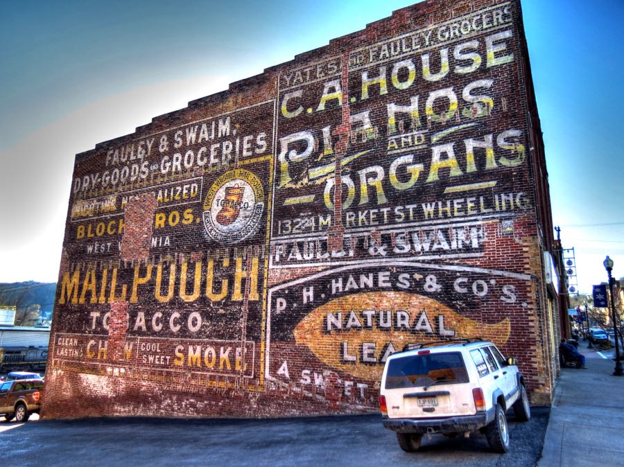
This building in Grafton seems to have featured almost every sort of advertisement possible.
Remember the rare old railroad control tower near the Kingwood Tunnel? Well, Grafton still has one, too. In all my traveling, I hadn’t seen a single one; now I’d found two within the space of 90 minutes!
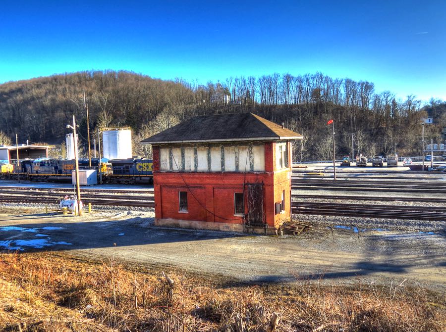
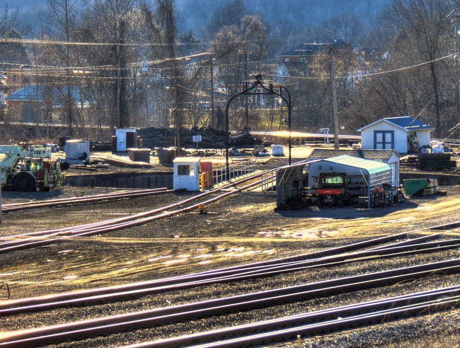
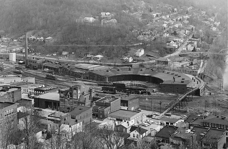
Speaking of rare, you don’t see many railroad roundhouses anymore—but there’s one in Grafton. The “house” part is long gone, sadly, but the pit and turntable can be seen in this photo.
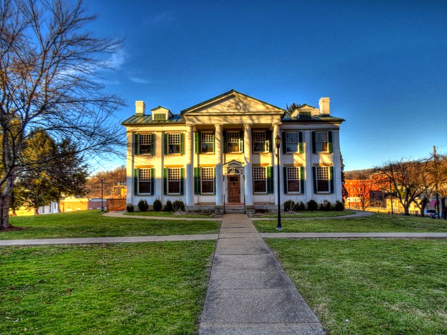
With the shadows lengthening by the minute, I returned to Route 50 and made haste for Clarksburg—only to arrive in the middle of evening rush hour. I dove off the busy highway and into the heart of the downtown area, where the traffic was thankfully much less dense. Job and Jerviah Goff moved to this area in 1804, along with their 8 children, one of whom was Waldo P. Goff (1796-1881). Waldo and his wife Harriet Moore built this beautiful Neo-Classical brick mansion in 1839, and their daughter May named it Waldomore after her parents’ names. The Goff family and their descendants lived here for 92 years, when May left it to the city of Clarksburg for use as a public library.
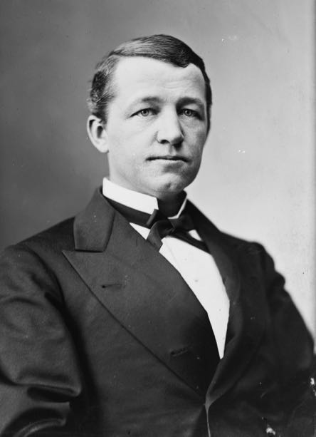
Waldo Goff’s son, Nathan, served honorably in the Civil War and became a prominent lawyer and politician. He was elected Governor of West Virginia in 1880—sort of. He had a thin margin in the popular vote over his rival, A. Brooks Fleming, but the vote was contested. While that was being sorted out, both Goff and Fleming were sworn in as Governor, and the sitting Governor refused to leave office. Thus, for a short time, West Virginia had three Governors at the same time. The issue was settled by a party-line vote of the WV Legislature. Nathan did not prevail, but he later became a Federal Judge and then a Senator. (From left to right, Waldo and Nathan Goff. No photos of Harriet or May seem to exist.)

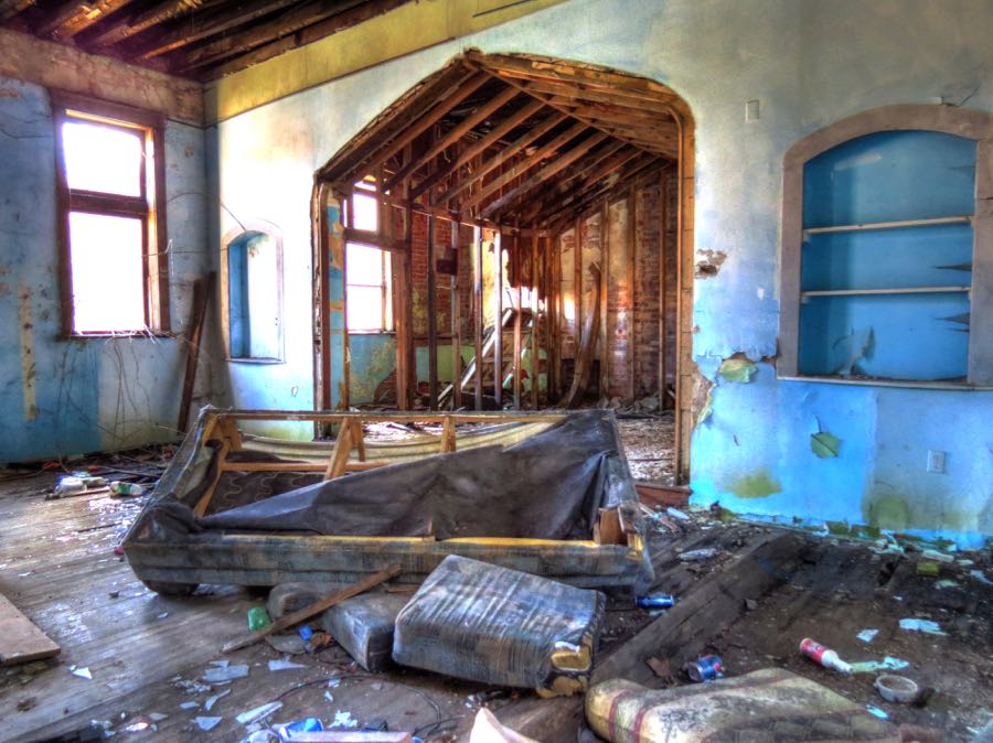
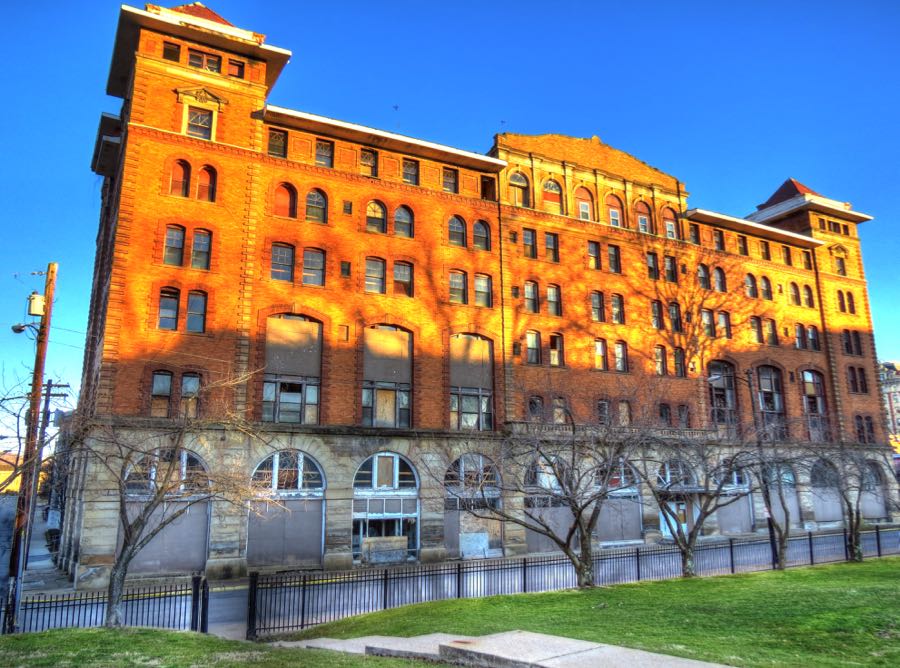
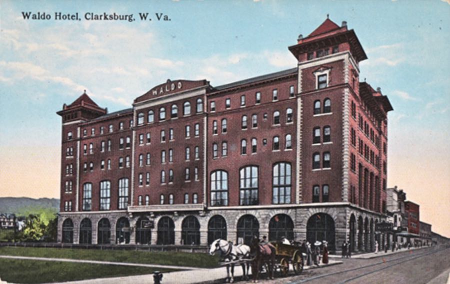
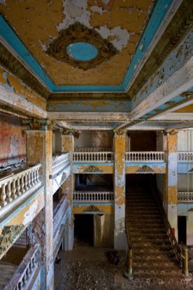
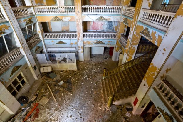
Somewhere along the way, Nathan Goff decided that Clarksburg needed a luxurious hotel to match its growing wealth and prominence. He funded construction of the Waldo Hotel, which opened for business in 1904 and prospered until the Great Depression struck. The hotel went out of business, served as a college dormitory for a few years, then as an apartment and office building, and finally as low-income housing. It was abandoned in 1994 and condemned 15 years later. The Waldo Hotel Preservation Society is attempting to raise funds to stabilize and renovate the grand old building, but I suspect its days are numbered. (Interior photos from 2012 courtesy of Richard Nickel, Jr. at The Kingston Lounge.)
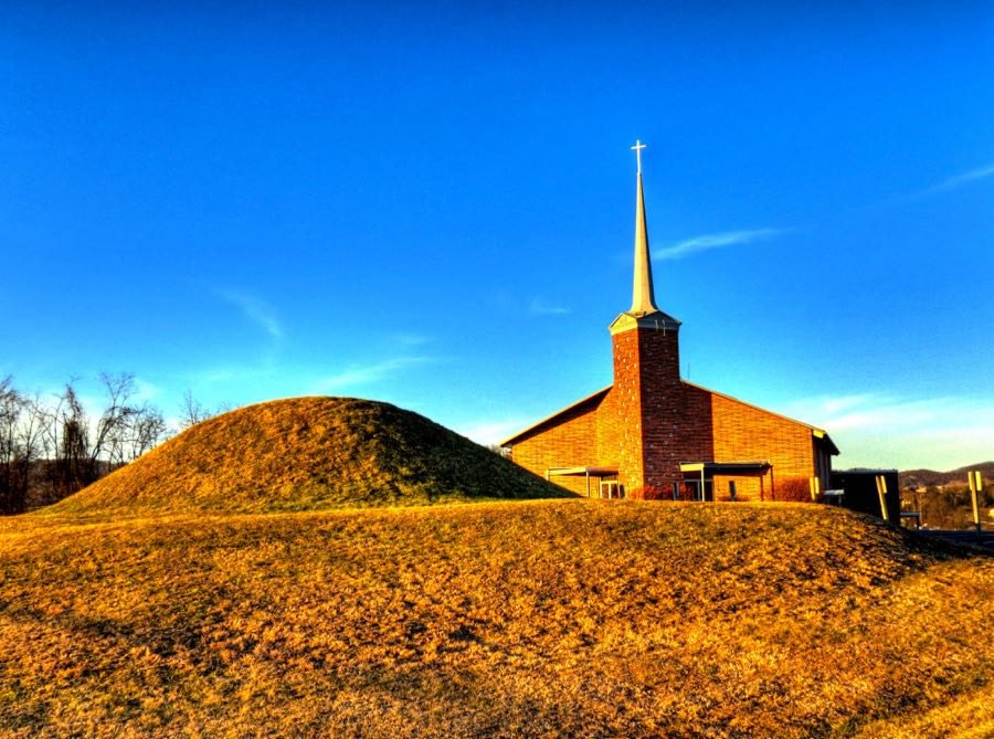
Lots of churches have adjoining cemeteries—but in the case of the Oak Mound Evangelical Church in Clarksburg, the cemetery is a 2,000-year-old Indian burial mound. Archaeologists in 1969 found the remains of two individuals (probably members of the early Hopewell culture), along with a number of flint tools and pottery shards.
Flinderation!
I had one more destination before heading to my overnight stop in New Martinsville, WV on the Ohio River. You all know the meaning of “reintarnation,” right? That is, after you die you come back to life as a hillbilly? Well, if that’s what reintarnation means, then what does “Flinderation” mean? I was determined to find out. In the meantime, I began using Flinderation! as an expression of surprise, annoyance, or general bemusement. It seemed like an appropriate West Virginia exclamation.
As it turned out, Flinderation is a both a place and an expression. The expression means “a state of being in flinders” (i.e., fragments). The place is a very small town west of Clarksburg, one that happens to be the location of the 1857 Flinderation railroad tunnel—considered one of the most haunted spots in West Virginia. All the ghost stories refer to a train roaring into the 1,086-foot tunnel while a repair crew was inside fixing the tracks. The resulting derailment killed either 1, 2, or 3 of the workers, and the tunnel has been a source of eerie lights, strange moaning sounds, loud crashing noises, whispers of “Help me!” and assorted other phenomena ever since.

Ghost stories aside, there is no historical evidence that any train ever derailed here. On the evening of my visit, I saw and heard only the steady drip of water from the ceiling of the tunnel. A lot of water, given the prior day’s rain. The water falls from the sky, enters the ground above the tunnel, passes through it, and then falls from the ceiling, creating numerous puddles. Should I mention that, consequently, the water is also passing through the human remains buried at the Brandy Gap Cemetery, which is directly overtop of the tunnel? (Flinderation!)
After a long day of touring, and absent any more daylight for photos, I was anxious to get to New Martinsville for some dinner and rest. My scheduled route would have taken me up Route 20, but I opted for the equally curvy Route 18, which was a little quicker. It would have been a fabulous driving opportunity, but its patched and broken pavement made for a long, rough ride. Next time I’ll stick to Route 20.
It had been a terrific day, full of exciting West Virginia roads, historical hiking, and wonderful sights. After a quick dinner, a call to my very patient wife Nancy, and a brief review of the next day’s route, it was lights out.
Rick F.