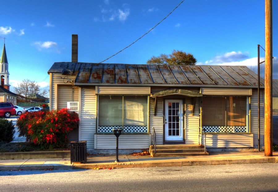
My tour began in what looked like a pouring rainstorm but was, in reality, the inside of a brushless car wash in Hancock, MD. After my rain-soaked and muddy tour of Tidewater Virginia, the poor car was overdue for a wash.

Hancock is just across the Potomac River from Berkeley Springs, WV, which in turn is at the base of Cacapon Mountain. At the top is this well-known view of the river, which has delighted countless visitors both before and after George Washington’s several trips to this spot.

Zooming in a bit brings the small town of Great Cacapon into better view. It’s located immediately west of the Cacapon River and south of the Potomac. Back in the day, I canoed many rivers in the Mid-Atlantic area with my long-suffering Dad, and the Cacapon was always my favorite. “Cacapon,” incidentally, means “medicine waters” in the Native American Shawnee language; American Indians lived in this area at least as far back as 1300 A.D. At the time of his death, George Washington still owned 240 acres of land bordering on the two rivers.
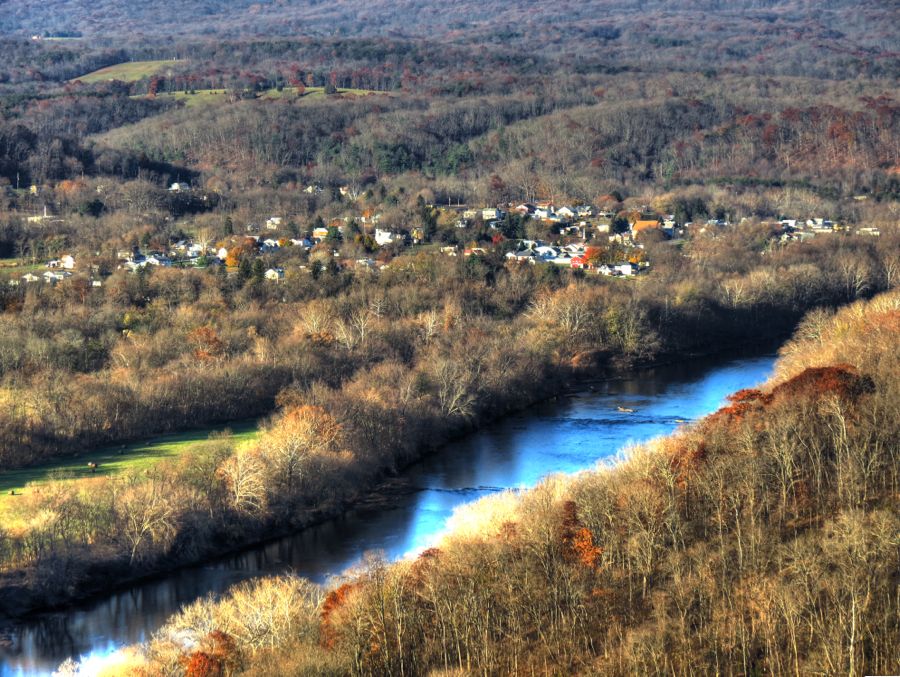
The bridge in the distance has been carrying the Baltimore & Ohio / CSX Railroad across the Cacapon for nearly 150 years. It replaced the timber bridge that was burned on January 5, 1862 by Confederate Colonel Albert Rust. The bridge had been fiercely defended by Union Col. William Slaughter’s infantry forces, but they were eventually forced to retreat—through the freezing waters of the Potomac. Then, as now, the Cacapon joins the Potomac just beyond the bridge. Although the foliage surrounding the river was an uninspiring brown color, the low angle of the sun helped to light it up, and the water reflected the bright blue of the sky.
I was disappointed to find that one of my favorite sights in Great Cacapon had disappeared altogether since my last visit, leaving an empty lot. This “ghost photo” shows the abandoned church that used to sit here. Not all historic buildings are rescued before it’s too late, sad to say. (B & W photo of church building courtesy of Rick Lanning. Photoshop montage courtesy of Pekoe the Racing Cat.)

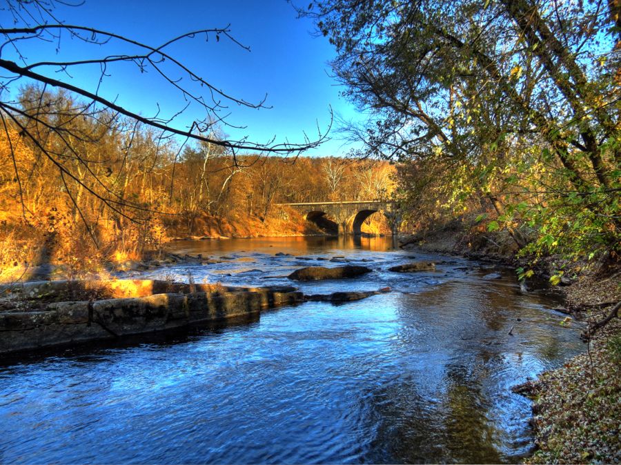
Despite all the canoe trips down the Cacapon, I’d somehow never managed to find the old power plant dam near Great Cacapon. With my fecklessly unreliable Garmin Montana 600 GPS onboard, however, I was determined to locate it. Along the way I discovered this low-water bridge across the river, which seemed as good a place as any to park for a photo.

A couple of miles and at least 200 feet in elevation gain farther on, I found the dam. The very edge of a steep and guardrail-less cliff seemed as good a place as any to park…

Getting out of the car (being careful not to close the door too hard!) and tiptoeing up to the edge produced this view of the Cacapon and dam. The power plant buildings are long gone. According to a 1905 article in the Morgan Messenger, by S.S. Buzzerd, the power lines from the plant were just going up and would deliver electricity to Great Cacapon for the first time. I wasn’t able to determine whatever happened to the power plant, but a good candidate is the flood of 1936, which crested at over 30 feet.

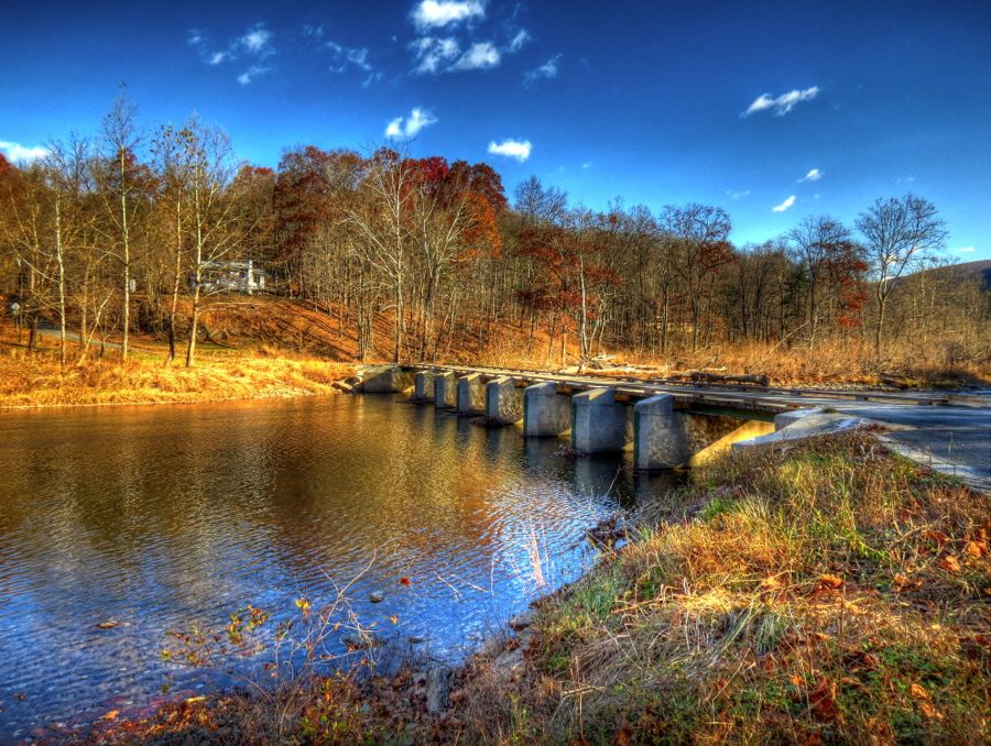
My goal was to take Rock Ford Road for about 6 or 7 miles, following the Cacapon and eventually returning to Route 9. I got off to a good start, finding another low-water bridge that offered these views:

Before long, Rock Ford Road turned into a narrow dirt path. There were signs of development, however, such as this relatively new riverside dwelling. (Note to prospective buyers: those stanchions are considerably less than 30 feet high!)

The older homes along the path were much more basic. I liked this “illuminated” log cabin the best. It was, in fact, a very pretty day, with temperatures ranging from 38 to almost 60 degrees. The Z4’s top had been down since the mid-40’s, which is how long it took the convertible top to dry out following the car wash.

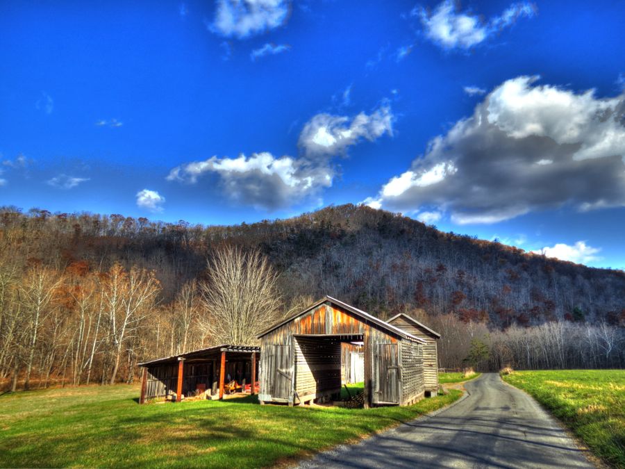
Just as I was congratulating myself on having navigated the dirt road to my destination, I discovered that it ended about half a mile shy. It was clear that the road used to continue all the way, but a steel gate and two large and unfriendly Dobermans suggested that no further progress was advisable. Accordingly, I turned around (with large dog faces barking directly into my ear) and jounced my way back to civilization, where I’d started an hour earlier. Looking on the bright side, I found this pretty, late-fall view. If the shed had contained an old Aston Martin or a pre-war Indian motorcycle, it would have been perfect!
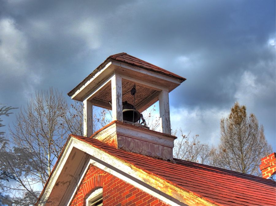
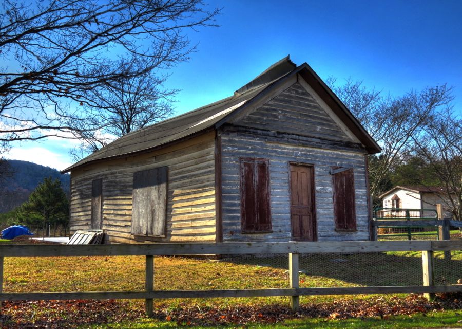
Route 9 eventually took me back to the other end of Rock Ford Road, where I located this 1920 one-room schoolhouse. Out of all the similar schoolhouses I’ve seen on my various tours, this was the only one that still has its original bell, rope and all. As of 2012, it was for sale for $55,000—“positively as is.”

As always, the faithful Z4 was performing beautifully and was content both to putter along at a snail’s pace on rough dirt roads and to wail like a banshee when curving hills popped up. In rural West Virginia, you find both categories in abundance.

I’m pretty sure that yet another low-water bridge used to cross the Cacapon right here (on Fisher’s Bridge Road). On this day, however, the road just ended abruptly—without even a warning sign!

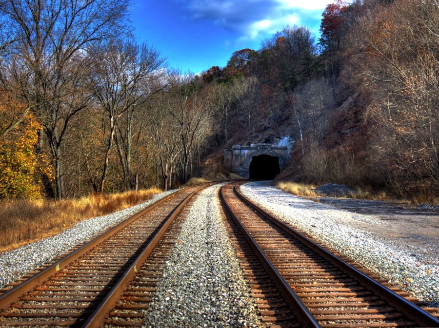
I made a brief detour to Paw Paw, WV to see if I could locate the Carothers railroad tunnel. Having failed miserably to find the oldest such operational tunnel in the U.S. a couple of trips ago in Phoenixville, PA, I was now determined to find any old tunnel, and this one from 1914 would have to do. Getting there involved driving along the original B&O right of way for a mile or so and then climbing a bank (on foot) and following the current CSX tracks for another quarter mile. Thankfully, the Feckless Montana was working okay, and I found the scenic tunnel without difficulty.
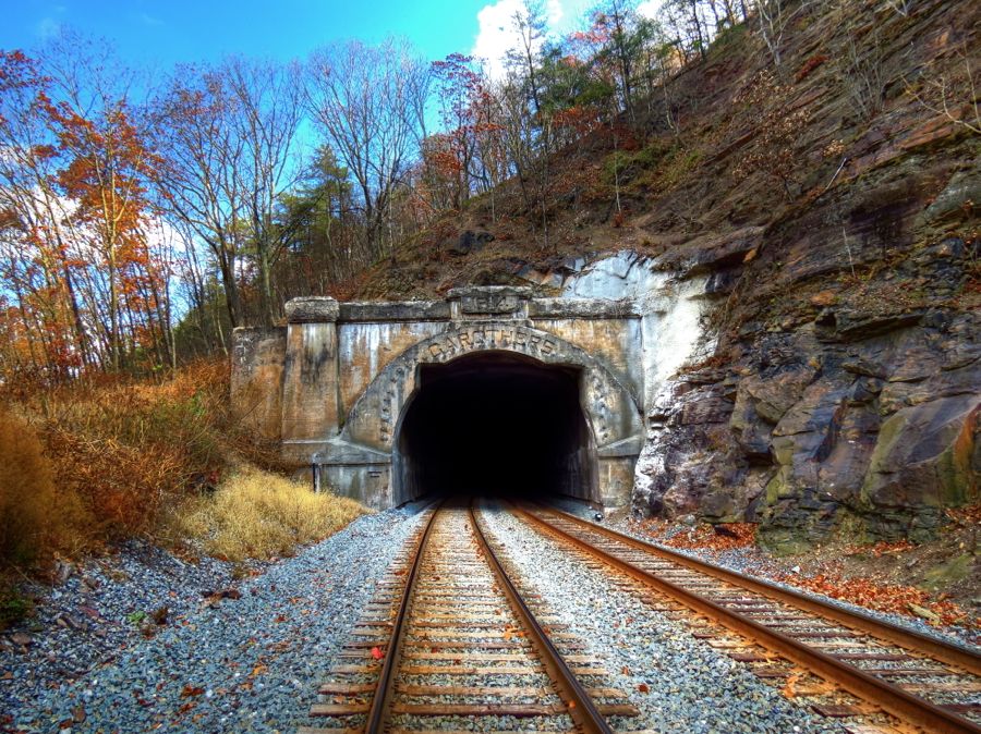
Needless to say, it’s important to pay attention when you’re wandering around on active railroad tracks. On this day, the strong wind blowing through the trees and the tunnel itself produced a sound that was unnervingly like that of a train approaching! None appeared, however—or, if one did, I didn’t notice… Note the notches cut in the top corners of the tunnel to allow modern container cars to fit. They are apparently a recent addition, since photos from 2010 don’t show them. (We get three guesses as to how CSX determined they were needed.)
Let’s see, now where was that road again?

Speaking of obscure roads, my next goal was to try to locate an old abandoned wooden church, somewhere in the mountains near Bloomery. I wasn’t sure of its location or whether it even still existed, but the photo I’d stumbled across was sufficiently enticing to make me want to find it. “Eddie Milbourn Road” appeared to be the only road in the general area, so I gave it a try. At first, it was reasonably passable.

Before long, the road turned more sharply uphill and became narrower and rougher in the process.

As I began to doubt that the church still existed or was anywhere near here, I debated giving up and turning around. I decided to reach the top of the mountain—if, indeed, it was reachable at all—before throwing in the towel. And guess what I found at the top? Yep, this weathered old wooden church, smack in the absolute Middle of West Virginia Nowhere. And not a house, farm, or other sign of civilization nearby. I wonder why it failed?

The only door to the church was wide open, but the entranceway didn’t inspire confidence.

The view from where the altar had been, with sunlight streaming through the holes in the roof was about as scenic as it gets.

It wasn’t easy to find any information about the old place, but Yr Fthfl Srvnt persevered. This was the Eubulus Methodist Church, founded by James D. McCool (1823-1902), who is buried in the adjoining cemetery. The few other marked graves were also mostly for McCools, including his wife Emeline and at least 3 of their 11 children. James D. was a farmer near Bloomery and fought with the Confederate Army in the Civil War. He later served as President of the Hampshire County Board of Education. With a last photo from the cemetery, it was time to skitter back down the mountain and continue my trip.

By comparison, it was a piece of cake to find the Pin Oak Fountain, outside of Bloomery. It was built in 1932, using quartz and other rocks quarried near the Bloomery Iron Furnace. (The word “bloomery,” incidentally, means a forge that produces “blooms” of wrought iron.) The fountain provides water from a nearby spring, although none was to be found on the day of my visit.

While traveling on toward Bloomery, I took a shortcut and suddenly realized that I’d been there before. In fact, it was the elusive (and nearly nonexistent) hamlet of Forks of Cacapon. I’d motorcycled through here some years ago and discovered that the actual place is nowhere near the GPS-specified location. And, if I remember correctly, a prior BMWBMW rally once specified Forks of Cacapon as a location—one that was only correctly identified by that indomitable Beemer couple, Unity and Flash! (See John’s report for more details.) I was pleased to see that the old farmhouse and the general store / post office are still there.

Forks of Cacapon got its name because the North River joins the Cacapon nearby. The North River and its associated bridge are both pretty scenic—but you might want to cross the bridge sooner, rather than later. That middle stanchion is getting smaller every year.


As I continued my seemingly never-ending trip to Bloomery, I found the iron furnace with some difficulty. The park was closed, but it was fairly easy to hop over the gate for a couple of photos. The furnace was built in 1833, replacing an earlier one from 1770. At its peak operation, it produced 8,500 tons of iron a year, which were floated down the Cacapon and Potomac Rivers on rafts.

This building was probably the furnace master’s house. I initially thought it was the Furnace School, but I later learned that the school had collapsed into oblivion under the weight of the Blizzard of 2010.

Sometimes this is all the closer you can get to an old historical site. In the distance is the Bloomery grist mill, also known as Johnson’s Mill. It operated from the early 1800s through 1936, when its overshot water wheel collapsed. The mill remains in good shape and appears to be part of an active farm.

The Bloomery Presbyterian Church has commanded this sweeping view since 1825. I was pleased to finally find some semblance of Fall Colors.


Over the years, I’ve driven by numerous roads named “Poorhouse,” “Old Church,” “Covered Bridge,” “Stone Schoolhouse,” or something similarly intriguing. At least half the time, there has actually been a church, bridge, or school along such roads, but I’ve only ever found two poorhouses. Well, as I temporarily left West Virginia and drove into Virginia, I found a third one—and what a find it was. Here’s what it looks like from a distance:

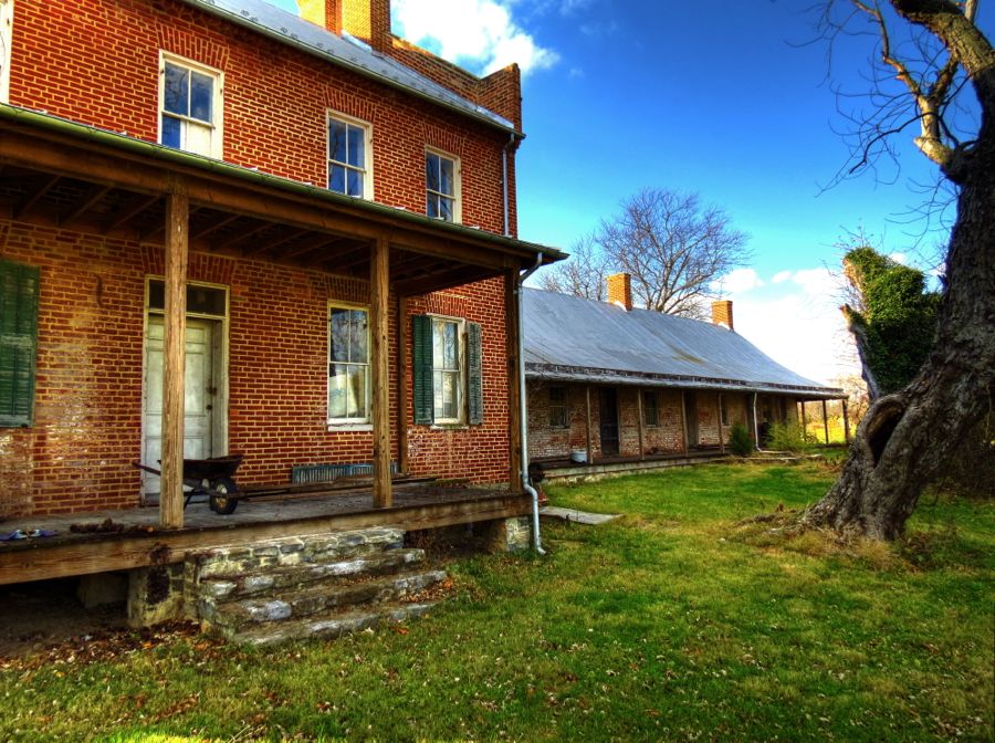
Venturing closer, I soon made the acquaintance of the caretaker of the place, a hardworking and friendly fellow named Randy. He confirmed that this was indeed the Frederick County, Virginia “Poor Farm,” which was established in 1820 and continued to operate until 1947. The central portion is two stories, and there are single-story wings on each side, all of which date back to the original construction in 1820. A two-story “ell” was added to the central building in about 1850. It is the oldest and best-preserved poorhouse in Virginia.


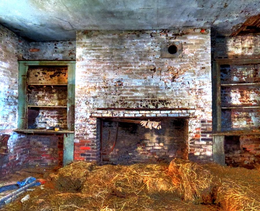
Before very long, Randy and I were talking animatedly about preservation of historic landmarks, the damage done by vandals, our mutual fascination with history, and related topics. And the next thing I knew, he invited me to look inside a couple sections of the old poorhouse! This room is at the rear of the ell, and it served as a kitchen for the facility. The fireplace’s iron arm for hanging kettles is still there and swings in and out easily, but almost all of the other furnishings have disappeared over the years. The kitchen’s handsome brick floor has survived, although it was largely covered by old hay bales.
There’s still some of the old wallpaper left in this room in the north wing, but its days are numbered. Both wings have five rooms, each with its own doorway to the outside. Interconnecting doorways were added to some of the rooms at a later period. Randy mentioned that the basement of the main house had chains on the walls, apparently for restraining the criminal residents of the poorhouse. Or, quoting from the application for a listing in the National Register of Historic Places, “The poorhouse manager maintained discipline by confining ‘unruly, disorderly, or stubbornly perverse’ inmates to a ‘dark room’ and a diet of bread and water.”

The current owners of the farm have invested heavily in shoring up and stabilizing the poorhouse. As can be seen in this shot, where the plaster has fallen off the brick walls in places, there may be further work in store. Note that the wall on the right has been supported by concrete blocks to prevent its collapse.

Along with the kitchen, this ell room appeared to be the largest in the house. Its fireplace has been boarded over. All in all, the interior of the poorhouse was quite a sight, and I am very much indebted to Randy for his time and willingness to tell me about the old place.

A detailed history of the poorhouse, including its origins following the disestablishment of the Church of England in Virginia, is available at Frederick County Poor Farm NRHP Nomination. Randy mentioned that little has been said about the role of the poorhouse during the Civil War. There were three major battles at nearby Winchester, VA, and the poorhouse—like so many other buildings during the war—served as a hospital for casualties on both the Union and Confederate sides. He also told me that when the roof of the main building was being replaced, workmen found a live rifle cartridge in the attic, evidence that snipers may have been positioned there.
Back outdoors, I learned that this wooden building had been the blacksmith’s shop for the poorhouse farm. The remains of the smithy’s hearth and the chimney exit are still visible at the far end. Unusually, the building has no foundation whatsoever—the boards forming the walls just sit right on the ground.


The farm’s springhouse probably predates the poorhouse itself. It had been heavily damaged, either during the Civil War or at a later date, but the owners have restored it using the original bricks.


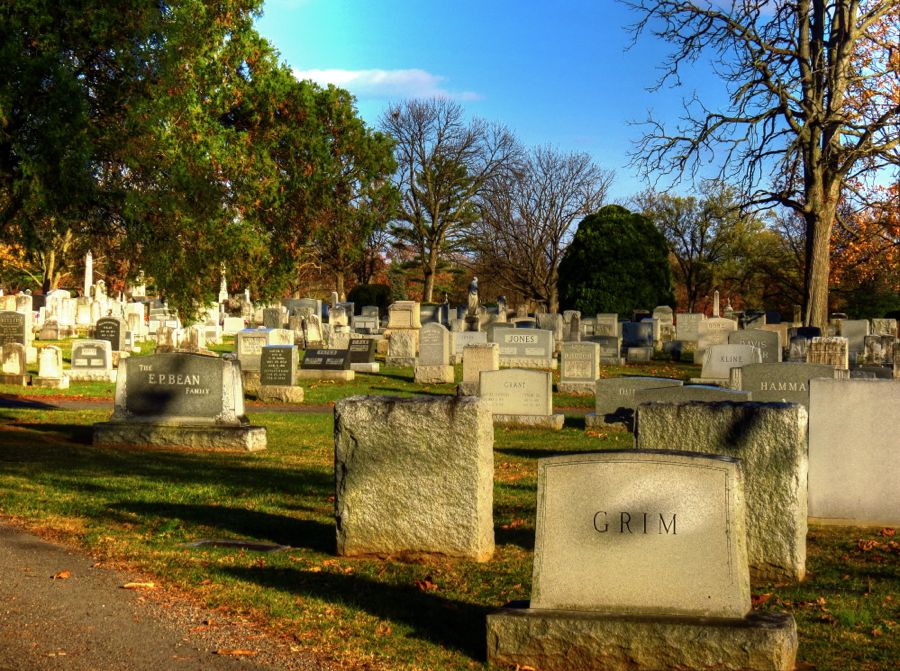
As my grand tour was coming to an end, my new friend Randy had another surprise up his sleeve—the poorhouse cemetery. He asked if I was up for a quarter-mile hike to the top of a hill near the farm, and I readily agreed. Along the way, he expressed his concern that Frederick County, which owns the property where the cemetery is located, had allowed the site to become completely grown over and untended. As we fought our way through the underbrush, vines, and fallen branches, it was easy to see his point. Most of the gravestones are no longer visible, and some have apparently even been carried off by vandals or souvenir hunters. (I remarked that such theft surely qualified as “tempting fate” and would be appropriately punished by an infestation of ghosts!) We eventually arrived near the top of the hill, and Randy began pointing out the simple stones that marked the graves. The majority of them did not contain any engraved information, but some, such as this one, showed only a number—“22” in this instance.

My guide said that only a few of the stones had actual names on them, and he wondered if these were for the graves of soldiers killed during the Civil War action in this area. This example marked the final resting place of James Rouzee. Had he died while living at the poorhouse, and, if so, why does his grave contain a name? Or was he perhaps killed during the Civil War and buried at the poorhouse cemetery?

Back home, I spent an interesting couple of hours trying to track down the late Mr. Rouzee. There were several James Rouzees who were too recent to have been buried here prior to 1947. And then there was James H. Rouzee, who was born near here and enlisted at the start of the Civil War in Winchester’s Company K of the 146th Regiment, Virginia Militia. Military records indicate that he began and ended his service as a Private, but there is no record of his birth date or date of death. Might he have died in action near here?
The 146th Regiment disbanded in 1862 and was absorbed into other Virginia regiments, with no clear record of which ones. But, during June 13-15, 1863, General William “Extra Billy” Smith led five regiments of Virginia infantry in the Second Battle of Winchester, and General John M. Jones led another six Virginia artillery regiments. Was Private James Rouzee among the Confederate soldiers in this battle? I don’t know for sure, but here’s a clue from a section of General Richard Ewell’s map of the battle:
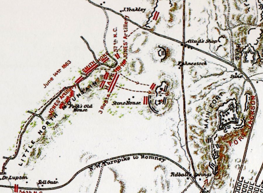
On the map, at the left, notice where Jones’ Artillery and Smith’s infantry forces are located. Namely, at the site of the “Folk’s Old House,” which I confirmed was the exact location of the Frederick County Poorhouse! Based on this information, I’ll hypothesize that Private James Rouzee was indeed one of the 47 Confederate soldiers killed during this battle and that he was buried at the poorhouse cemetery, earning a name on his gravestone in the process.
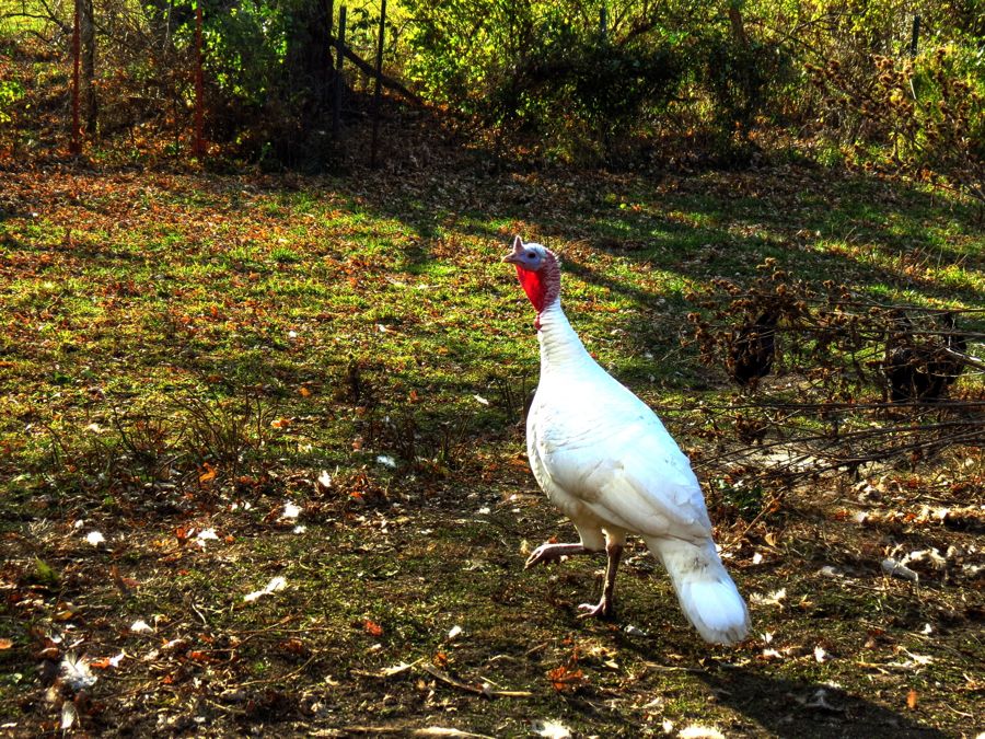
As I was saying thanks and goodbye to Randy, I glanced over and noticed a large, perfectly white turkey. Randy proceeded to gobble at the turkey, and said turkey immediately gobbled right back at him. (I’m not making this up!) However, I’m still waiting for Randy to tell me what the turkey said to him…
With a last look at the middle section and north wing of the poorhouse, it was time to resume my tour. Long may it stand.
I’ve driven through Winchester, VA on a number of occasions—and each time I stumble onto something new and interesting. For example, this 1874 “Hexagon House” was the home of James Burgess and was designed to maximize interior space and natural lighting. It is 80% original inside, including its rare ventilation system and inside bathroom. Octagonal houses are quite rare, but I’m told that hexagonal ones are even rarer. This one is the only such home in all of Virginia.

Seemed as good a place as any to park for a photo…

U.S. Route 50 hasn’t achieved quite the legendary status of the National Road (Route 40) or Route 66, but it is still capable of carrying traffic all the way from Sacramento, CA to Ocean City, MD. As it happens, Route 50 passes directly through Winchester, initially on Boscawen Street before jogging down to Cork Street and other avenues. If you don’t jog and just continue on Boscawen, you find this narrow and charming old village setting, complete with brick paving.

And if you’re really hell-bent on staying on Boscawen, it will lead you right into the massive Mt. Hebron Cemetery. The long-suffering Z4 was a tight fit through the archway of the Superintendent’s imposing limestone gatehouse. The cemetery was established in 1844 and, not surprisingly, substantially expanded in 1866 to accommodate over 2,500 Confederate war dead. (Most Civil War soldiers killed in action were temporarily buried near the battlefields where they fell and later transferred to proper cemeteries. Our Private Rouzee appears to have been an overlooked exception.)

As cemeteries go, Mt. Hebron is pretty impressive (in a “grim” sort of way).

Eventually Boscawen Street became lost in a maze of graveyard lanes, and I was forced to turn around and exit via the gatehouse. It looked even more scenic from this side.

I found Kent Street without difficulty and was soon rewarded with Winchester’s Last Fall Color.


More importantly, this modest house stood directly across the street. Virginia Patterson Hensley lived here from age 16 until turning 21, when she married Gerald Cline. By the time she was 22, Patsy Cline had achieved her dream of becoming a country music singer—and she went on from there to become one of America’s all-time greatest female country singers, with mega-hits such as Crazy, I Fall To Pieces, and Walkin’ After Midnight, and performances everywhere from the Grand Ol’ Opry to Carnegie Hall. Along the way, she helped a number of aspiring singers including Loretta Lynn. By the time she was 30, however, Patsy began having premonitions of death and gave many of her favorite possessions to close friends. Within months, she died in a plane crash while returning to Nashville. Her albums continue to sell at multi-platinum levels even 50 years later.


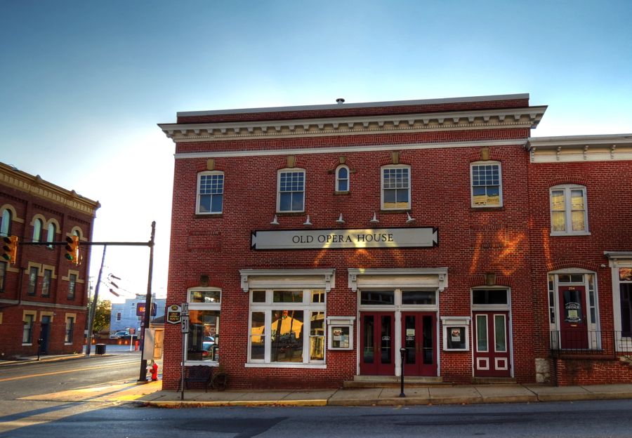
From Winchester, it was a short hop over to another old favorite haunt—Charles Town, WV. I was pleased to learn that the Old Opera House here had had a quiet history (in marked contrast to the Rhoads Opera House in Boyertown, PA, as reported previously). It opened in 1911 with vaudeville acts and plays and closed in 1948. It has since been refurbished, and the original theatre is now used for local performing arts.
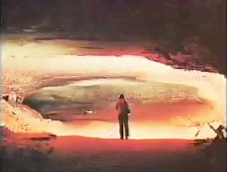
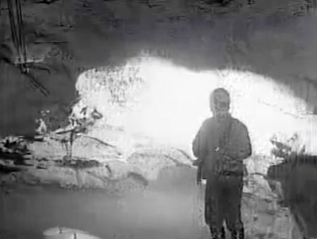
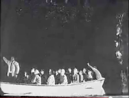
My real goal, however, was this vacant, ordinary-looking building. Among other things, it had most recently been a bakery or cafe. But its real interest is “what lies beneath.” Although I’d towed my race car through the city’s streets innumerable times and passed through on R1200GS and Z4 tours many more, I never knew until now that there is an immense cavern and a 175-foot-long lake sitting directly underneath Charles Town! It was discovered in 1906, and the entrance is located in the basement of this building. A passage leads roughly 300 feet to the lake, and the largest chamber is further past the lake.
A local businessman developed “Lakeland Caverns” and the “Weller Dance Hall” in 1929, taking advantage of the lake’s crystal clear waters. Charles Town High School held its senior prom in the cavern in 1932, but the Great Depression soon put an end to the cavern’s tourism. Today, the lake is said to be polluted and the cavern full of noxious gases—but I suspect that’s just an effort to discourage unwanted visitors—like me! I believe the city now owns the underground area and has no interest in making it available to the curious. Sigh… (Underground photos courtesy of Jim Surkamp’s interesting and informative video History of the Cave in Charles Town.

Elsewhere in Charles Town, I found that the historic Perkins House is for sale. Actually, it’s been for sale for quite a while, originally with an asking price of $2.2 million, then failing to sell at auction in 2011, and now listing for $899,000. It seems to be a buyer’s market for historic Victorian homes these days—and this one is definitely historic. It was built in 1891 on the grounds where John Brown was hanged in 1859. (Don’t worry; his body “lies a-mouldering in the grave” far from here. This song, incidentally, became a popular anthem among Union soldiers in the Civil War, and it served as the inspiration for Julia W. Howe’s “Battle Hymn of the Republic.”) The 18-room mansion was built in the Queen Anne style, with a Norman 3-story tower for good measure. It has 6 bedrooms and 4 ½ baths, not counting the restored privy outside.

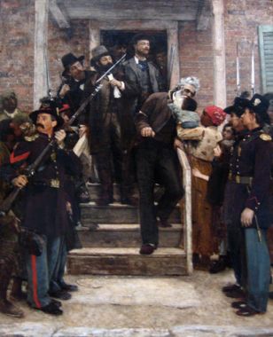
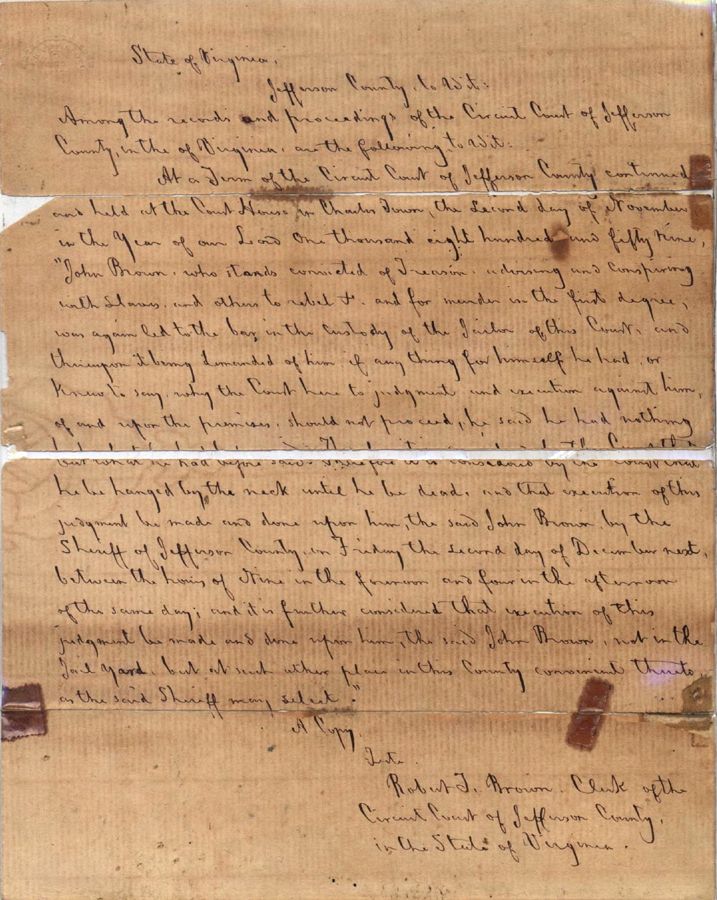
The Perkins House was originally built by John Thomas Gibson, who, as a colonel commanding the “Jefferson Guards of Charles Town” of the Virginia Militia, led the first force to reach Harpers Ferry in response to John Brown’s raid. Later, they were also responsible for security at Brown’s hanging in Charles Town. The paintings below show “The Final Moments of John Brown” by Thomas Hovenden and “Death Warrant of John Brown,” apparently by E. Avey. The first portrays Brown being led from the courthouse and stopping to kiss the brow of a child held by its enslaved mother. Most historians now believe this story to be apocryphal. I don’t know how realistic the “Death Warrant” painting is—but the original warrant is in the files of the Jefferson County Clerk’s Office in Charles Town. In addition to Col. Gibson, other notable persons present at the hanging included Thomas J. “Stonewall” Jackson, J.E.B. Stuart, and John Wilkes Booth.

In contrast to the Perkins House, I know nothing about this one—other than there’s a really nice-looking car parked in front of it.

Leaving Charles Town on George Street (named for Charles’ brother, George Washington), I soon found myself on Bloomery Road—which is named for a different Bloomery altogether than the one I’d been through earlier in the day. I consulted the sometimes-helpful Montana GPS and learned that I had all of 45 minutes left before sundown, so I skipped a couple of planned sites in order to reach Chambers Farm on the outskirts of Harpers Ferry in the remaining daylight. At the intersection of Bloomery, Millville, and Blair Roads, I found this pair of diesel locomotives, idling patiently on a siding. (Because large diesel engines can be difficult to start, they are often left idling for long periods between use.)

My route took me directly alongside the beautiful Shenandoah River, so despite my desire to reach the Chambers Farm, I just had to stop for a picture of the setting sun lighting up the last of the Fall Colors. The little dot in the center of the second photo, incidentally, is a noble Great Blue Heron—I just didn’t realize it at the time.


I also had to see the Booth House, or “Haunted Cottage” as it’s now called. It would be impossible to believe all of the legends, folklore, and wild stories associated with this place, but it is clear that John Wilkes Booth stayed here a few times on visits to this area—principally for trysts with attractive local ladies, it is said. The house is currently owned by hypnotist and certified parapsychologist Vince Wilson, who heads up the Haunted Cottage Paranormal Research Center. I report, you decide…

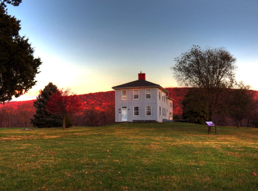
With 15 minutes to go before sunset, I finally reached the Chambers Farm and leapt out of the Z4 in hopes of hiking the roughly 1 mile roundtrip before the park closed for the night (leaving me stranded on the wrong side of a locked gate!) The farm is named for Edmund H. Chambers who bought the place in 1848. Although Chambers was a staunch Unionist, the Union Army commandeered his farm in 1862 and forced the family to leave. The army set up a defensive position here to help guard the armory at Harpers Ferry.
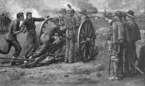
In the days leading up to the Battle of Antietam, Robert E. Lee worried about the large Federal force and the munitions at Harpers Ferry. Accordingly, he ordered Stonewall Jackson to capture the town and armory. Jackson’s brilliant strategy in carrying out this order is still taught at military academies—and it succeeded in large part by an overnight flanking maneuver that brought men and artillery along the banks of the Shenandoah and up a steep ravine to Chambers’ fields, shown here:

By the time the Battle of Harpers Ferry was over, the Confederates had captured 12,000 Union soldiers and quantities of rifles, pistols, ammunition, wagons, and supplies, paving the way for Robert E. Lee’s invasion across the Potomac River and into Maryland. As the sun was setting, I got a final look at the Shenandoah, from the vantage point reached by A.P. Hill’s Confederate troops during their flanking maneuver. Imagine dragging 2,000-pound cannon up this embankment, at night!

Edmund Chambers and his family returned to their farm after the Civil War, finding it completely destroyed. They rebuilt the property, including the farmhouse pictured earlier, and spent the next 23 years attempting to be reimbursed for their damages by the Federal government. Chambers died in 1890 without ever having been repaid.
As I hustled back to the parked Z4 in the growing darkness, I kept my fingers crossed that the gate had not been closed! Fortunately, I made it out okay and drove the easy 80 miles back home, stopping only for a Sheetz dinner along the way. It had been a great day of BMW Z4 touring, and there were plenty of great roads and historic sights to replenish my spirits.
Rick F.
PS: In an interesting historical footnote, many of the Confederates who captured Harpers Ferry opted to replace their worn and dirty grey uniforms with brand new blues ones, courtesy of the Union supply house. During the Battle of Antietam, when things were going badly for Robert E. Lee, he and his staff anxiously awaited the arrival of A.P. Hill’s division of 3,000 men, who were marching the 17 miles from Harpers Ferry.
When lookouts spotted a long column of blue-uniformed soldiers in the distance, they alerted Gen. Lee that a Union force was approaching. After a long look through his telescope, Lee quietly responded, “No, it is A.P. Hill… thank God.” The additional Confederate infantry arrived just in time to repulse the final Union charge that, otherwise, would likely have destroyed the Confederate Army and ended the Civil War 2 ½ years earlier than its eventual outcome.


 It's amazing how much wonderful scenery and history there is in our own back yards. It takes you to point it out, tho.
