Any trip to West Virginia offers adventure, history, and beautiful scenery. This one was different, however. I was traveling to Huntington, WV, to the funeral of a close friend's mother, Frankye. I'd met her only days before, but I knew all about this remarkable woman, having heard many stories of her in her prime, and later, during her long, heartbreaking decline. This trip report is dedicated to Frankye and to the State where she lived for most of her 84 years. Appropriate to the sad circumstances, it rained—more on than off—throughout most of the trip.
I had the choice of leaving for Huntington on Saturday afternoon and traveling by Interstate or leaving early Saturday morning and exploring parts of West Virginia where Frankye and her family vacationed, many years ago. It was an opportunity to try to find the lake, the cabin, and the church that her daughters, Cathy and Sharon, had told me about. It was an easy choice. It also offered a chance to see some of the history of the Chesapeake & Ohio Railroad—the company that employed Frankye for more than 40 years.
A quick 250 miles brought me to Covington, Virginia, and the "James River and Kanawha Turnpike," now known as Route 60. Almost right away, I spotted a sign for "Humpback Bridge Park," which naturally required investigation. There, I found something I'd never seen before: a humpbacked covered bridge.
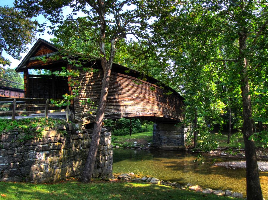
Three earlier bridges—none of which was covered or humpbacked—preceded the construction of this one. Within the span of about 1825-1856, each predecessor was either washed away or collapsed from overuse and weathering. To solve these problems, the current bridge was built in 1857 and protected by a roof and a center section that was four feet higher than either end. It remained in operation through 1929, carrying all the traffic of the Turnpike. Although the flooring of the bridge has never been renovated, it could easily handle vehicle traffic again. It is now the oldest covered bridge in Virginia, and one of only two or three humpback covered bridges remaining in the country.
It is also home to one of the best swimming holes in the State, or so the local kids told me. The rain had not yet begun, it was plenty hot, and Dunlap Creek looked plenty inviting. Just be sure to swing beyond the rocks!

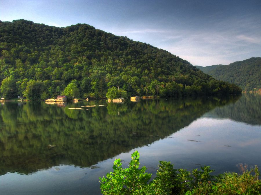
A few miles further on, I picked up Johnson Creek Road and began my search for Sherwood Lake. It soon turned to dirt, and then rough, rocky dirt, and, as noted above, I wondered how Frankye, Howard, her sister Norma, and children Howard Lee, Sharon, and Cathy ever managed to come this way. Eventually, however, I reached civilization—in the form of Sherwood Lake Road, which was actually paved, and it dawned on me that Frankye and her family never had to take the goat trail that I'd just left. They would have driven directly from Neola. By either path, however, the destination was well worth it.
Sherwood Lake featured a remote and beautiful setting, with nice shady trees for overheated explorers to walk under.

The lake was not at all crowded on this Labor Day weekend, and everyone I saw was having a wonderful time—including this adventurous toddler.

A quick exploration demonstrated why Frankye and her family enjoyed Lake Sherwood so much.

Encouraged by the easy success of finding the lake, I set off on the harder challenge of finding the cabin that served as the vacation base for the family. I had little to go on as to its location: somewhere near Neola, WV and not far from an old church. But Sharon had managed to locate a snapshot of the place.

The building had started life as a one-room schoolhouse. It was later converted to a bare-bones cabin for hunters and fishermen, with a low second story added on, full of cots for sleeping. The downstairs had a wood stove, a rudimentary kitchen, and a blackboard that spanned the entire wall. There was no indoor plumbing, but fresh water was available from the hand pump next to the front entrance, being used in the photo above by Howard. Her sister Norma is at the rear door.
I found Neola without difficulty, but a quick pass through town—actually more of a giant trailer park, these days—showed nothing that looked like the cabin or any signs of an old church. The Neola Baptist Church was clearly too new (but I thought Cathy would like to see it anyway, being staunchly of the Baptist persuasion). The sign out front read, "If you have Jesus in your heart, inform your face"!
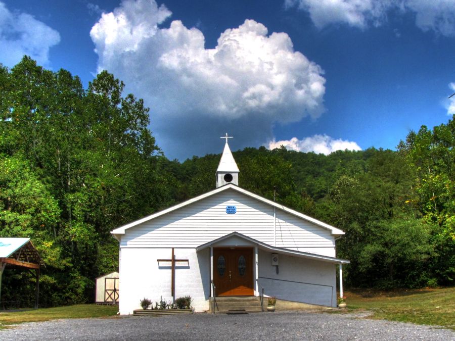
I located two other churches in Neola, but neither one remotely matched Sharon's description. Moreover, none of the interesting old houses resembled the cabin in the slightest.


The south side of the road through Neola was home to hundreds of camping trailers and trailer homes, many enclosed in odd-looking wooden frames that served as auxiliary supports and front porches. This dwelling had seen better days. I don't think it's still being used—although it's possible that a really heavy camper was indoors, sleeping on the far side of the unit…

On the north side of the road was Anthony's Creek, precariously spanned by this and other bridges. I dutifully crossed each bridge—on foot!—to look on the other side for the cabin and/or church, but there weren't any signs of them there, either. At least the creek was scenic.


Knowing that the cabin was on mild incline, I followed one of the back roads all the way to its end, against the distant hillside. Alas, all I found was a good ol' boy, working on a dilapidated car, and his wife/companion, who was fetching wrenches for him despite being nicely dressed up. They seemed pleased to see me, but neither knew anything about the schoolhouse/cabin. But Mrs. Good Ol' Boy knew of an old church… After chatting a few minutes and thanking them for their help, I retraced my steps through Neola and discovered this United Methodist Church on the outskirts of town. Was I on the trail at last?
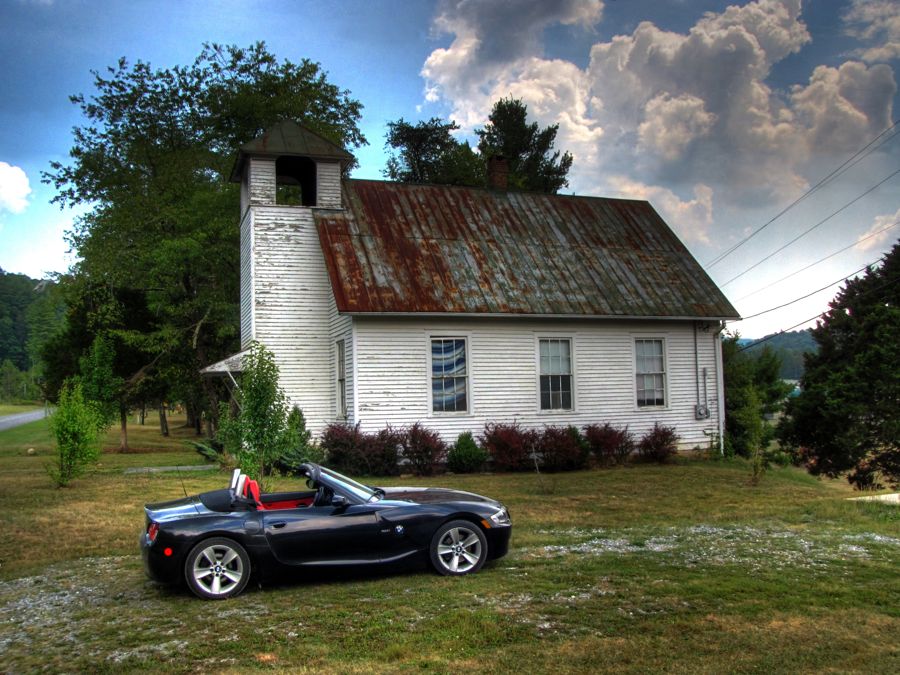
Well, perhaps… When I showed this photo to Sharon the next day in Huntington, she wasn't confident that this was the correct old church, although it looked about right. If it is the right one, and you follow the path down to the main road, turn left, go a short ways and turn left again to the cabin, then you find yourself in the middle of the Anthony Correctional Center, barbed wire and all! In other words, the cabin would no longer exist. If, on the other hand, this is not the correct church, then the cabin (and church) may yet be out there somewhere, somewhere between Neola and Marlinton. A good excuse for another trip to West Virginia.
After my in-depth exploration of Neola, it was time to press on. As I left the town, the rain began to fall—perhaps in sympathy for Frankye's lost vacation setting. My remaining itinerary was designed to take me to Beckley for the night. In a straight line, it would have taken only another hour. But there are no straight roads in West Virginia and, besides, I had charted a zig-zag route there in the hopes of finding additional scenic and historic sites (if the rain and impending darkness would allow them to be seen at all).
If you're driving through White Sulfur Springs, WV, then it's important to stop and get a picture of the famed Greenbriar Resort Hotel. And what a place it is. It started life in 1778, and the Grand Central Hotel shown here was built in 1858, but its fortunes really began to soar soon after the Civil War, when the expanding Chesapeake & Ohio Railroad ran a line through the town.

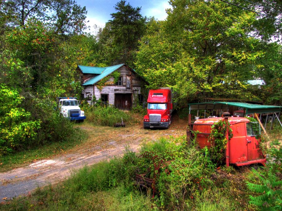
At the opposite end of the scale from the Greenbriar, I'd long heard rumors of The Tractor-Trailer Graveyard, sought by adventurers and big-game hunters from across the world. I'm pretty sure this was the entrance to it.
As I motored on, traversing little-known rural West Virginia roads, I saw many signs of the continuing poor economic conditions. The front of the first house below looked bad enough; but look carefully at the right-hand window.


From time to time, the rain would just pour from the sky in sheets. The rain-sensing windshield wipers in the Z4 got quite a workout, turning themselves on and off, faster and slower, as necessary to deal with the cascade. Technology is a wonderful thing. I had been following the Greenbriar River for some time, through Ronceverte and Fort Spring, trying to find a good spot for a photo. The opportunity finally arrived in Alderson, although finding a non-flooded place to park was a bit challenging. Fortunately, it offered both a good view of the river and a dramatic old house as well.


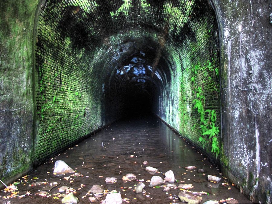
Next, I went in search of "Great Bend Tunnel," reputed to be somewhere near the town of Talcott, WV. Eventually, acking any obvious "historic interest" signs or other guidance, I was forced to leave Route 3 and just drive alongside the railroad tracks toward a mountain in the distance. (I mean, really—the things I do for you faithful readers!)

After abusing the poor Z4 yet again, along a mile or more of bumpy, crushed-rock track shoulder, I found Big Bend Tunnel. The little spot of light in the far distance in this photo is the opposite end of the tunnel, more than a mile away. This tunnel, however, was not what I was looking for. It's a later addition, having been built in 1932 (and still in use today).

After some backtracking and creative efforts to get on the other side of a tall chain-link fence, I found Great Bend Tunnel in all its glory. It was dug in the early 1870s to allow the Chesapeake & Ohio Railroad to avoid a lengthy detour around Big Bend Mountain and Great Bend on the Greenbriar River. By this time, Collis P. Huntington had taken over operation of the railroad and was investing heavily in its expansion. Getting past the Allegheny Mountains was one of his major hurdles. Building this tunnel took 3 years and 1,000 workers to construct, using hand tools to drill holes for explosives.

One of the workers, a tall African-American named John Henry, was considered the most capable of them all. Naturally, when a new-fangled steam drill arrived on the scene, John Henry challenged its operators to a contest—man versus machine. The result is legendary: John Henry, the "Steel-Drivin' Man," drilled two 7-foot holes in the rock, using his 14-pound sledge hammer, in the same time that the steam drill only managed one 9-foot shaft. At the end of the contest, however, John Henry was exhausted. He collapsed on the ground and "died with a hammer in his hand, Lord, Lord."
As best historians can tell, this is all a true story—and the residents of Talcott swear that it's accurate, which should count for something. After all, they've gone to the trouble to erect a statue in his honor high on Big Bend Mountain, directly above the tunnel entrance. For an objective report on the story, see John Henry - the Steel Drivin' Man: Man or Myth? The traditional version of the Ballad of John Henry, sung by Roger McGuinn, can be heard at John Henry.

As for Great Bend Tunnel, it's still there in all its glory, even though flooded by water. If you want to find the opposite end, be sure to bring your waders and a hard hat… Note that there's no sign of a light at the end of this tunnel. It's possible that the ceiling has collapsed at some distant point.
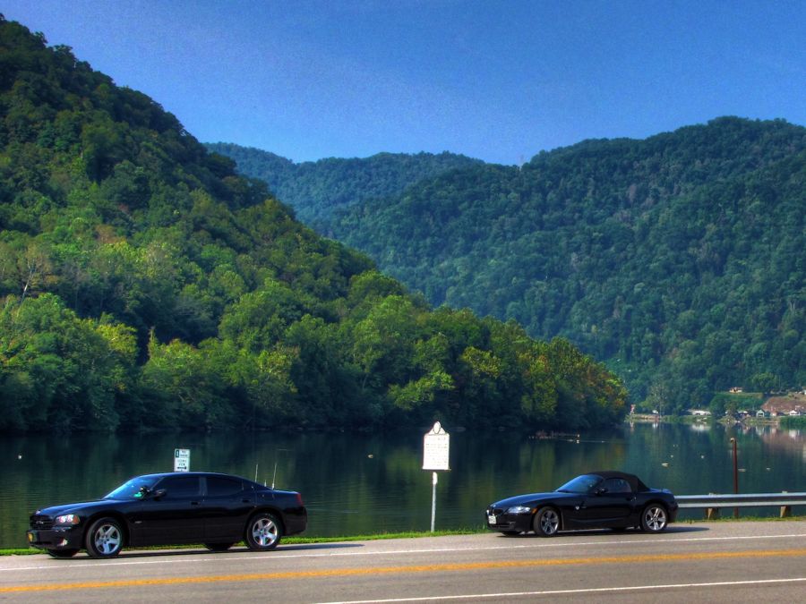
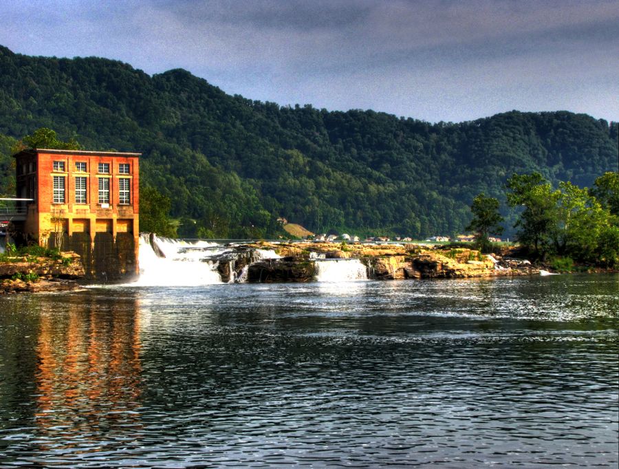
With the skies so dark that photos were almost impossible, and with continuing downpours from time to time, any sensible explorer of West Virginia would have headed directly to the warm, dry Hampton Inn room awaiting him in Beckley. Yr Fthfl Srvnt, however, had one more landmark to find. Leaving the Greenbriar River, I went in search of the New River, which, incidentally, is not so aptly named: Geologists believe it is between 250 million and 360 million years old, which would make it the second-oldest river in the world, surpassed only by the Nile.
In particular, I wanted a look at Sandstone Falls. Part of the New River Gorge National River, the falls are roughly 10 miles north of Hinton—and "readily accessible" by a narrow, meandering, paved road that is not a lot higher than the river. Given the heavy rainfalls during much of the day, I was hoping that it would not be flooded. With only mild trepidation, I drove along New River Road, trying to look for oncoming traffic around the blind corners and through the pouring rain. And there was a lot of oncoming traffic, as it turned out, since everyone else was leaving the state park because (i) it was the end of the day, (ii) the sun was setting, and (iii) it was pouring rain!
Fortunately, I arrived at the park without mishap and naturally had no trouble finding a parking space. A deserted boardwalk led out to the falls, with just enough light left for a picture.


But the boardwalk continued, and a nearby sign indicated that I was at Lower Falls, with Upper Falls another quarter mile or so further on. The New River is 1,500 feet wide at this location, and drops as much as 25 feet at the falls.

To get the above photo, incidentally, I had to climb out on a series of rock ledges. It wasn't until I was about to turn around and retrace my steps that I realized that some of the rocks had a thin coating of wet mud, making them as slippery as ice! With extreme caution, I following the least-muddy path back, spotting this little stone statue in the process, and regained the boardwalk without falling into the river, breaking a leg, or otherwise adding to the adventure.

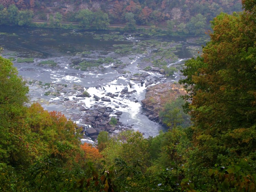
Driving back to Hinton, I crossed over the river to the legendary Route 20—one of the twistiest and most scenic roads in West Virginia. Which is saying a lot. Route 20 climbs and plunges its way along the banks of the New River, and it was fun to unleash the Z4 a bit, after a day of plonking slowly around in the rain. And it even offered an aerial view of Sandstone Falls, from about 600 feet above the river.
Only a mile from Interstate 64, I encountered this scene, which is not what you want to see when you're cold, tired, and hungry, and have been pushing your luck for much of the day. Fortunately, it was not an accident but merely a car carrier that had bottomed out and gotten stuck while trying to turn onto Route 20 from a steep road. A few minutes later, I was safely detoured around the truck.

Half an hour after that, I was settled into the motel for the night. Frankye's service was at 2:00 the next afternoon, and I had two more West Virginia landmarks to visit on the way to Huntington.
Rick F.