The Skyline Drive from Front Royal to Route 211 offered its usual assortment of wonderful overlook.

It also featured a lot more bicyclists than usual (who easily rode up that first, very long climb to the visitor center—how do they do that?)

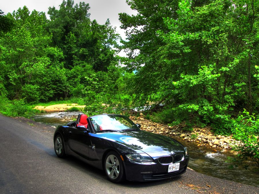
And every so often a handsome sports car would appear.

Descending from Thornton Gap on good old twisty 211, I soon caught up to a pickup towing a horse trailer. To avoid unnerving the horses (I was only thinking of them, you understand), I borrowed the uphill passing lane for a short stretch and soon regained a traffic-free jaunt down the mountain. Of course, the Z4 is made for roads like this and was happy to leap from corner to corner. (Believe me, 215 horsepower, going downhill, is plenty enough!) The wide tires and sport suspension also hugged the turns like nothing I've owned since my Porsche 944. Lots of fun, although I kept everything within reasonable limits. But I can see that a track day is in order—I haven't raced with the SCCA since 1993, and I miss the all-out effort that you can strive for at the (fairly) safe confines of a proper race track.
South of Sperryville, there were farms everywhere you looked.

Not to mention beautiful old farm houses in good repair and the associated farm ponds.


Even with the best of routes handed to you from a great book, it's still important to make occasional detours, right? And when you see a sign with "Slate Mill Road," then the Committed Tourist has an obligation to find out whether the mill is still there. After a bit of exploring, I couldn't find any sign of a mill—but I did run across this scenic old log home (which happened to be for sale, in case any of you are interested

Another detour down a dirt road brought me to the Sharp Rock Vineyards and Bed & Breakfast. When I arrived, however, it was 30 minutes or so before the winery opened. Fortunately, there was no shortage of other interesting things to see and do for 30 minutes. The first order of business was to find Old Rag Mountain, famous for its exposed, bald rock summit and the numerous hiking and climbing opportunities it presents. It was easy to find the mountain, which pretty much dominated the skyline. The granite that underlies the mountain dates back roughly 1 billion years, and the mountain was formed a mere 300 million years ago when the Lapetus Ocean receded, the continental masses of Laurentia (North America) and Gondwana (Africa) collided and then divided, the granite went westward, and the Atlantic Ocean formed. After millions of years of erosion, Old Rag (and the rest of the Appalachians) is what's left. Sounds like a busy time.

The next challenge was to find a way to drive to the top, which, in retrospect, can't be done! I gave it a good shot, however, passing by this enticing driveway to a farm (also for sale, by the way).

The Hughes River called out for a photo stop, naturally.

After a while, I located State Route 600, which appeared to head straight up to the top of Old Rag.

It didn't make it all the way there, of course, and stopped at the (closed) upper parking lot for the trail to the summit of Old Rag. From there, it's a not-so-easy 8-mile roundtrip hike to the summit. Did I mention that the lower parking lot was jammed with cars and hikers? Apparently Old Rag is one of the most popular hiking destinations in the Appalachians. At peak season, lines actually form at narrow spots on the trails, and you have to wait your turn to continue to hike! (It's also one of the more arduous and dangerous hikes in the Shenandoah National Park, as indicated by the frequency of search and rescue missions.)
After turning around on the narrow mountain road (where was my faithful GS when I needed it?), I drove back down and back toward the winery, discovering the Nethers Mill along the way. The owner is in the process of restoring the place. What I want to know is, how in the world did he move the mill's water wheel to its current location for repairs?? It was a good 15 or 20 feet in diameter and must weigh a couple of tons or more. I hope it has a parking brake…


Eventually, I made it back to the Sharp Rock Vineyards and had a most enjoyable talk with owner/operator Jimm East. In addition to being extremely knowledgeable about wines (as you might expect), Jimm is a sports car aficionado, having owned several classic Porsches and campaigned an Austin-Healey Bugeye Sprite in vintage racing for some years. He currently drives a BMW 330ci.


After sampling the Sharp Rock's International-Award-winning sauvignon blanc and a couple of their other specialties (and purchasing 6 bottles for later use), it was time to continue the trip. Once I was safely back on Route 231, I stayed there for all of a few moments before deciding to see if there was any sign of a poorhouse on Poorhouse Road. Maybe this was it?

I also wandered through the tiny crossroads town of Criglersville, with its interesting old general store.

I'd never heard of Criglersville, by the way, but subsequent research revealed the following story (from a Crigler Family website): "Jacob [Kriegler] came to America in 1717 along with hundreds of other Germans fleeing the devastation of the Franco Prussian Wars, and the persecution of their Lutheran beliefs. … Jacob, and some one hundred others left England in early 1717 by ship for Philadelphia, but a raging storm drove them southwards and the ship landed in Tappahannock, Virginia. Here the captain of the ship held these people for the balance of the monies due for their passage. … Governor Spotswood of Virginia heard of their plight and agreed to reimburse the Captain of the ship and arrange their release. In exchange for this payment, Governor Spotswood required … they work in his mines and farm his lands in order to repay him. These immigrants led a harsh life and later had to sue Spotswood in court for monies due them and for the final settlement of his claim against them for passage monies advanced. Instead of giving these people money, he gave them land grants even further in the interior." Well, you get the idea—life was tough and then you die (in 1734, in Jacob's case). Over time, the farming community became Criglersville.
That same year (1734—try to keep up here), the first Lutheran "Glebehaus" (parsonage) was built nearby, followed in 1740 by the Hebron Lutheran church, which, with some expansion in 1800, is still home to worshippers these many years later. It's the oldest, continuously operating Lutheran church in the country. And there are a number of Criglers buried in the church's cemetery, I noticed.

As good fortune would have it, when I stopped to get a picture I promptly encountered Pastor Lil—who proceeded to give me a guided tour of the historic church. Here is the inside. Note the goblet-shaped pulpit to the right of center.

Chandeliers were added in 1850 (at a cost of $100), and the ceiling frescoes were created in 1885 by Joseph Oddenino of Turin, Italy.

And here is my tour guide, Pastor Lil herself, who generously shared quite a bit of her time to show me around the beautiful church. Thanks again, Lil!

On the other side of 231 from the Hebron Church, I spotted this stately old house sitting on top of a hill, apparently undergoing renovation.

Speaking of churches, just for my friend Cathy I stopped in Madison to get a picture of the imposing Beth Car Baptist Church, built in the mid-1800s.

On my way to Stanardsville, I ran across my old friend the Rapidan River (see A Rainy Excursion to Virginia. Still scenic, I was glad to see.

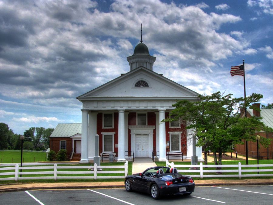
Stanardsville featured this courthouse (near which a Civil War skirmish was fought, involving one General George Custer)…
…as well as the Lafayette Inn, which opened in 1840 and later served as a hospital for soldiers wounded in the Civil War.

All during the day, clouds would form overhead, break apart for a while, and then reform. There, in a brief patch of sunshine, sat a perfect Day Lily—which I promptly photographed, just for a certain BMWBMW club member! (It is a Day Lily, right Jody?)

In Elkton, which was previously called Conrad's Store, I found the Miller-Kite House without difficulty. It's the home of the Elkton Historical Society and serves as a (free!) museum, featuring Civil War artifacts. It was the headquarters of Stonewall Jackson at the start of his successful defense of the Shenandoah Valley during the early years of the war.

Inside the museum, I reveled in the cool temperature for a few minutes while I talked with the guide. Did I mention that the temperature had risen to 90 degrees, along with the humidity? Small town museums tend to have anything and everything, and the Miller-Kite House was no exception. I just love places like this.

This sword was (literally) fished out of the South Fork of the Shenandoah River in 1955 by a former resident of the house. He snagged it while fishing and was astonished to see what he'd reeled in, 93 years after it was apparently lost during the Battle of Port Republic.

This beautiful 1860 Colt 44 Army revolver belonged to William E. Kite.

While I'd been touring the museum, the skies finally opened up. With the top securely up, I continued my tour of Elkton. As noted above, the town was originally called Conrad's Store. And this, I believe, is Conrad's Store, which the Historical Society hopes to purchase and renovate some day.

In the rain, on the outskirts of Elkton, I found a large farm that was slowly deteriorating. The farmhouse must have been quite a sight in its glory days. Now it just begs for someone to restore its handsome exterior before it's too late.

A little farther on is the family home of Adam Miller, the earliest European settler in this area. His original home still stands, although it looks like a shack or shed behind the later, and much larger, family home. Behind the home is the Bear-Lithia Spring, the waters from which were bottled and sold as a medicinal tonic for many years in the late 1800s. The spring water is now freely available to anyone who cares to take it, although a sign helpfully points out that you should drink it only at your own risk. Because of the lithium oxide in the water, it's believed to be helpful for kidney problems. Next to the spring stands this reminder of a long-gone home.

Moving on, I soon found the once-thriving railroad town of Shenandoah. Thanks to bounteous natural resources and the power produced by the South Fork of the Shenandoah River, the town grew rapidly from its founding in 1838 and produced pig iron and cannon balls for the Confederacy during the Civil War. In 1870, a colossal flood literally wiped it off the map. Its plucky citizens rebuilt, however, formed the Shenandoah Valley Railroad, and prospered until 1890 when an economic depression and a series of fires decimated the industrial section of the town.
The river lives on, of course, and the dam pictured in the foreground apparently helps with that pesky flooding problem.

I hear the fishing is good, too.

Although no longer a major railroad hub, the station and tracks live on…

…as do the frequent trains passing through. This one pulled to a stop right in front of me, then backed up out of sight, then returned, stopped, and backed up all over again. Honest!

As best I could tell, the engineer was practicing parallel parking—which, for a very long train, probably takes some doing.

A few of the quaint old houses have survived, fortunately, despite additional damaging fires in 2006 and 2007.

Speaking of fires, there must have been another one here. I'm not sure what is keeping the tall chimney from toppling over.

After a while, I arrived back in Front Royal, completing the official part of my trip. As I drove back to Catonsville, however, I couldn't resist returning to White Post, VA. Although this town is best known for its world-class vintage automobile restoration company, it's also quite interesting for its homes, churches, and other buildings. This is the Meade Memorial Episcopal Church.

As I drove around, I couldn't help noticing a large, barely visible, white house hidden behind a stand of tall trees. Curious, I drove by the trees a couple of times, looking for a vantage point to see what was hiding back there. I found the driveway, but I thought it would be just a little brazen to drive right up. After a while, I spotted what looked like a trail into the woods. A little while later, I discovered that the trail did, indeed, lead up to the back of the house. So, I got my picture of the grand dwelling and beat a hasty retreat before learning if White Post has a police department…

The rest of the trip was uneventful, and I returned home after about 12 hours and 385 miles of happy touring (rain and all). The Mighty Z4 got 28 mpg and the GPS registered a maximum speed of 95 mph. (Now how in the world did that happen??
 ) All in all, the trip proved to be the perfect way to spend that one day off.
Rick F.