In the meantime, my noble spouse Nancy (no relation to Hello Kitty) was working up a Major Vacation to the Grand Canyon, Zion National Park, Bryce Canyon, Antelope Canyon, Sedona, etc. etc. etc. Between planning for the vacation, laying out the SRR tour, and work, I kept pretty busy.
Eventually, I had a suitably scenic, 139-mile, 62-turn SRR route established. The 20,000-foot view looks something like this...
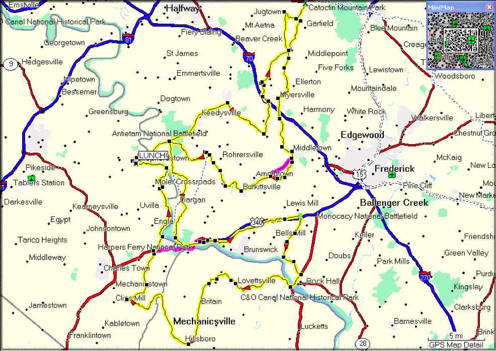
...while the specific route instructions and a MapSource file can be downloaded from the following two links.
Scenic Route Sheet xxxx Scenic Tour MapSource file
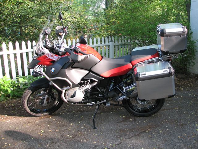
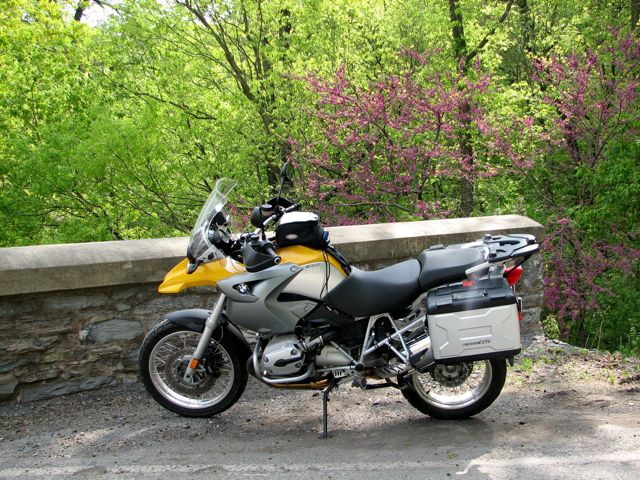
Of course, I wanted to test the route before I actually inflicted it on a number of unsuspecting SRR attendees. For this purpose, I drafted my work colleague and friend Tim--who had very recently sold his Harley-Davidson Road King (with which he had criss-crossed the U.S. a number of times) and bought a new 2008 R1200GS Adventure at Bob's BMW. Tim readily agreed, and arrived at the appointed hour on May 4th. His new GSA was a handsome brute indeed, ready to climb mountains, ford rivers, pull tree stumps, and lay waste to entire villages:
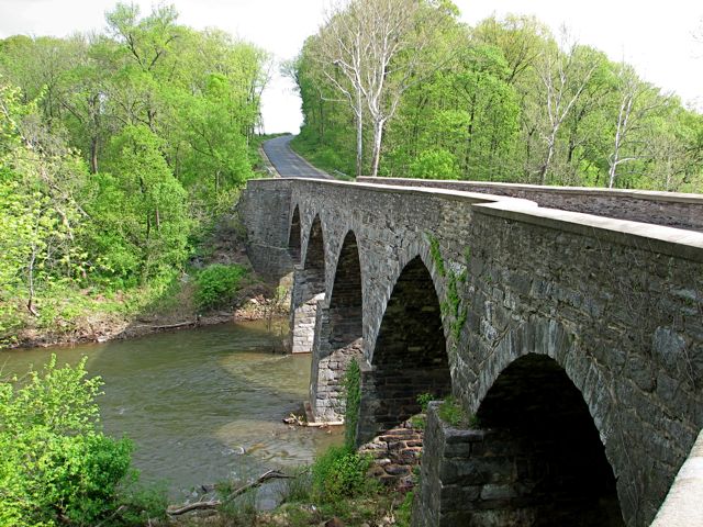
We set off for Thurmont to test-ride the route--but, naturally, it made sense to take a fun and scenic route to get to Camp West-Mar. Along the way, I took Legore Bridge Road on the theory that there might be an interesting bridge there. Sure enough, the stately Legore Bridge appeared, having been built in the late 1800s and still standing 50 feet tall over the Monocacy River.
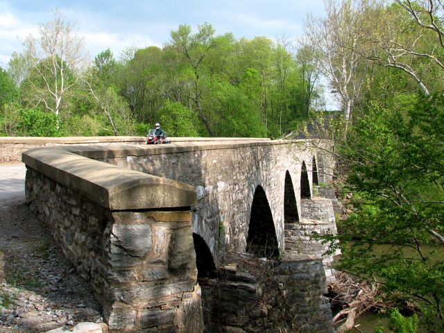
I made Tim ride over the bridge and back with this GSA, figuring that if the it could handle the extra weight of an 8.7-gallon Adventure gas tank, then it could safely handle my own svelte GS...
Soon enough, we arrived at West-Mar and began the SRR scenic tour proper. Along the way, we stopped near Burkittsville (the setting for the movie "The Blair Witch Project") to see if "Spook Hill" still worked. As I expected, it still works just fine: While going down a gradual hill, you stop, put your bike/car/roller skates in neutral, release the brakes, and then begin rolling back up the hill! Since it's only 23 miles or so from West-Mar, Spook Hill clearly deserved to be on the tour.
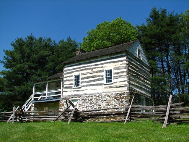
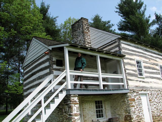
After crossing over South Mountain at Gathland State Park (former home of George Alfred Townsend, the noted Civil War correspondent, who wrote under the pen name "Gath"), Tim and I took a detour from the official route so that I could show him Kennedy's Farm. John Brown, part of his family, and various other conspirators lived here during July-October 1859 while they planned their raid on Harpers Ferry.
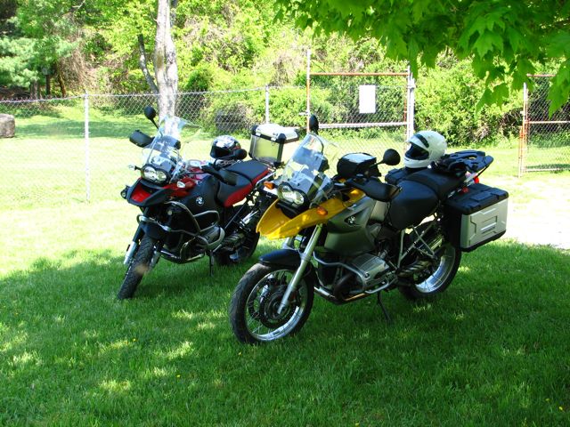
Although it was a cool day, we parked our GS's in a shady spot. We came back to discover that thousands of little insects were happily buzzing around in the shade. How do you put a helmet back on without trapping at least a few hundred of the little rotters inside??
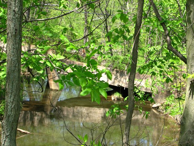
During this trial run, I'd foresworn my usual complement of picture-taking. (Yes, that amounts to heresy on my part, but I wanted to time the route so that I'd know about when the SRR group would return to West-Mar.) After we crossed over into Virginia, however, I spotted what looked like another abandoned bridge off in the woods to the side of the road. Doubling back, it proved indeed to be such a bridge. No picture of the GS's posing on this one, however, since it looked rather unsafe. (Well, we probably would have ridden onto it anyway, but the property owner's house was close by...)
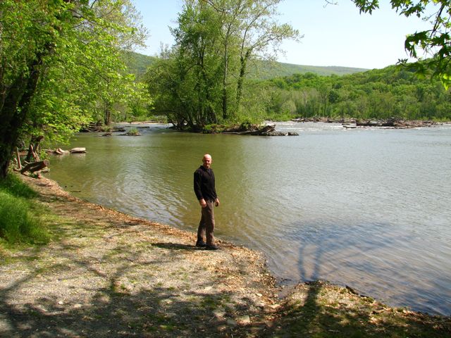
Later, we crossed the Shenandoah River on Route 9 and immediately turned right onto Bakerton Road (if you believe MapSource) or Millville Road (if you believe Google Maps; I don't remember what the road sign actually said). This road runs immediately alongside the Shenandoah and offers numerous beautiful vistas of the river. This spot is upstream from the Millville Dam, so the Shenandoah is very wide here. But it also represents a bit of a mystery: Note in the picture with Tim that, in the background, there are rapids. The level of the lake-like stretch of river, created by the dam, clearly dropped roughly 5 to 10 feet where the rapids were. So, how can you have a lake with a rapids in the middle of it?? My 91-year-old Dad, who has thousands of white water canoeing miles under his belt, says anything is possible when a river is in flood stage. Any other opinions out there?
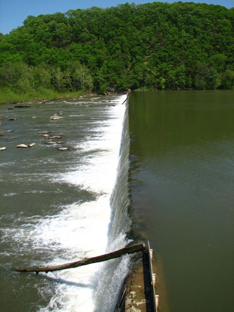
A little later on, Tim and I made another detour off the route, to find the Millville Dam itself. This involved taking a steep gravel road up the side of a mountain where, sure enough, we located the dam. This dam has a gigantic spillway off to one side to generate power (not pictured). It's also one of the only dams in the U.S. with an "eelway" (for eels to safely negotiate the dam). I bet you didn't know that...
After our successful trial run of the tour, which Tim deemed to be first rate, we slabbed on back home. Now I could head off to the Grand Canyon, knowing that my SRR preparations were complete.
A few weeks later, on May 30th, I rode over to Thurmont after work and camped out at the Cozy Inn. Up early the next morning, I checked the weather and found a 60% probability of severe thunderstorms, starting around noon. Accordingly, I trimmed the Scenic Tour route down to about 90 miles and 2 1/2 hours, which was designed to get us safely back to West-Mar before the thunderstorms. The best-laid plans...
At the appointed hour of 9:00 AM, a small contingent of eager tourers showed up, consisting of Ken, Bob, and Herb. We consulted Herb's nifty marine GPS with weather antenna, saw that we had a fighting chance of beating the storms, and we headed off.
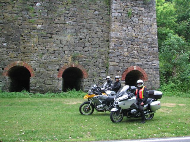
Through Wolfsville, Myersville, Middletown, Middletown Valley, Burkittsville (Spook Hill and all), Sharpsburg, etc., we saw plenty of dark clouds and even occasional distant flashes of lightning. But weather.com couldn't be wrong, could it? We stopped for a brief group photo at the old iron furnance near Antietam Village. From left to right are Bob, Ken, and Herb.
The shortened tour plans took us south alongside the east (Maryland) side of the Potomac River to Harpers Ferry. Then across the Potomac and up the west (West Virginia) side of the Potomac. Fate had other plans for us, however. When we reached Sandy Hook road opposite Harpers Ferry, a few drops of rain began. We immediately pulled over under some trees so we could don our rain gear--but before we could even get off the bikes, the skies had well and truly opened. A ferocious thunderstorm was upon us as we sheltered next to the cliffs.
Checking Herb's weather radar, we decided to proceed a few miles to a restaurant at 340 and Keep Tryst Road, where we could get an early lunch and wait out the storm. But before we could depart, we noticed that passing cars were now returning, and a pickup driver stopped to tell us that the storm had knocked over a tree, which was now completely blocking the road. Not even a GS could get through...
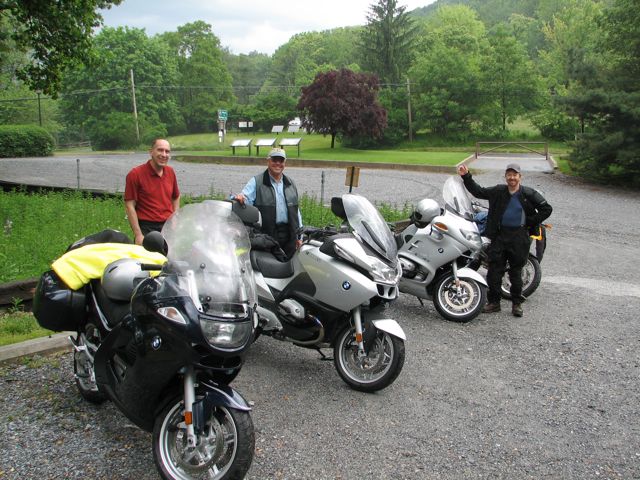
We had to backtrack quite a ways north, and in the process I decided that discretion was the better part of valor and it was time to head back to the camp. I managed to pick up the tail end of our scenic route just outside Boonsboro, and we stopped at the elegant South Mountain Inn for a leisurely lunch--in the hopes that the storm would blow through. Actually, we were quite a sight when we arrived, dripping, weighted down by sopping rain suits and riding gear, etc. Fortunately, the nearly empty restaurant welcomed us in.
This is what we looked like during a brief respite from the rain. From the left, Bob was riding what I think was a K1200GT, while Herb had a 2007 R1200RT and Ken had a slightly older RT. All things considered, it was a pretty happy-looking group!
After lunch, Herb doubled-back briefly to Boonsboro (to restock his liquid refreshments, which had mysteriously been depleted during the course of Friday night). By the time he returned, it was pouring down again, and we set off at a subdued pace to return to camp.
Near Middletown, Ken peeled off from the group to return to his home there. He's lived in this area for some time and was pleased that our abbreviated route had taken him to a number of places that he'd never happened across previously.
Herb, Bob, and I continued on. The roads were very wet, of course, and we occasionally encountered a thick layer of tree petals that were incredibly slippery. We all stayed upright, thankfully, and we returned to West-Mar in time for the afternoon tech and other sessions. It was a fun ride, although rather more of an adventure than I had originally planned.
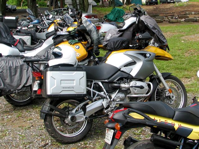
For the next several hours at the camp, I left a sizable puddle of rainwater wherever I went. Eventually it stopped raining, I traded my rain gear for a new (and dry!) BMWBMW long-sleeved t-shirt, and I enjoyed the sessions, dinner, etc. Meanwhile, my BMW wasn't the only one with wet gear draped across it to dry out.
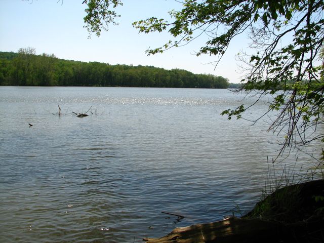
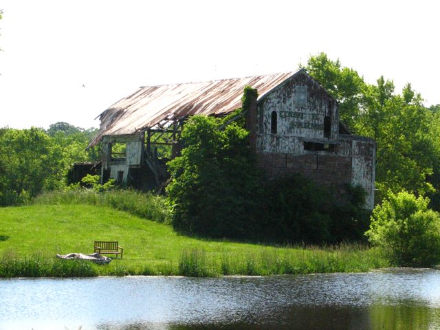
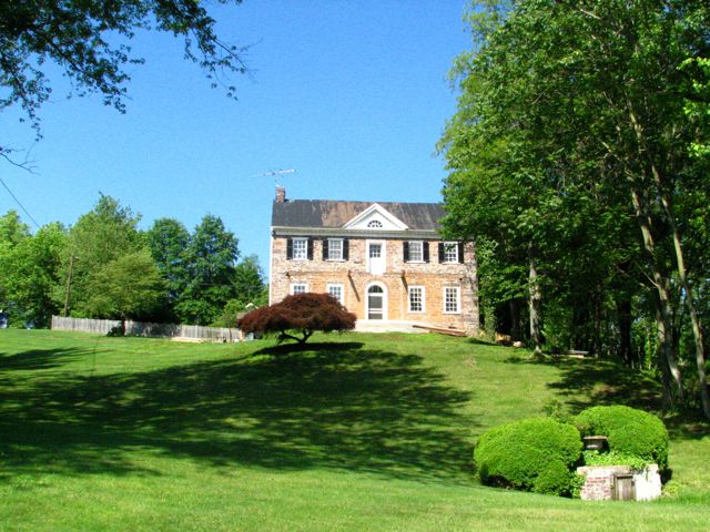
At dusk, I returned to the Cozy, where I stayed in the Richard M. Nixon room. (No, I don't know if it was bugged or not...) Sunday morning, I feasted at the Cozy's justifiably famous breakfast buffet, packed up, and took yet another scenic route back to Catonsville. Uncharacteristically, I stopped for only a handful of pictures on the way back. Instead, I took advantage of the dry weather and enjoyed the twisting roads a bit. Nonetheless, here are a few scenic views, to help make up for the lack of same during the prior day's rainstorms:
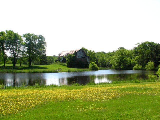
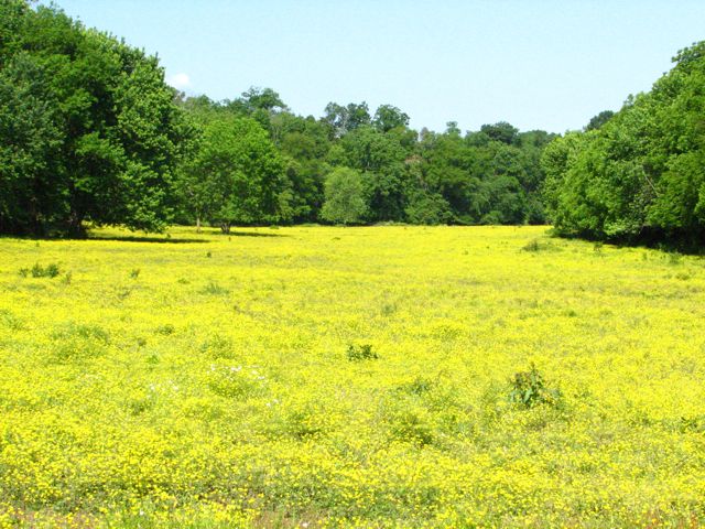
By the way, does anyone (i.e., you, Jody) know what these yellow flowers are? They weren't dandelions.
Back home, I reflected on the Scenic Tour adventure. Bob, Ken, and Herb all seemed to enjoy it, despite the rotten weather and abbreviated trip. I had fun, too--but I was especially glad that (i) the Sandy Hook Tree didn't fall on us, and (ii) we all made it back safely. The experience reinforced my general desire not to ride in the rain if at all possible.
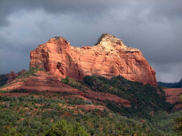
Well, maybe next year I'll have another chance to lead a small group on the full tour, in good weather. I'll leave you faithful readers with two of the 1,800 or so pictures I took on my Utah/Arizona vacation, the first one from Sedona where there were also threatening clouds...
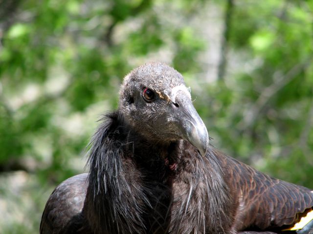
...and the second from the Bright Angel Trail on the South Rim of the Grand Canyon, where I bumped into an amiable Condor.
Rick F.


