I took a rare day off work to take advantage of the good weather on April 17, since Saturday was already booked and Sunday promised (and delivered) torrential rains. My route was provided by Motorcycle Journeys Through the Appalachians, 2nd edition, by Dale Coyner. The night before, I translated his tour directions into a Garmin route for the Zumo. That proved to be the hardest part of the trip, given Dale's somewhat abbreviated road descriptions. (He generally uses route numbers, often omitting the road names. My favorite evil twins, Garmin and Google, however, generally use names and only occasionally the numbers.) Eventually I was able to enter his "Trip 12: Mosby's Confederacy" route, modified slightly to start in Charles Town, WV rather than Front Royal, VA.
I got a nice early start at 7:30 am, which prompted use of Herr Gerbings for an hour or two. On the way to Charles Town, of course, one goes right by Harpers Ferry. (At least if one is starting from Baltimore.) Looking across the Shenandoah River to Harpers Ferry...
...I decided that a quick detour to visit the old town was in order. This early in the morning, no one minds if you ride right on into the town. Along the entrance to the park on Virginius Island, the ruins of the Shenandoah Pulp Factory invited a brief tour. Built in 1887, it had 5 spillways to generate power for producing wood pulp to use in making paper. The factory went broke in 1935--just in time to be completely destroyed in the flood of 1936.

Downtown Harpers Ferry was largely deserted. All of the buildings have been refurbished over the years. I remember family outings here when I was 10 or so. My brother and I had discovered a secret, back way inside these same buildings, long before they were opened up to the public. Great fun (as most things are when you're 10.)

Try parking on Shenandoah Street a little later in the season!

Harpers Ferry is an extremely vertical place. On this visit, I decided not to climb up to Jefferson's Rock in my heavy motorcycle gear. But it was tempting.

The Hilltop House hotel and restaurant has been in business pretty much forever, and it's still an imposing place. Moreover, the view out over the Potomac and Byrnes Island from its backyard park is still one of the best around.


Motoring west from Harpers Ferry takes you through Bolivar Heights, which was the scene of the Battle of Harpers Ferry during the Civil War. This major engagement isn't well-known; Stonewall Jackson's victory here for the Confederates paved the way for Lee's first invasion of Maryland, culminating in the Battle of Antietam. A comprehensive description of the battle is available at http://en.wikipedia.org/wiki/Battle_of_Harpers_Ferry.

Moving on to Charles Town, I picked up Dale Coyner's trip on Old Route 9, which wound its way up and over the Blue Ridge Mountains. This was a perfect motorcycling road, but it was littered with slow-moving trucks and grannies (and grampies), some of whom might have been as old as I am. At Hillsboro, I left Route 9 and picked up 719 (Dale) or Stoney Point Road (Rick). This was a great little road, with scenic views and the ruins of a mill. For either a motorcyclist or a photographer, it was fantastic. And if you just happened to be both...
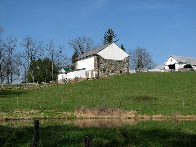

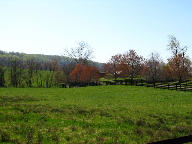
Although the ride coincides with the area that Mosby's Rangers called home, the most prominent features are the horse farms. They're everywhere, and scenic to boot.

At Round Hill, I made a slight detour to see how much progress they had made on this old house since my last visit a couple of years ago. The answer appeared to be "not much."

Continuing on Airmont Road, south of Round Hill, I crossed over the famous Snickersville Turnpike and soon encountered the Ebenezer Baptist Church. Actually, "churches" would be more appropriate. The stone church on the left was built in about 1770. The larger white church was built in 1888 and has been in continuous operation since then. A well-tended and very old cemetery lay to the left of the trees, behind a stone wall.

Did I mention that the weather forecast was for temperatures in the 80s? Here's a picture of my newest (only?) farkle, an ambient temperature gauge, which is showing an honest 93 degrees! Well, "honest" is perhaps a relative term here. As John (Unity) cautioned me, most stick-on temperature gauges aren't very accurate, and this one typically reads 5-6 degrees high. Plus, it was sitting in the sun. Still, it was quite hot.

As my roads always do, this one turned to dirt after a while. But that's okay, I've got to live up to the GS reputation.

As Dale Coyner predicted, in the nifty little town of Uppersville, the stately Trinity Episcopal Church appeared on the right. The original church was built in 1842, replaced in 1895, and replaced again in 1960. The current one managed to look imposing and welcoming all at the same time. Its cool stone interior felt great, considering the outside temperature.


Continuing on to Paris, VA, I turned south and made a short stop at the Sky Meadows State Park. This relatively new park has numerous trails and is centered around the Mount Bleak Farm. The manor house was built by Abner and Mary Settle in the 1840s. Their son Thomas was born there, became a physician, joined the Army, and was called upon to confirm John Brown's death after he was hanged in 1859. John Brown's famous words, "the sins of this guilty land can only be purged with blood" were heard and recorded by Thomas (after Brown was hanged, as best I can tell...). Thomas went on to ride with the Virginia Cavalry during the Civil War, while his brothers joined Mosby's Rangers.

There was a small troop of young'uns at the state park, one of whom managed to coordinate effectively with the cherry blossoms.

Turning onto Leeds Manor Road, I immediately found it to be another glorious, tiny, interesting back road--right up my alley. I don't know if this was the "manor" that the road was named after, but I hope not. This place had clearly seen one flood too many.

Farther along, the Leeds Episcopal Church appeared. Following establishment of Leeds Parish in 1769, the church was constructed in 1842 and served as a hospital for wounded soldiers during the Civil War. A cannon ball penetrated the church and exploded inside, causing considerable damage to the church.

Hume Road, leading (naturally) out of Hume, VA was yet another narrow back road along this enjoyable route. Here, it points dead ahead to Oventop Summit, standing roughly 1,300 feet at its peak (or about 700 feet above the road level). (And, no--I have no idea why it's called "Oventop.")

This rickety old bridge crosses Fiery Run, but its crossing days appear to be over. I was sorely tempted to find a way onto the bridge to take advantage of its photogenic potential. While the bridge and the house it once led to were quite old and run down, however, a shiny new lock and chain kept the entrance gate solidly closed. No trespassing in pursuit of a good picture for you all, I'm afraid. (Maybe another time!)

The Appalachians route next took me into and out of Front Royal, leaving via the famous Route 55. Along the way, I went through Old Markham, Old Sage, and a few more "Old's" before reaching Oak Hill, the family home of Supreme Court Justice John Marshall, who was named by the 2nd President, John Adams. The original home is the smaller stone dwelling on the right, built in 1769. Justice Marshall added the "Greek Revival" portion on the left in the early 1800s.


Oak Hill is a private residence, but I didn't figure that out until I'd already ridden up the long driveway and around back--where I found this languishing farm. A quick picture, and I scooted on away. But what a great place to live (although if you have to ask, you can't afford it...)

Eventually I arrived in the town of Marshall and had a late lunch at the Marshall Diner--in fact, it was the best cheeseburger I've had in a long time. Suitably reinvigorated, I continued on to The Plains, Halfway, and Middleburg--home of the rich and famous. The Red Horse Inn was doing a brisk lunchtime biker business, and the whole town was filled with stately homes. Well worth a return visit, although even on a Friday it was rather crowded.


Leaving Middleburg on Sam Fred Road (or was that Ricky Bobby Road?), I soon arrived back at the Snickersville Turnpike. Although I'd ridden here twice before, I'd forgotten how charming this road is, with its humpback bridges, old mansions, etc. I especially liked "Creek Hill" in Mountville:

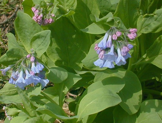
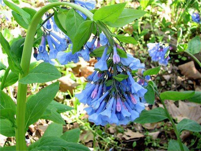
Near Blumont, I hopped onto Route 7 west--and right into the midst of Massive Friday DC-Exodus Weekend Traffic! Booo! Hiissssss! I dodged the caravan of cars, trucks, minivans, and other Assorted Detritus for as long as I could stand, then decided to make a little detour on Castleman Road to ride along the Shenandoah for a while. As it happened, I also rode along field after field of these pretty blue flowers. Calling Jody: What are these??

I forgot to mention that as I left Route 7, with Major Vehicles bearing down on me, I pulled over onto the shoulder to brake for the turn. I went from 60+ mph to a complete stop relatively quickly--no big deal, of course--except that there was a 3-foot-long patch of gravel right in the midst of my short deceleration zone. Trusting my ABS, I just left the brakes full on. Crossing the gravel proved to be absolutely uneventful. (Get it?) The deceleration went from maybe 0.8 g instantaneously to next to nothing and immediately back to 0.8 g. Very impressive, and there wasn't even any distracting lever pulsation. Who says the servo brakes are undesirable?
Eventually I had to get back on The Dread Route 7 and muscle my way along to Crum's Church Road--my usual western way to Summit Point, back in my racing days when I would stay overnight at Winchester. It hadn't changed very much, and I found my way to (and by) the track without difficulty. I stopped by the Hillbrook Inn bed & breakfast, just to see if it was still there and operating. It was, and it now features a restaurant as well. My wife and I stayed here a number of years ago and found it to be a great place for a getaway.

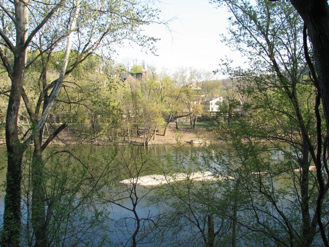
Well, my trip was nearing an end, and I decided to return to Route 340 by Dale Coyner's recommended way. This involved leaving Charles Town (again) by Old Route 9. This time, I looked for the scenic turnoff that he mentioned, climbing the mountain. I found a sign for it, but the turnoff area had been blocked off by guardrails. I parked at the top of the hill and--just for you guys!--hiked a quarter mile down the shoulderless, busy road to get a picture. The things I do for you all... When I got there, I discovered that bushes had grown up and largely blocked the view. But I got a picture of the Shenandoah River anyway--just for you!--and then hiked back up the mountain, warily eyeing the fast-moving traffic the whole way...


This time, I turned off of Route 9 onto Route 671, heading back towards Harpers Ferry and Loudon Heights. Along the way, I had one more good adventure in me. Crossing an unnamed little creek, I spotted another Bridge to Nowhere back in the woods. Naturally I went back for a picture, and I managed to find a little path leading onto the bridge itself. No problem for a mighty GS, of course, so I motored down a small embankment and onto the bridge, parked, and walked back to the real bridge for the picture...

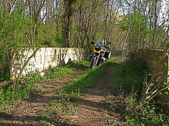
Returning to the GS, I had the choice of turning around and going back the way I'd come or continuing on the path to see where it went. I continued on (of course!), hoping to find more abandoned houses or other scenic pho-op's. A short way further on, all I found was a roughly 5' embankment leading to another little road. The path was a bit muddy, but where it climbed the embankment was nice dry dirt--so I decided it was worth climbing, rather than turning around.
For any GS rider worth his salt, this would have been a trivial scramble up the embankment. I got a decent running start, attacked it carefully, and, just as the front wheel was at its maximum height and my weight was shifting backwards, managed to inadvertently pull the clutch in part way! Needless to say, I came to an abrupt stop, with the front wheel near the top of the rise and the bike at a good 45-degree angle. All I can say is that it's a good thing that I'm 6 1/2 feet tall, 'cause I could barely reach the ground and hold the bike upright.
There was no chance of continuing forward, so on tiptoe I eased it back down to the muddy path. There, I'm ashamed to admit, I decided against trying it again. I turned around on the narrow, muddy trail, obliterating many deer hoofprints in the process, and, suitably chastened, motored back the way I'd come.
From there, it was an easy ride on 340 and 70 back home. I arrived just before 7:00 pm, making it a nearly 11 1/2 hour ride from door to door. It was great fun, full of beautiful scenery, and I felt like I'd barely scratched the surface of this great part of Virginia. Definitely worth several return trips!
Rick F.