My goal for the day was to find the Killiansburg Caves along the C & O Canal. I read about them in A Guide to Civil War Sites in Maryland, and they apparently sheltered a number of townspeople from Sharpsburg during the Battle of Antietam.
Before getting underway, I had to get the GS over a 6' long patch of thick ice that bordered my neighbor's garage where I keep the bike. That involved wrestling the thing around 180 degrees within a narrow space so that I could coast downhill over the ice (without touching the brakes) rather than backing down the slight incline. It all worked out okay, fortunately, and I even got warmed up in the process.
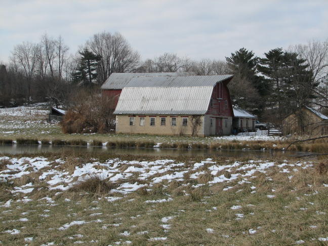
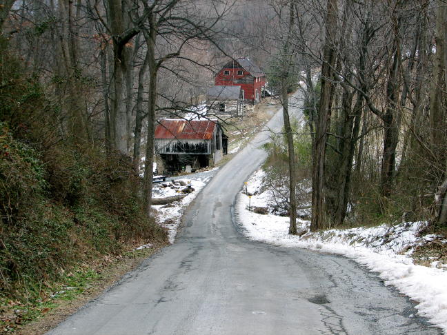
Once underway, I slabbed it to Jefferson and then followed MD 180 to Knoxville. Along the way were numerous wintry scenes, naturally, and I got to exercise the camera after my long layoff. Not a lot of farming going on here at the moment, as best I could tell:
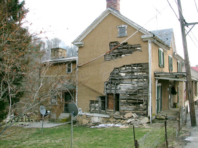
I hadn't been in Knoxville, MD, for probably 30 years, and I'd forgotten what a picturesque little town it is. This house was a jumble of contrasts, between its lived-in back section (with smoke coming out of the chimney) and its front section that was rather less hospitable. Plus, a 150-year-old house with not one but two satellite dishes in the side yard. I'm not sure why the end of the house was all torn up. I suspect it involved Fortunato and a cask of amontillado...
I went looking for the Weverton area, near the intersection of 340 and 67, and found it without too much trouble. On Keep Tryst Road (don't you love it?), I stopped to get a picture of this double arch...
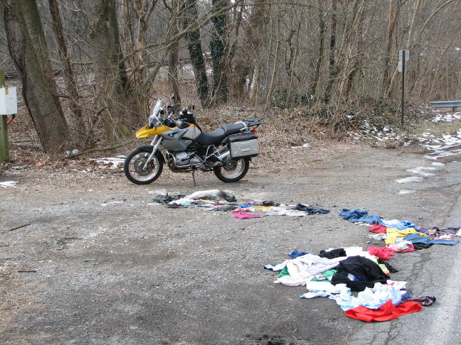
...and when I returned to the GS, I realized that I'd parked next to the remnants of some Tragic American Family Story. I have no idea why so many clothes were strewn about, but it must have been interesting.
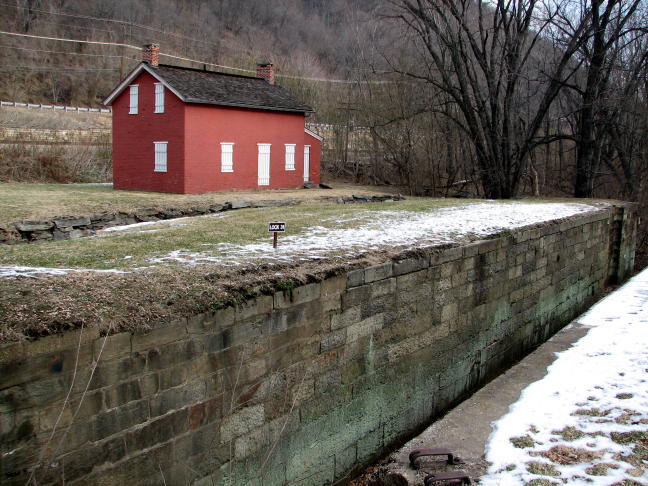
Nearby, I found Lock 31 on the C & O Canal, together with its surviving lockhouse.
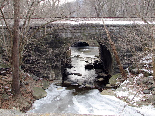
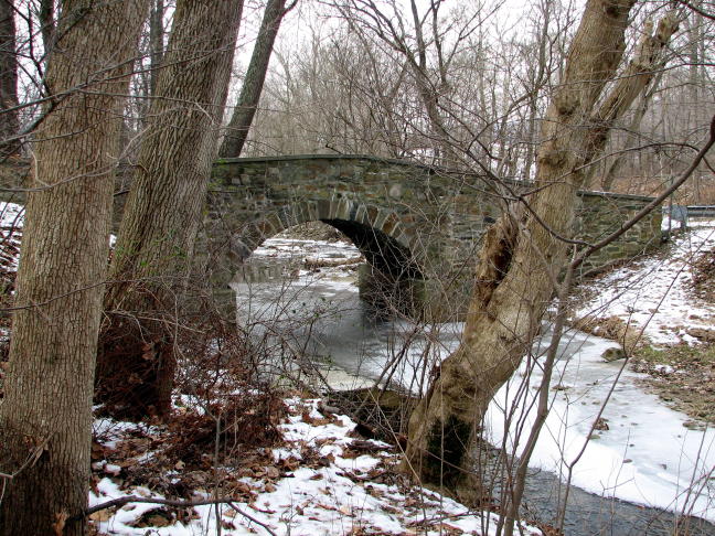
Along Valley Road, a one-arch, single-lane, stone bridge appeared over Israel Creek. Fun to look at, but it had a nasty big patch of thick ice covering part of the center line. No problem, since it was quite apparent, but it was a good reminder that not every section of every road was clear of ice and snow.
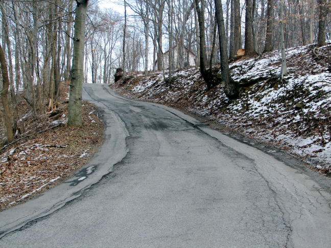
I spent nearly the whole day on out-of-the-way little roads like this one. Just what I needed after a two-month layoff from riding.
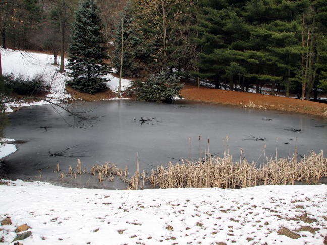
On my way to Sharpsburg, this frozen pond appeared, complete with ominous spidery breaks in the ice.
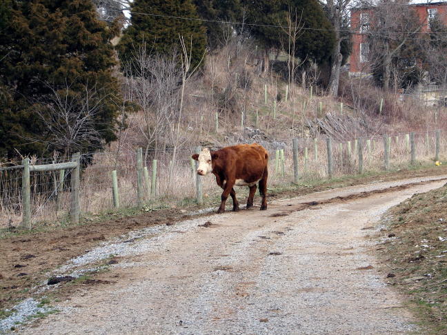
Did I mention that the roads were narrow and remote? This fellow wasn't too ominous-looking but did take quite an interest in a tall yellow motorcycle with a tall picture-takin' rider.
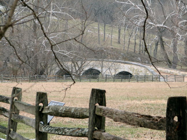
Approaching Sharpsburg, I spotted Burnside's Bridge off in the distance--but that wasn't my destination.
On the other side of Sharpsburg, at Snyder's Landing, I finally reached the Potomac and the start of my search for the Killiansburg Caves.
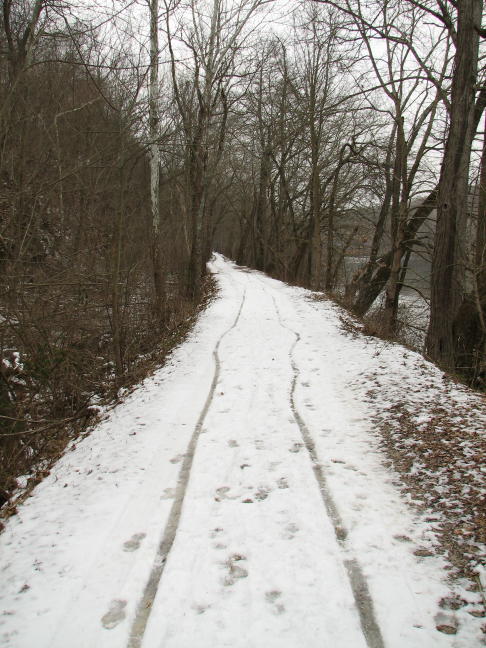
To get there required either (i) hiking a mile on foot on the snow-covered C & O Canal towpath, or (ii) sneaking the GS onto the towpath and riding there. I'll let you all decide which option I chose...
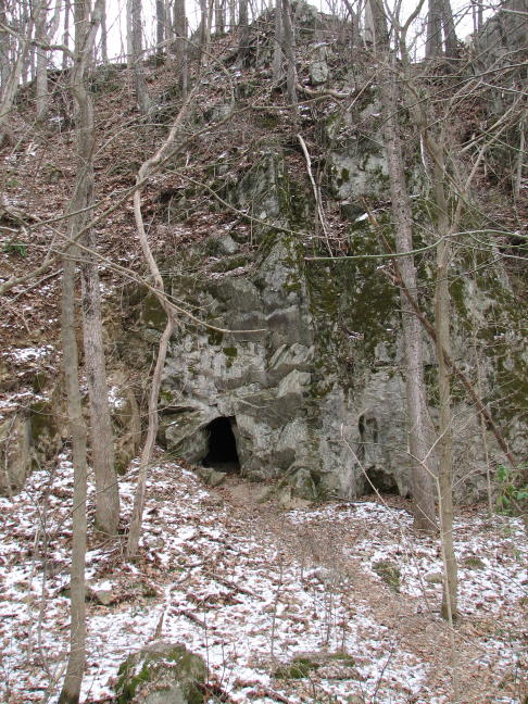
After the duly appointed mile, I found the first of the caves. It was set back a ways from the towpath, on the far side of the (dry) Canal. With a bulky set of winter riding gear, I could still get into the opening without scraping the sides and ceiling all at the same time--but not by much.
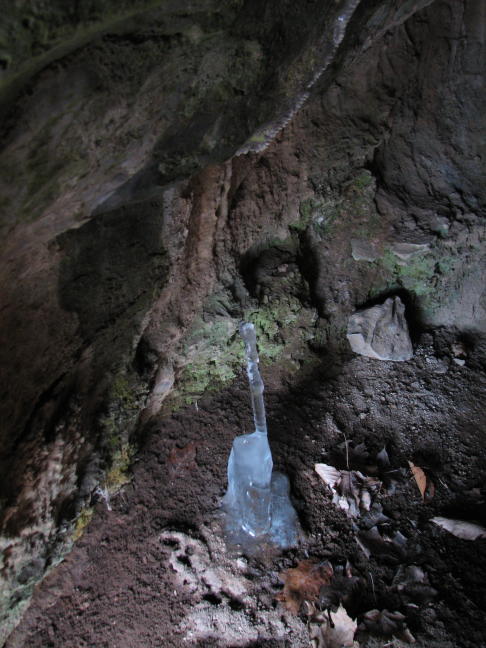
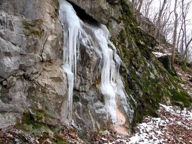
Notice the elegant little blue-ice stalagmite near the entrance. In contrast to the actual stalactites and stalagmites, this one probably didn't take 100,000 years to form.
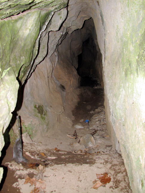
I went into the cave for about 15 feet before it dawned on me that I hadn't brought a flashlight... (Duh!) I went another 15 feet or so using the flash on my trusty Canon camera, and the cave looked like it continued for easily another 30 feet. Further exploration will have to wait for warmer weather and more light, however.
Back on the towpath, another cave appeared along with evidence of a sustained higher water level, somewhere back in the eons.
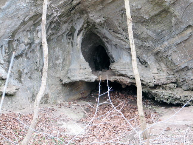
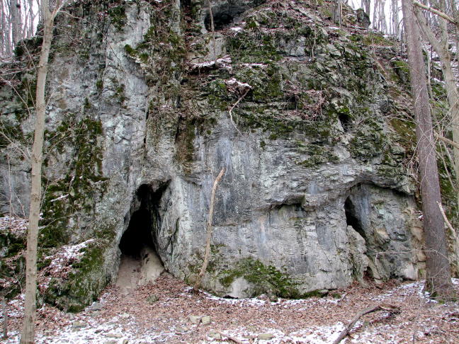
A bit further, I found the "official" Killiansburg Caves--all three of them. If you look carefully, one of them appears as a "window" about 20 feet above another cave entrance at ground level.
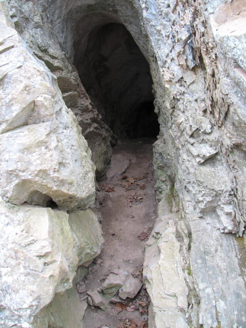
The entrance to this one was quite narrow and steep, before the cave plunged back downhill. It also appeared to continue on for quite some distance.
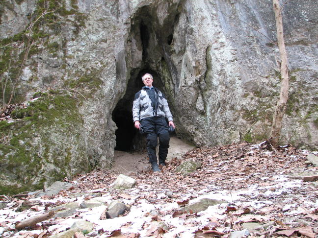
Here's a ground-level view of Yr Fearless Explorer standing bravely outside the entrance to the first of the K. Caves. It went only a short distance before being blocked off my a rockfall.
I'm guessing that these caves were all formed by the flow of water from the hilltops down through the rock formations. Evidence in support of this theory was plentiful (if frozen):
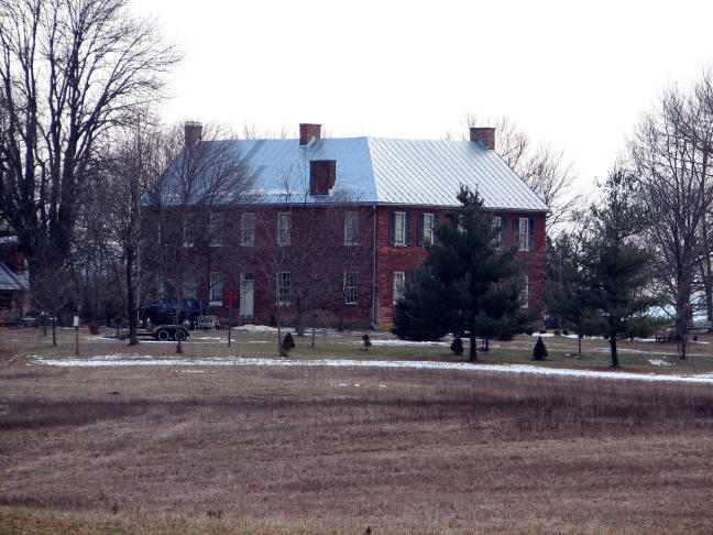
After hiking (or was it riding?) back from the caves, I returned to Sharpsburg and set off to find more Civil War sites. My guide book pointed out this large brick house that was set well back from Route 34. The Stephen Grove farm, "Mount Airy," served as a hospital for both the Union and Confederate wounded after the battle and was visited by Abraham Lincoln.
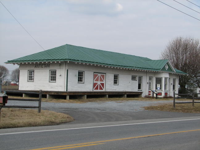
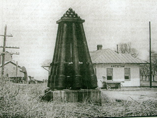
Across Route 34, the original Antietam railroad station remains. It used to have a nifty monument made of cannon barrels and cannonballs, but it's long gone.
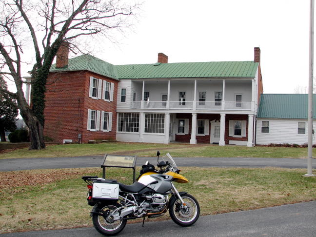
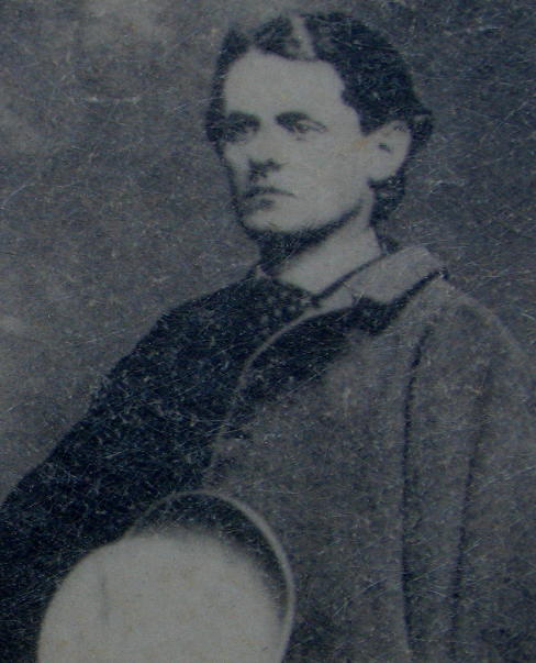
Just before the bridge over the Potomac into Shepherdstown was Ferry Hill Place, the home of Col. Henry Kyd Douglas, author of I Rode With Stonewall. The house was built in 1812 and served, for a time, as a National Parks headquarters for the C & O Canal. Depending on who you believe, Col. Douglas's father either (i) sent signals to the Confederate forces on the West Virginia side of the river from this house or (ii) had the misfortune of having shutters blow open, revealing the light inside, while Union troops were watching. Either way, he was arrested and spent a couple of months imprisoned at Fort McHenry in Baltimore.
Col. Douglas, a dashing if somewhat Goth figure:
By now it was about 2:00 PM, and I'd been on the road/towpath/etc. since 8:30 AM. Hesitating no further, I motored into Shepherdstown for a 3-donut lunch at the Shepherdstown Bakery. There, I bumped into another idiot--I mean another motorcyclist--who had braved the cold weather and snow flurries to go for a ride.
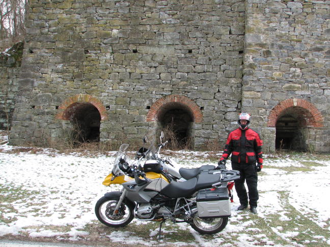
Bob and I chatted a bit about routes, Gerbings gear, etc., and after lunch he joined me for a portion of my return ride. Here we've stopped at the iron furnace at what used to be Antietam Village, dating back to the mid-1700s. It was used, among other things, to make cannonballs for the Revolutionary War.
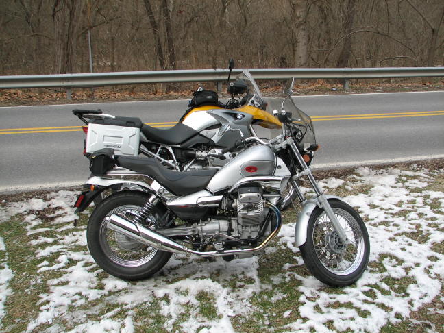
Bob was riding this Moto-Guzzi (the Italian BMW, according to some). He didn't have any heated gear or grips, so he was stopping pretty regularly to warm his hands on the cylinder heads!
We rode together along Canal and Limekiln Roads before he headed down Harpers Ferry road to return to College Park, while I went north on more assorted back roads. Along my way, I passed this once-proud farm. Could that be a motorcycle in the shed on the left, with rusting Jesse bags? Maybe Bob Higdon's very first bike??
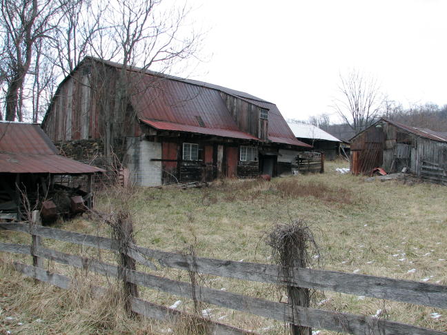
Nah, it was some weird farm implement, a-moulderin' in the shed.
Did I mention the beautiful little roads I was on?
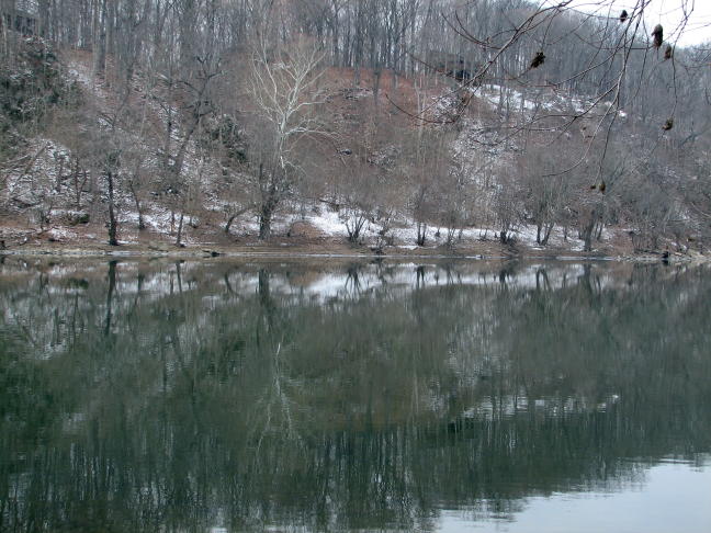
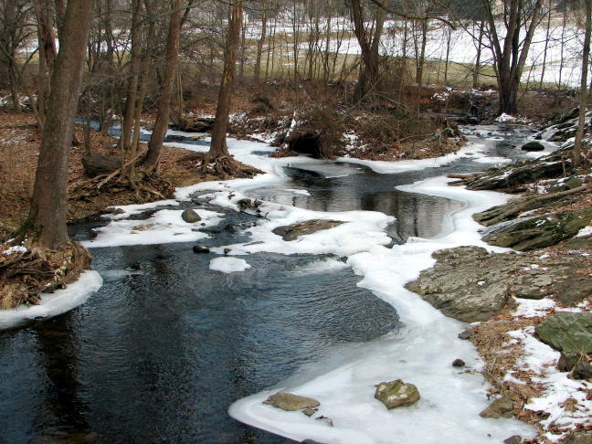
Everywhere I rode, there were semi-frozen streams like this one. Whoever said "there is beauty in Nature" certainly had it right.
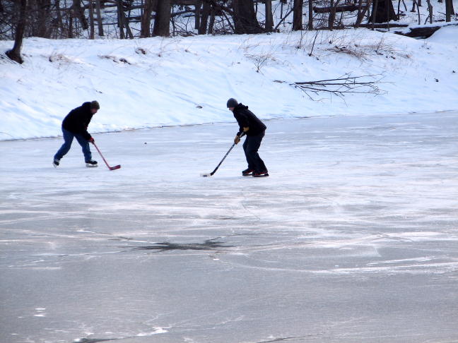
I eventually ended up on Crow Rock Road and then Hamburg Road, northwest of Frederick. I thought I'd never been on these roads before, but then I came across a little pond and remembered it from an early trip on my F650CS. When I looked more carefully, I realized that there were some guys playing hockey on the ice, presumably avoiding those ominous, black, spidery-shaped openings...
As I continued on Hamburg Road toward home, I spotted a single headlight in my rear view mirrors, some distance back but gaining on me. Egads--there is yet a third idiot/frozen motorcyclist out here today, I thought. As the rider caught up to me, I waved him on by--and realized that it was another R1200GS with vario sidecases. He made rapid work of the narrow, twisting, boulder-lined road and disappeared from sight. At the end, however, I encountered him again when he turned around to do it all in the opposite direction!
May it always be such.
Rick F.
PS: The temperature never went above 35 degrees, but it never snowed. Roundtrip was 180 miles and 8 hours of pure fun.


